Maps and Brochures
Local Maps
Rim Lakes Recreation Area
A 15" x 10" PDF map the Rim Lakes Recreation Area on the Black Mesa Ranger District.
Visitors Map
Apache - Sitgreaves Forests Visitors Map
The map may be purchased from any Ranger District office of from the National Forest Service map store.
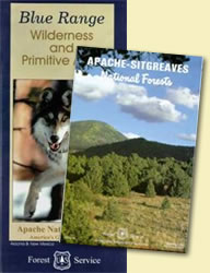
Wilderness Map
Blue Range Wilderness and Primitive Area Map
The map may be purchased from any Ranger District office of from the National Forest Service map store.
GIS Datasets
Selected GIS data that encompass the Apache-Sitgreaves National Forests are available for download from the site listed below. A link to the FGDC compliant metadata is provided for each dataset. All data are in zipped shapefile format, in the following projection:
- Universal Transverse Mercator
- Zone: 12
- Units: Meters
- Datum: NAD 1983
- Spheroid: GRS 1980
The GIS Datasets are available at: http://www.fs.fed.us/r3/gis/aps_gis.shtml
|
Local Visitors Links: Lodging, Restaurants, Skiing, Businesses, etc |
|
Apache-Sitgreaves National Forests |
|
|
|

USDA Forest Service - Apache-Sitgreaves National Forests
Last Modified:
Wednesday, 07 November 2007 at 14:12:18 EST