
Southwestern Colorado
Public Lands
Campground Guide
Tabloid format, 12-pages. Detailed descriptions of all San Juan
NF campgrounds with related camping information and tips. Free.
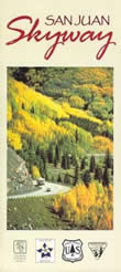
San Juan Skyway
This 232-mile loop, one of the most scenic drives in America,
is open year-round (except when passes are closed temporarily by
snow). The brochure includes a map and descriptions of the communities
linked by the Byway, including Durango, Silverton, Ouray, Telluride,
Dolores, and Cortez. Free.

Alpine Explorer
A 23-page guide to the natural and historical resources on the ALpine Loop Backcountry Byway. Lavishly illustrated. $6.99 plus postage.
|

Alpine Loop
ATVs and
Unlicensed Motorcyles Summer Travel Routes
The 65-mile Alpine Loop Backcountry Byway winds through the alpine
terrain of the San Juan Mountains, connecting the towns of Lake
City, Ouray, and Silverton. Recommended for four-wheel drive vehicles,
all-terrain vehicles, motorcycles, and mountain bikes. Brochure
contains map and explains legal restrictions on motorized vehicles.
Free.
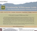
Weminuche Wilderness Guide
Tabloid format, 8 pages. Descriptions of popular areas, regulations,
Leave No Trace principles, stock use, safety tips, coexisting with
wildlife, and more. Free.
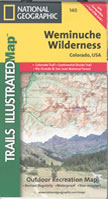
Weminuche Wilderness Map
Contours (80'), roads, trails, regulations, no-camping and no-campfires
areas, safety tips. Plastic coated, waterproof, tear resistant.
Published by National Geographic / Trails Illustrated. $11.95 plus
postage.
|
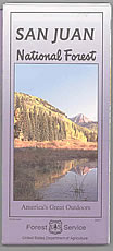
San Juan
National Forest
Visitors Map
Roads, trails, campgrounds, Wilderness information, points of interest
and overlooks, travel-management rules. Plastic coated. $10

Colorado Southwest
Recreation Topo Map
Trail and road access on public land near Cortez, Durango, Lake
City, Pagosa Springs, Silverton, and Telluride. Plastic, waterproof,
tear resistant. Published by Latitude 40. $11.95 plus postage.
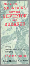
Map of the Mountains
between Silverton and Durango
Three-dimensional, plastic. Contours (80'), landforms, roads, trails,
etc. Published by Drake Mountain Maps. $9.00 plus postage.

Mountain Bike Map: Durango, Silverton, Telluride
Shows 33 dirt and 7 road rides, with difficulty ratings, length,
net vertical feet, highest elevation, etc. Contours (80'), roads,
trails, riders' responsibilities. Plastic coated, waterproof, tear
resistant. Published by National Geographic / Trails Illustrated.
$9.95 plus postage.
|
![[design image slice] U.S. Department of Agriculture Forest Service on faded trees in medium light green background](https://webarchive.library.unt.edu/eot2008/20090116075516im_/http://www.fs.fed.us/r2/sanjuan/local-resources/images/rmt-trees-left-usfs.gif)