 |
||
Natural Hazards >> Fires >> Bushfires in Northern Territory, Australia
| ||||
|
Bushfires in Northern Territory, Australia
Abundant rainfall during the wet season in northern Australia waters the tropical savannas, where grasses can grow as high as three meters (more than 9 feet). During the dry season (Southern Hemisphere winter), these grasses become extremely flammable, and they fuel enormous bushfires. Fires are triggered by lightning and by people. This photo-like image captured by the Moderate Resolution Imaging Spectroradiometer (MODIS) on NASA’s Aqua satellite on August 17, 2008, shows numerous large fires in Arnhem Land in Northern Territory, Australia. Places where the sensor detected fire are marked in red.
NASA image by Jeff Schmaltz, MODIS Rapid Response Team. Caption by Rebecca Lindsey. Recommend this Image to a Friend Fires: Topic Home | Archive | Related Links Natural Hazards Home | Section FAQ |
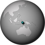
Where in the World
Image Posted August 19, 2008 Satellite & Sensor Aqua- MODIS Fires Latest Events Fires in Oregon and Northern California Fire in the Kalahari Fires in Mozambique, Zimbabwe, and South Africa Fires in Central South America Fires in Idaho | |||
|
Subscribe to Natural Hazards
About the Earth Observatory & Natural Hazards Contact Us Privacy Policy and Important Notices Responsible NASA Official: Lorraine A. Remer Webmaster: Goran Halusa We're a part of the Science Mission Directorate |