Water Resources of Massachusetts and Rhode Island
The mission of the USGS Massachusetts-Rhode Island Water Science Center is to provide the hydrologic information and understanding necessary for the management and use of the Nation's water resources. The WSC fulfills this mission by:
- Systematically collecting surface-water, ground-water, water-quality and biological data;
- Conducting interpretive water-resources studies that respond to cooperator and national needs;
- Developing innovative scientific approaches to various environmental processes and problems to improve our understanding of hydrologic systems;
- Publishing water data and results of investigations in high-quality reports
- Assisting other governmental agencies and the public to understand hydrologic information relevant to the policies and management practices that affect the Nation´s water resources.
Interactive GIS mapping website
New interactive GIS mapping website allows to view, query, and analyze the Massachusetts watersheds resource data online.
More on the Drainage Basins web page.
Water Programs in MA and RI
Long-Term Monitoring
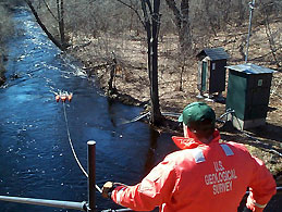
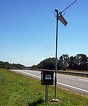
The USGS stream-gaging network:
![]() Massachusetts
- 128 stations, (127 with real-time discharge and gage
height data on the Web)
Massachusetts
- 128 stations, (127 with real-time discharge and gage
height data on the Web)
![]() Rhode
Island - 28 stations, (27 with real-time discharge and
gage height data on the Web)
Rhode
Island - 28 stations, (27 with real-time discharge and
gage height data on the Web)
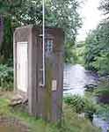
 The USGS ground-water observation-well network:
 End of the Month Water Conditions Statements
2006 Annual Water Data Report
Beginning with Water Year 2006, the ADR is a national report only and the reference to a local report in the WDR series is discontinued.
Therefore, to obtain the information about a specific state, basin or site, please start your search on the Water-resources data for the United States Water Year 2006 page.
This page gives the folowing options for search:
- Search by Site Number
- Search by US State or US State and County
- Search by area other than State, including Pacific Islands
- Search by Hydrologic Unit
A map-based tool for locating hydrologic data is also available.
The Mapper allows users to geographically locate surface water, ground water, and climatological sites and view and download published water data for those sites.