 |
Environmental Treaties and Resource Indicators Conference of Party (ENTRI COP) Decision Search Tool
An add-on to the Environmental Treaties and Resource Indicators (ENTRI) project, the tool is powered by a Google appliance and includes controlled “metadata” (coding of each decision document) to enable powerful advanced searches by date, COP number, or title of document. All decision documents are harvested and converted to PDF for consistency, but for reference purposes the original URL is listed.
|
 |
Environmental Treaties and Resource Indicators Service
A searchable relational database containing international environmental
treaties, treaty summaries, treaty status files, and natural resource
indicators.
|
 |
IPCC Special Report on Emissions Scenarios
Access scenarios of future greenhouse gas emissions prepared by Working Group III of the Intergovernmental Panel on Climate Change. |
 |
Model Visualization and Analysis for Integrated Assessment Models of Climate Change
Access to guide information on Integrated Assessment Modeling, selected IAMs, and scenario outputs from selected IAMs.
|
 |
Potential Impacts of Climate Change on World Food Supply: Data Sets from a Major Crop Modeling Study
Query an online data set on projected crop yield changes due to climate change and carbon dioxide enrichment. Developed by researchers at the Goddard Institute for Space Studies.
|
 |
Ramsar
Wetlands Data Gateway
Providing access to spatial and
tabular data relevant to Wetlands of International Importance listed
under the auspices of the Ramsar Convention. It includes database
query interfaces and a Web-mapping tool.
|
 |
SEDAC Map Client
Fully compliant with Open Geospatial Consortium (OGC) standards, the tool may be used via exploring different thematic views of SEDAC global data holdings, or, in the advanced mode, may incorporate data available through other OGC services. Results can be saved as an e-mailable file (a context file) pointing to the data layers that can be shared with other users.
|
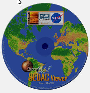 |
TerraViva! SEDAC Viewer
A global spatial data visualization and analysis product that enhances examination of SEDAC data collections of sustainability and socioeconomic variables and maps. Updated for 2008 with several new features.
|