CALIPSO Science Objectives Animation
|
Scientists are eager to use CALIPSO data to study the nature of the atmosphere. Using lidar and a pair of infrared and visible imaging systems, CALIPSO promises to deliver new insights into how clouds and aerosols work to affect the atmosphere.
|
|
|
|
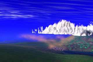
This animation illustrates how CALIPSO captures data to study the nature of the atmosphere.
Duration: 24.0 seconds
Available formats:
320x216 (29.97 fps)
MPEG-1
2 MB
720x486
Frames
320x216
PNG
83 KB
160x80
PNG
20 KB
80x40
PNG
5 KB
720x480 (29.97 fps)
MPEG-2
13 MB
640x480 (29.97 fps)
MPEG-4
9 MB
320x216 (29.97 fps)
X-FLV
652 KB
How to play our movies
|
|
|
|
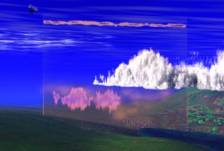
This print resolution still from the animation above illustrates how CALIPSO obtains a vertical slice of atmospheric data.
Available formats:
3000 x 2025
TIFF
6 MB
320 x 216
PNG
92 KB
|
|
|
|
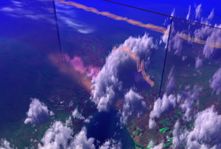
This print resolution still Illustrates a vertical slice of data from a higher vantage point.
Available formats:
3000 x 2025
TIFF
7 MB
320 x 216
PNG
127 KB
|
|
|
Back to Top
|

