- Original Caption Released with Image:
-
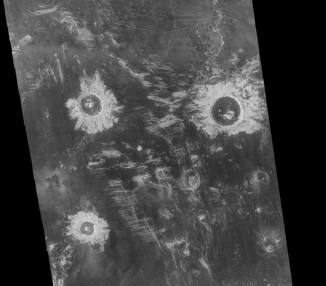
One of the most useful Magellan standard data products is the full resolution mosaic, the F-MIDR (Full-Resolution Mosaiced Image Data Record). These products are mosaics of about 500 kilometer (300 mile) segments of 30 or more individual image strips. This image is an F-MIDR made from orbits 376 to 407, obtained between September 15 and September 19, 1990, part of the first orbits in which the Magellan flight team operated the radar system in the mapping mode. The mosaic is centered at 27 degrees south latitude, 339 degrees longitude, in the Lavinia region of Venus. Three large impact craters with diameters ranging from 37 kilometers (23 miles) to 50 kilometers (30 miles) can be seen located in a region of fractured plains. The craters show many features typical of meteorite impact craters, including rough, radar-bright ejecta, terraced inner walls and central peaks. Numerous domes of probable volcanic origin can be seen in the southeastern corner of the mosaic. The domes range in diameter from 1-12 kilometers (0.6-7 miles), and some have central pits typical of volcanic shields or cones. Resolution of the Magellan data is about 120 meters (400 feet).
- Image Credit:
-
NASA/JPL
|

