
Enceladus Atlas Index
Presented here is a complete set of cartographic map sheets from a
high-resolution Enceladus atlas, a project of the Cassini Imaging Team.
The map sheets form a 15-quadrangle series covering the entire surface of
Enceladus at a nominal scale of 1:500,000. An index for the atlas is
included here, along with an unlabeled version of each terrain section.
The map data was acquired by the Cassini imaging experiment. The mean
radius of Enceladus used for projection of the maps is 252.1 kilometers
(156.6 miles). Names for features have been approved by the International
Astronomical Union (IAU).
***ERRATA (2008-02-13): Longitude System Discrepancy*** The maps presented
here did not account for the most recent recommendations by the
International Astronomical Union cartography working group as described in
Seidelmann et al., 2007. There is a slight difference (about 0.9
degrees) between the longitudes given in this atlas and the IAU
definition. With the new recommendations, crater Salih should have a fixed
longitude of 5 degrees West. Crater Salih is hardly visible in the Cassini
images therefore the exact consequences of preparation of these maps
without the new recommendations is difficult to estimate. Crater Salih
will be imaged with better resolution during the upcoming Enceladus flybys
in 2008. The imaging team will use these coming images to determine the
exact shift between the current atlas and the IAU definition and will
release a corrected (shifted) version of this atlas in 2009.
References:
- Davies, M. E. and Katayama, F. Y., The control networks of Mimas and
Enceladus, Icarus, 53, 332-340, 1983.
- Seidelmann, P. K. and 14 co-authors, Report of the IAU/IAG Working
Group on cartographic coordinates and rotational elements: 2006, Celestial Mech. Dyn. Astr., 98, 155-180, 2007.
Photomosaic Maps

Sindbad Region (Se-1) | 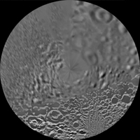
Unlabeled Sindbad Terrain Section
|

Ali Baba Quadrangle (Se-2) | 
Unlabeled Ali Baba Terrain Section
|

Se-3 Quadrangle | 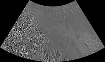
Unlabeled Terrain Section
|

Shahrazad Quadrangle (Se-4) | 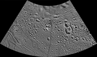
Unlabeled Shahrazad Terrain Section
|
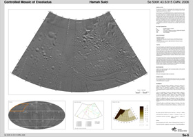
Hamah Sulci Quadrangle (Se-5) | 
Unlabeled Hamah Sulci Terrain Section
|

Salih Quadrangle (Se-6) | 
Unlabeled Salih Terrain Section
|

Se-7 Quadrangle | 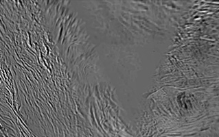
Unlabeled Terrain Section
|

Khusrau Quadrangle (Se-8) | 
Unlabeled Khusrau Terrain Section
|

Ebony Dorsum Quadrangle (Se-9) | 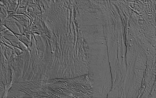
Unlabeled Ebony Dorsum Terrain Section
|

Aziz Quadrangle (Se-10) | 
Unlabeled Aziz Terrain Section
|

Se-7 Quadrangle | 
Unlabeled Terrain Section
|

Aziz Quadrangle (Se-10) | 
Unlabeled Aziz Terrain Section
|

Hassan Quadrangle (Se-13) | 
Unlabeled Hassan Terrain Section
|

Cashmere Sulci Quadrangle (Se-14) | 
Unlabeled Cashmere Sulci Terrain Section
|

Damascus Sulcus Region (Se-15) | 
Unlabeled Damascus Sulcus Terrain Section
|
The Cassini-Huygens mission is a cooperative project of NASA, the European
Space Agency and the Italian Space Agency. The Jet Propulsion Laboratory,
a division of the California Institute of Technology in Pasadena, manages
the mission for NASA's Science Mission Directorate, Washington, D.C. The
Cassini orbiter and its two onboard cameras were designed, developed and
assembled at JPL. The imaging operations center is based at the Space
Science Institute in Boulder, Colo.
For more information about the Cassini-Huygens mission visit
http://saturn.jpl.nasa.gov/. The Cassini imaging team
homepage is at http://ciclops.org.


