| Home >> | Advanced Search >> |
 |
|
Astronaut Photography of Earth - Display Record
ISS002-E-5401
Low-resolution Browse Image
(Most browse images are not color adjusted.)Images
Conditions for Use of Images >>Image Transformation Tutorial >> Saving, Color Adjusting, and Printing Images >>
Images to View on Your Computer Now
| File Name | File Size (bytes) | Width | Height | Annotated | Cropped | Purpose | Comments | |
|---|---|---|---|---|---|---|---|---|
| View | ISS002-E-5401.JPG | 31459 | 400 | 273 | No | No | Photographic Highlights | |
| View | ISS002-E-5401_2.JPG | 43603 | 640 | 437 | No | No | ||
| View | ISS002-E-5401.JPG | 66803 | 540 | 332 | Yes | Yes | NASA's Earth Observatory web site | |
| View | ISS002-E-5401.JPG | 176733 | 540 | 369 | Photographic Highlights | (540px resized images) | ||
| View | ISS002-E-5401.JPG | 1041280 | 3060 | 2092 | NASA's Earth Observatory web site |
Large Images to Request for Downloading
| File Name | File Size (bytes) | Width | Height | Annotated | Cropped | Purpose | Comments | |
|---|---|---|---|---|---|---|---|---|
| Request | ISS002-E-5401.JPG | 487902 | 1024 | 700 | Photographic Highlights | actual files used | ||
| Request | ISS002-E-5401.JPG | 1041280 | 3060 | 2092 | No | No | ||
| Request | ISS002-E-5401.TIF | 18696382 | 3060 | 2036 | No | No | Reef RS |
Download a Keyhole Markup Language (KML) file for use in Google Earth.
Electronic Image Data
Camera Files >> No sound file available.Identification
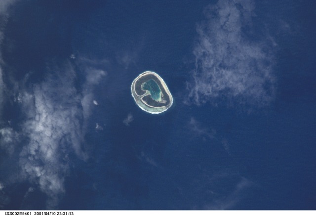
Mission: ISS002 Roll: E Frame: 5401 Mission ID on the Film or image: ISS002Country or Geographic Name: TUAMOTU ARCHIPELAGO
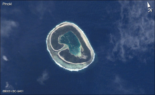
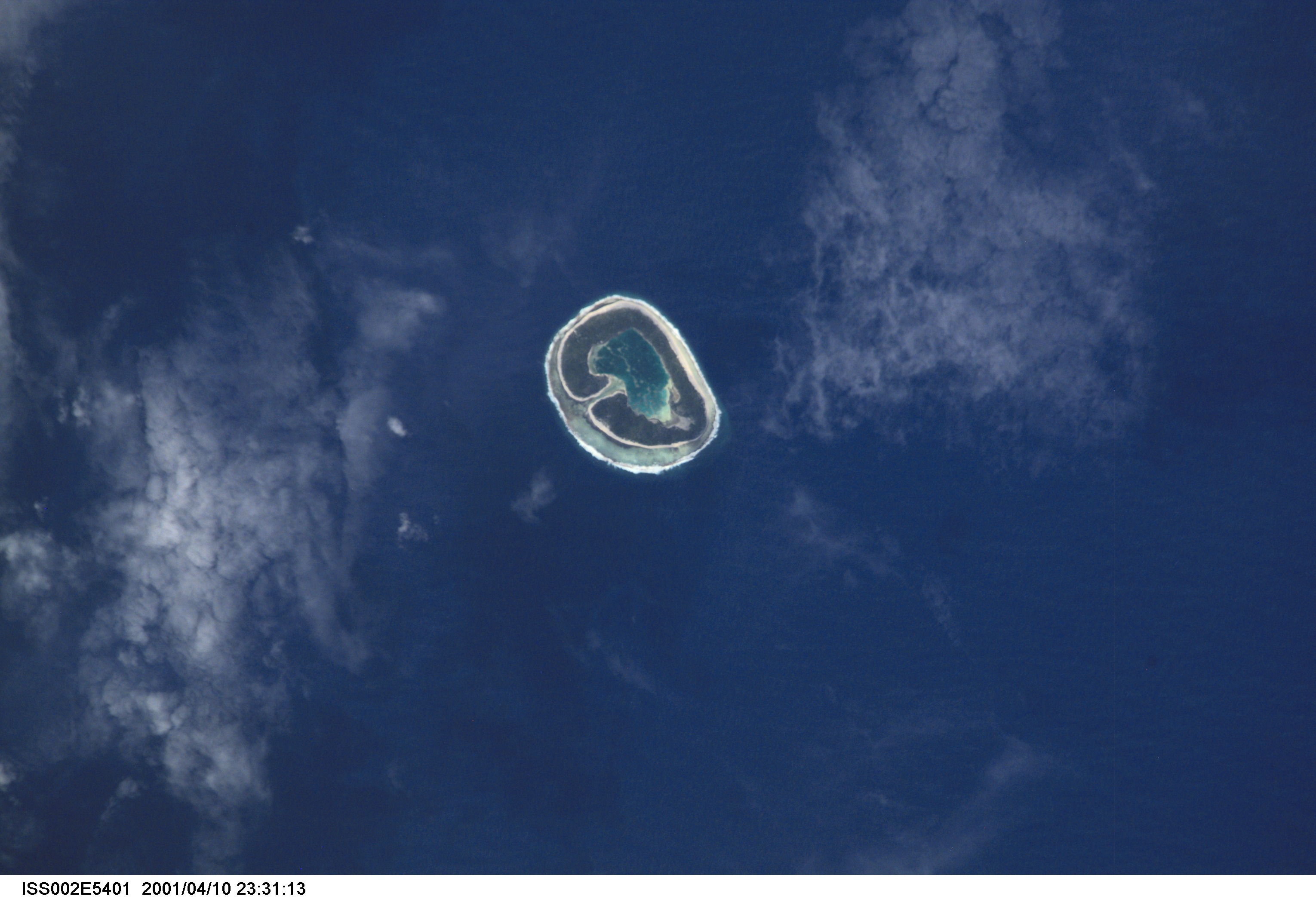
Features: PINAKI ATOLL
Center Point Latitude: -19.5 Center Point Longitude: -138.5 (Negative numbers indicate south for latitude and west for longitude)
Stereo: (Yes indicates there is an adjacent picture of the same area)
ONC Map ID: JNC Map ID:
Camera
Camera Tilt: 17Camera Focal Length: 800mm
Camera: E2: Kodak DCS460 Electronic Still Camera
Film: 3060E : 3060 x 2036 pixel CCD, RGBG array.
Quality
Film Exposure:Percentage of Cloud Cover: 10 (0-10)
Nadir
Date: 20010410 (YYYYMMDD)GMT Time: 231713 (HHMMSS)Nadir Point Latitude: -20.5, Longitude: -138.2 (Negative numbers indicate south for latitude and west for longitude)
Nadir to Photo Center Direction: North
Sun Azimuth: 310 (Clockwise angle in degrees from north to the sun measured at the nadir point)
Spacecraft Altitude: 209 nautical miles (387 km)
Sun Elevation Angle: 48 (Angle in degrees between the horizon and the sun, measured at the nadir point)
Orbit Number: 1659
Captions
This image of the Tuamotu Archipelago, French Polynesia, illustrates diversity in the morphology of atolls, one of the major types of coral reef formations. A typical atoll structure is a lagoon surrounded by a closed rim of cays and shallow spillways that control the exchange of water between the ocean and the lagoon. However, like human beings, this general scheme may vary according to the history of each individual atoll, resulting in a high diversity of morphology, especially for small atolls. Pinaki (3.54 km2) has a drying shallow lagoon still connected to the ocean via a single narrow spillway. Images such as these are useful to classify and study the atolls according to their spatial structure.Link to Earth Observatory Caption >>
Download Packaged File.
This option downloads the following items, packaged into a single file, if they are available:
- Browse image
- Cataloged information with captions
- Camera file
- Sound file
Server: 2 |
This service is provided by the International Space Station program. |
Recommended Citation: |
||

