| Home >> | Advanced Search >> |
 |
|
Astronaut Photography of Earth - Display Record
ISS001-E-5113
Low-resolution Browse Image
(Most browse images are not color adjusted.)Images
Conditions for Use of Images >>Image Transformation Tutorial >> Saving, Color Adjusting, and Printing Images >>
Images to View on Your Computer Now
| File Name | File Size (bytes) | Width | Height | Annotated | Cropped | Purpose | Comments | |
|---|---|---|---|---|---|---|---|---|
| View | ISS001-E-5113.JPG | 62277 | 540 | 360 | Yes | No | NASA's Earth Observatory web site | |
| View | ISS001-E-5113.JPG | 124270 | 640 | 437 | No | No | From STIC | |
| View | ISS001-E-5113.JPG | 625689 | 3056 | 2036 | No | No | NASA's Earth Observatory web site |
Large Images to Request for Downloading
| File Name | File Size (bytes) | Width | Height | Annotated | Cropped | Purpose | Comments | |
|---|---|---|---|---|---|---|---|---|
| Request | ISS001-E-5113.JPG | 625689 | 3056 | 2036 | No | No | NASA's Earth Observatory web site | |
| Request | ISS001-E-5113.JPG | 2217836 | 3060 | 2092 | No | No | From STIC |
Download a Keyhole Markup Language (KML) file for use in Google Earth.
Electronic Image Data
Camera Files >> No sound file available.Identification
Mission: ISS001 Roll: E Frame: 5113 Mission ID on the Film or image: ISS01Country or Geographic Name: ARGENTINA
Features: SAN LORENZO PEAK, LAKES
Center Point Latitude: -47.5 Center Point Longitude: -72.0 (Negative numbers indicate south for latitude and west for longitude)
Stereo: (Yes indicates there is an adjacent picture of the same area)
ONC Map ID: JNC Map ID:
Camera
Camera Tilt:Camera Focal Length: 400mm
Camera: E2: Kodak DCS460 Electronic Still Camera
Film: 3060E : 3060 x 2036 pixel CCD, RGBG array.
Quality
Film Exposure:Percentage of Cloud Cover: 25 (11-25)
Nadir
Date: 200012__ (YYYYMMDD)GMT Time: (HHMMSS)Nadir Point Latitude: , Longitude: (Negative numbers indicate south for latitude and west for longitude)
Nadir to Photo Center Direction:
Sun Azimuth: (Clockwise angle in degrees from north to the sun measured at the nadir point)
Spacecraft Altitude: nautical miles (0 km)
Sun Elevation Angle: (Angle in degrees between the horizon and the sun, measured at the nadir point)
Orbit Number:
Captions
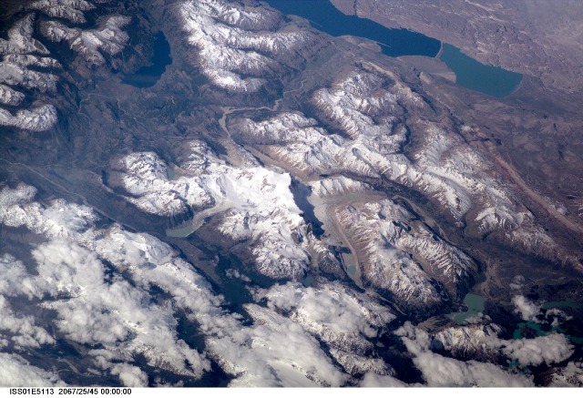
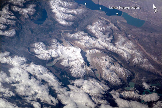
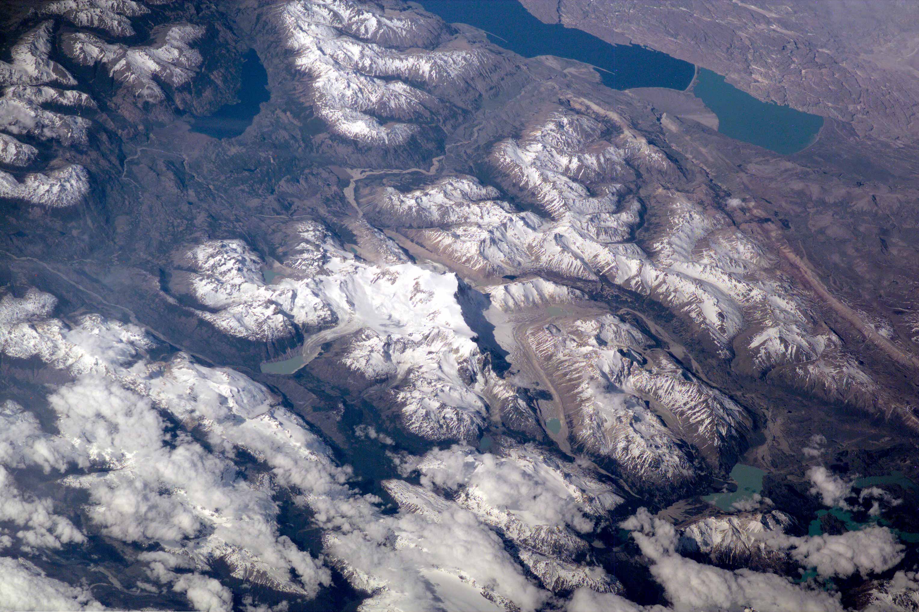
Erosion by Ice and Water in the Southern AndesThis scene on the remote, rugged Argentine/Chilean border in the far southern Andes Mountains offers numerous, dramatic examples of both erosional processes and features of ice and water. The sharp, glaciated crest of the Cerro San Lorenzo (center) exceeds 12,000 feet and casts a long shadow southeastward. Glaciers on its western flank flow into the valley.
Lago Pueyrredon, and the other lakes visible here, have been excavated by geologically recent episodes of glacier erosion, when glaciers extended all the way onto the lowland plains (top right). Since the last melting of the glaciers (~15,000 years ago) three distinct "fan-deltas" (semicircular features-arrows) have formed where rivers flow into the lake. Counterclockwise currents in the lake-driven by strong winds from the west-have generated thin sand spits from each fan-delta. The largest spit (attached to the largest fan-delta, see right arrow) has isolated an approximately 10-kilometer long segment of the south end of the lake. This river, which has constructed the large fan, presently discharges turbid water to this isolated basin, giving it a lighter color than the rest of the lake.
This Electronic Still Camera photo was taken from the International Space Station, in December 2000 (late spring) when most of the previous winter's snow had melted below an altitude of 6,000 feet. Little evidence of man's presence can be found in this rough, desolate region.
Glacial data collected over the past 50 years indicate that small ice bodies are disappearing at accelerated rates. (EOS, vol 81, no. 24, June 13, 2000) Predictions are that large fluctuations in land ice, with significant implications to society, are possible in the coming decades and centuries due to natural and anthropogenic climate change. Before glacial data can be used to address critical problems pertaining to the world's economic and environmental health, more detailed information about such glaciers is needed. Images like this from the International Space Station can be added to those taken from satellites (Landsat-7, instruments on the Terra satellite launched in 1999) to build data sets of glaciers in remote areas around the world.
Download Packaged File.
This option downloads the following items, packaged into a single file, if they are available:
- Browse image
- Cataloged information with captions
- Camera file
- Sound file
Server: 2 |
This service is provided by the International Space Station program. |
Recommended Citation: |
||

