| Home >> | Advanced Search >> |
 |
|
Astronaut Photography of Earth - Display Record
ISS007-E-10960
Low-resolution Browse Image
(Most browse images are not color adjusted.)Images
Conditions for Use of Images >>Image Transformation Tutorial >> Saving, Color Adjusting, and Printing Images >>
Images to View on Your Computer Now
| File Name | File Size (bytes) | Width | Height | Annotated | Cropped | Purpose | Comments | |
|---|---|---|---|---|---|---|---|---|
| View | ISS007-E-10960.JPG | 52049 | 639 | 435 | No | No | ||
| View | ISS007-E-10960.JPG | 102001 | 540 | 405 | Yes | Earth From Space collection | ||
| View | ISS007-E-10960.JPG | 656208 | 1000 | 685 | No | Yes | NASA's Earth Observatory web site | Color adjusted |
Large Images to Request for Downloading
| File Name | File Size (bytes) | Width | Height | Annotated | Cropped | Purpose | Comments | |
|---|---|---|---|---|---|---|---|---|
| Request | ISS007-E-10960.JPG | 923450 | 3032 | 2064 | No | No | ||
| Request | ISS007-E-10960.JPG | 6430814 | 3032 | 2000 | No | No | NASA's Earth Observatory web site | Color adjusted |
Download a Keyhole Markup Language (KML) file for use in Google Earth.
Electronic Image Data
Camera Files >> No sound file available.Identification
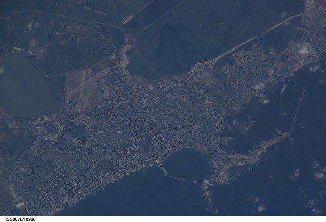
Mission: ISS007 Roll: E Frame: 10960 Mission ID on the Film or image: ISS007Country or Geographic Name: EGYPT
Features: ALEXANDRIA, PORT FACILITY
Center Point Latitude: 31.2 Center Point Longitude: 29.9 (Negative numbers indicate south for latitude and west for longitude)
Stereo: (Yes indicates there is an adjacent picture of the same area)
ONC Map ID: JNC Map ID:
Camera
Camera Tilt: 11Camera Focal Length: 800mm
Camera: E4: Kodak DCS760C Electronic Still Camera
Film: 3060E : 3060 x 2036 pixel CCD, RGBG array.
Quality
Film Exposure:Percentage of Cloud Cover: 10 (0-10)
Nadir
Date: 20030727 (YYYYMMDD)GMT Time: 152542 (HHMMSS)Nadir Point Latitude: 31.8, Longitude: 29.6 (Negative numbers indicate south for latitude and west for longitude)
Nadir to Photo Center Direction: South
Sun Azimuth: 281 (Clockwise angle in degrees from north to the sun measured at the nadir point)
Spacecraft Altitude: 203 nautical miles (376 km)
Sun Elevation Angle: 19 (Angle in degrees between the horizon and the sun, measured at the nadir point)
Orbit Number: 2732
Captions
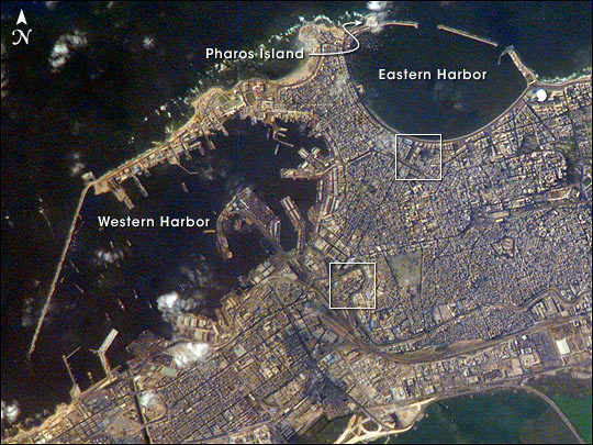
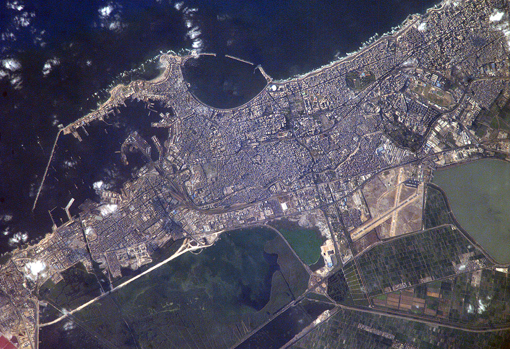
Alexandria, Egypt:Founded by Alexander the Great in 331 BC on the Mediterranean coast of Egypt, Alexandria became a center of trade and learning in the ancient world. Alexander built the causeway between the Eastern and Western Harbors, joining Pharos Island (arrow) to the mainland. Alexandria’s cultural status was symbolized by the lighthouse on Pharos, one of the “Seven Wonders of the World.” The causeway is still known as the old part of the modern city. Since the year 2000, underwater archeologists have located the sunken palace, ceremonial buildings and port facilities of ancient Alexandria, located along most of the curved southern shoreline of the Eastern Harbor.
The Eastern Harbor was the main port in the Middle Ages. This detailed image taken by Space Station crew members using an 800-mm lens provides a view of the modern port facilities in the Western Harbor, where wharves and many moored ships can be detected. The lower box indicates the part of the city where the famous Library of Alexandria was located, and also where Alexander the Great may be buried. The upper box indicates the entertainment quarter where literary figures from the Middle East and Europe have worked. A wider view of the city was taken from the International Space Station in December 2000.
Download Packaged File.
This option downloads the following items, packaged into a single file, if they are available:
- Browse image
- Cataloged information with captions
- Camera file
- Sound file
Server: 2 |
This service is provided by the International Space Station program. |
Recommended Citation: |
||

