Elko Area Photos - Click on Thumbnail
for Larger Image |
![Tuscarora](https://webarchive.library.unt.edu/eot2008/20080916194137im_/http://www.wrh.noaa.gov/images/lkn/tuscarora.jpg) |
Near Tuscarora |
![Adobe Mountains](https://webarchive.library.unt.edu/eot2008/20080916194137im_/http://www.wrh.noaa.gov/images/lkn/adobemtns.jpg) |
Adobe Mountains over-looking Elko |
![KLRX Radar Construction](https://webarchive.library.unt.edu/eot2008/20080916194137im_/http://www.wrh.noaa.gov/images/lkn/dollarlake.jpg) |
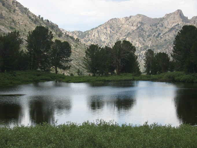
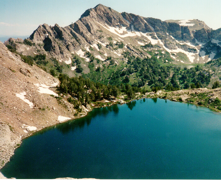
Beautiful Dollar Lake in the Ruby Mountains near Lamoille. |
![Griswold](https://webarchive.library.unt.edu/eot2008/20080916194137im_/http://www.wrh.noaa.gov/images/lkn/fromgriswold.jpg) |
Looking down at Spring Creek from Griswold Lake in the Ruby Mountatins. |
![KLRX Radar Construction](https://webarchive.library.unt.edu/eot2008/20080916194137im_/http://www.wrh.noaa.gov/images/lkn/finishre.jpg) |
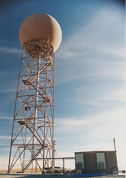
The finished radar, which took five months to
complete. Click on the thumbnail to see the radar. |
![The Elko Weather Office](https://webarchive.library.unt.edu/eot2008/20080916194137im_/http://www.wrh.noaa.gov/images/lkn/new-2re.jpg) |
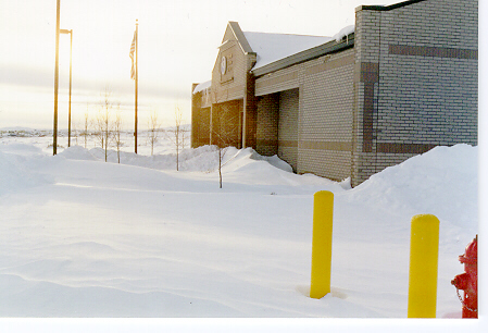
The Elko Weather Office covered in snow after
a record setting snowfall dropped nearly 22 inches
in a 24 hour period. The snowfall occurred on January
24-25 1996. |
![Thunderstorm Damage](https://webarchive.library.unt.edu/eot2008/20080916194137im_/http://www.wrh.noaa.gov/images/lkn/stmdmgre.jpg) |
86 MPH winds uprooted trees and caused a lot of
damage during a thunderstorm. The storm occured
July 10, 1995. |
|
This vehicle's window was also broken in the July
10th storm. |
![August 10, 1999](https://webarchive.library.unt.edu/eot2008/20080916194137im_/http://www.wrh.noaa.gov/images/lkn/stormsm.jpg) |
A shelf cloud from a severe thunderstorm bears
down on Elko. |
![August 10, 1999](https://webarchive.library.unt.edu/eot2008/20080916194137im_/http://www.wrh.noaa.gov/images/lkn/planesm.jpg) |
A brave pilot is seen flying during a storm. |
![Click to see pictures of Jarbidge, NV](https://webarchive.library.unt.edu/eot2008/20080916194137im_/http://www.wrh.noaa.gov/images/lkn/longroadsm.jpg) |
Follow the lonely road to see more pictures of
beautiful Jarbidge, Nevada. |
![Liberty Lake-July 1995](https://webarchive.library.unt.edu/eot2008/20080916194137im_/http://www.wrh.noaa.gov/images/lkn/ruby2re.jpg) |
This is a photo of snow-covered Liberty Lake in
July of 1995. Liberty Lake is located in the Ruby
Mountains. |
![Liberty Lake-August 1995](https://webarchive.library.unt.edu/eot2008/20080916194137im_/http://www.wrh.noaa.gov/images/lkn/ruby1re.jpg) |
Liberty Lake one month later missing its coat
of white. |
![West Fork-Lamoille Canyon](https://webarchive.library.unt.edu/eot2008/20080916194137im_/http://www.wrh.noaa.gov/images/lkn/ruby3re.jpg) |
The west fork of Lamoille Creek Canyon. |
![Lamoille Canyon](https://webarchive.library.unt.edu/eot2008/20080916194137im_/http://www.wrh.noaa.gov/images/lkn/ruby4re.jpg) |
Another branch of Lamoille Canyon. |
![Ruby Dome](https://webarchive.library.unt.edu/eot2008/20080916194137im_/http://www.wrh.noaa.gov/images/lkn/domepeaksm.jpg) |
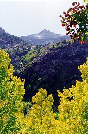
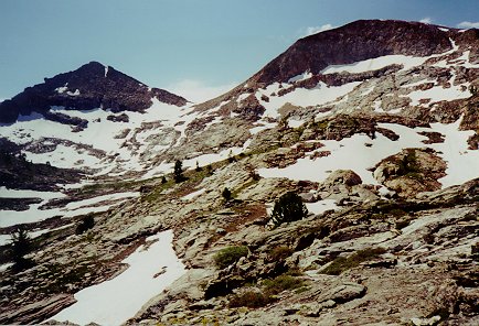
Ruby Dome(right peak) is at an elevation of 11,384
feet. |
![Griswold Lake](https://webarchive.library.unt.edu/eot2008/20080916194137im_/http://www.wrh.noaa.gov/images/lkn/grislksm.jpg) |
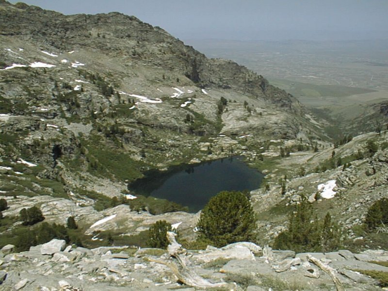
This is a photo of Griswold Lake and the Spring
Creek Valley. |
![Top Of The Dome!](https://webarchive.library.unt.edu/eot2008/20080916194137im_/http://www.wrh.noaa.gov/images/lkn/polesm.jpg) |
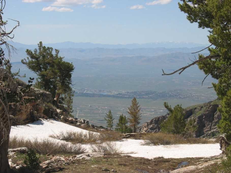
A view to the south from the top of the Ruby Dome. |
![A Very Pretty Trail](https://webarchive.library.unt.edu/eot2008/20080916194137im_/http://www.wrh.noaa.gov/images/lkn/trailsm.jpg) |
The trail leading to Griswold Lake and the Ruby
Dome. |