 |
 | |
  | |
|
|
|
|
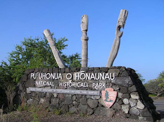
Pu`uhonua o Honaunau National Historical Park
Directions
|
|
|
|
|
| |
 |
 |
|
 |
From Kailua-Kona: Take Highway 11 south, approximately 20 miles. Between mileposts 103 and 104, at the Honaunau Post Office, turn right towards the ocean onto Hwy 160. Travel 3.5 miles and turn left at the Pu'uhonua o Honaunau National Historical Park sign. Travel times will vary due to ongoing construction in North Kona.
From Hilo, going north: Take Hwy 19 to the junction of Hwy 190 in Waimea. As the road bends follow Hwy 190 until it intersects with Hwy 11 and turn left. (Hwy 11 is also known as Hawaii Belt Road and Queen Kaahumanu Hwy). Between mileposts 103 and 104, at the Honaunau Post Office, turn right towards the ocean onto Hwy 160. Travel 3.5 miles then turn left at the Pu'uhonua o Honaunau National Historical Park sign. Total travel distance is approximately 116 miles.
From Hilo, going south: Take Hwy 11 south past Hawaii Volcanoes National Park, and the towns of Pahala and Naalehu. Between milesposts 103 and 104, at the Honaunau Post Office, turn left towards the ocean onto Hwy 160. Travel 3.5 miles then turn left at the Pu'uhonua o Honaunau National Historic Park sign. Total travel distance is approximately 107 miles.
|
|  |  |
|
|
|
|
|
|
|
|
|
 |
|
Did You Know?
Did you know that the ki'i (carved wooden images) found throughout the park are carved from the ohia tree? This tree grows in the uplands of Hawai'i and is among the first plants to colonize new lava flows.
|
|
|
|
Last Updated: December 14, 2007 at 19:30 EST |


