Skip Navigation Linksweather.gov 
NOAA logo - Click to go to the NOAA homepage National Weather Service   NWS logo - Click to go to the NWS homepage
Houston Central Weather Service Unit
Search 
   

Local forecast by
"City, St or Zipcode" 


Midland International Airport Del Rio International Airport Mathis Field (San Angelo, TX) Abilene Regional Airport Laredo International Airport McAllen - Miller International Airport Rio Grande Valley International Airport Brownsville - South Padre Island International Airport Alice International Airport Corpus Christi International Airport Victoria Regional Airport Stinson Municipal Airport San Antonio International Airport Austin-Bergstrom International Airport Waco Regional Airport Dallas-Fort Worth International Airport Easterwood Field (College Station, TX) Angelton/Lake Jackson-Brazoria County Airport Sugar Land Regional Airport Scholes Field (Galveston, TX) William P. Hobby Airport George Bush International Airport Huntsville Municipal Angelina County Airport Jefferson County Airport (Beaumont, TX) Lake Charles Regional Airport Shreveport Regional Airport Acadiana Regional Airport Lafayette Regional Airport Alexandria International Airport Monroe Regional Airport Baton Rouge Metropolitan Airport (Ryan Field) New Orleans International Airport (Moisant Field) McComb - Pike County - John E. Lewis Airport Jackson International Airport Gulfport - Biloxi Regional Airport Mobile Regional Airport Pensacola Regional Airport Alburquerque CWSU Fort Worth CWSU Memphis CWSU Jacksonville CWSU Atlanta CWSU
Airways  Airspace  ZHU Airspace Outline
(Click on Site for the Tactical Decision Aid)
Weather map of United States.  Click to go to forecast
Radar images for the Soutnern Plains United States.  Click to view radar images.
Collaborative Convective Forecast Product (CCFP).  Click to go to CCFP.
Center Weather Advisories.  Click to go to CWAs.
Aviation Weather Center Logo.  Click to go to the Aviation Weahter Center
Providing weather briefings and warnings for aviation since 1980
 
Mission:
The Houston (ZHU) Center Weather Service Unit (CWSU) is located at the Federal Aviation Administration (FAA) Air en-Route Traffic Control Center (ARTCC) in Houston, Texas. Four National Weather Service (NWS) meteorologists staff the office. Our hours of operation are from 5:00 A.M. to 9:00 P.M. daily. The primary goal is to enhance both the safety and the efficient flow of air traffic through the ZHU airspace.
 
 
Operations:
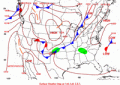
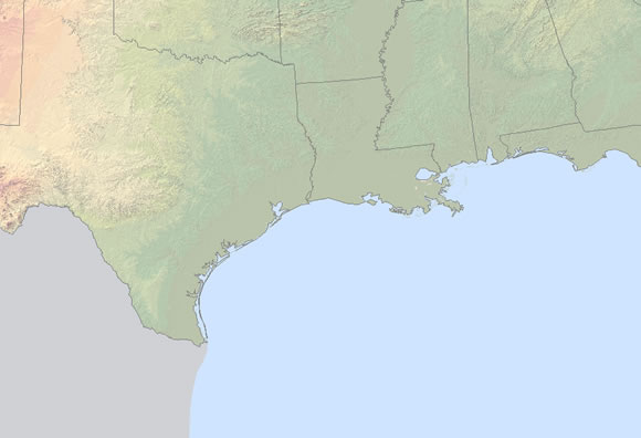
The ZHU ARTCC is one of 21 ARTCC's over contiguous United States and encompasses an area approximately 276,866 square nautical miles extending from the Texas Big Bend area eastward to the Alabama/Florida state line including a large portion of the Gulf of Mexico north of 24 degrees North latitude. Within the Houston Center area, there are 22 FAA control towers, 16 approach control facilities, 87 major airports and 15 military fields. This center handles approximately 2.5 million aircraft operations a year or over 7000 per day.

Our main responsibility is to provide up to the minute weather information to FAA Supervisors and the ZHU Traffic Management Unit (TMU). The CWSU 
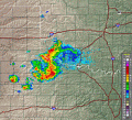
meteorologists issue two products, the Center Weather Advisory (CWA), which is an aviation weather warning for thunderstorms, severe icing or turbulence, and low IFR ceilings and visibility. The Meteorological Impact Statement (MIS) is a 2-12 hour forecast for weather conditions, which are expected to impact ARTCC operations.
 
Main Link Categories:
Forecast ProductsAbout the CWSUContact Us

National Weather Service
Houston Center Weather Service Unit
16600 JFK Blvd
Houston, TX 77032
Web Master's Email: ZHU Webmaster
Date modified: August 11, 2008
Disclaimer
Credits
Glossary

Privacy Policy
About Us
Career Opportunities