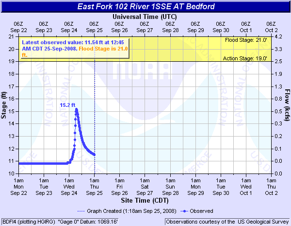
102 River (Click on an image to go to hydrograph webpage)
Beaver Creek (Click on an image to go to hydrograph webpage)


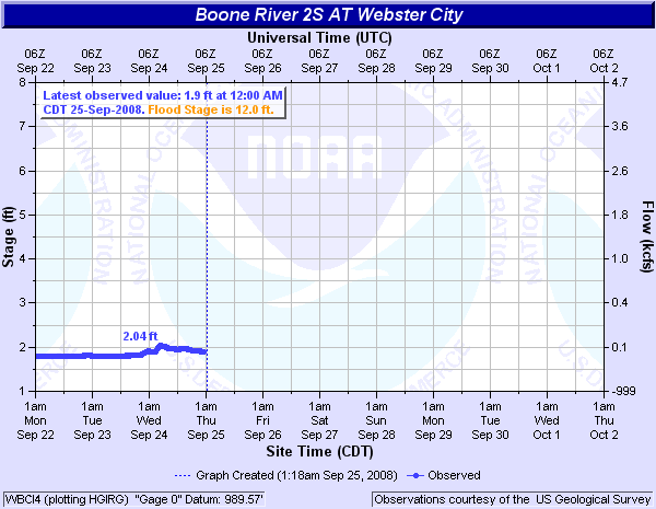
Boone River (Click on an image to go to hydrograph webpage)
Cedar Creek (Click on an image to go to hydrograph webpage)

Cedar River (Click on an image to go to hydrograph webpage)


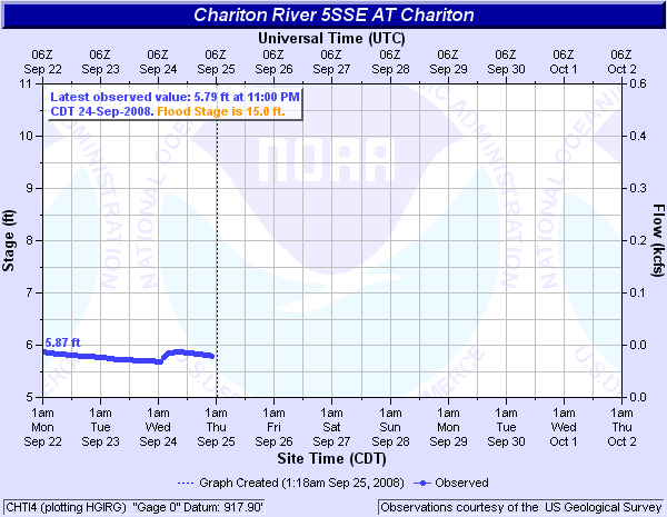
Chariton River (Click on an image to go to hydrograph webpage)


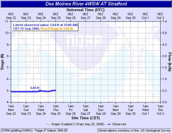
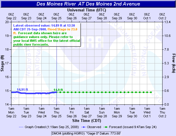
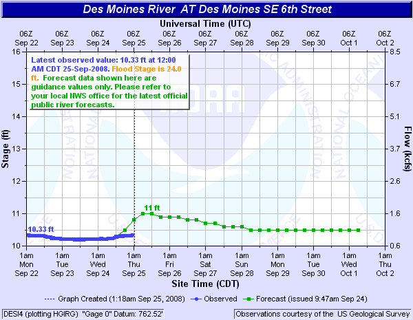
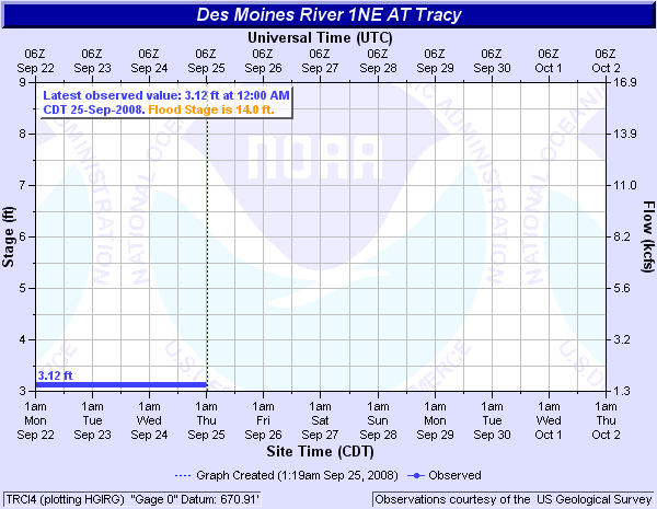
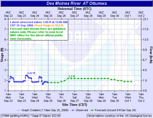
Des Moines River (Click on an image to go to hydrograph webpage)


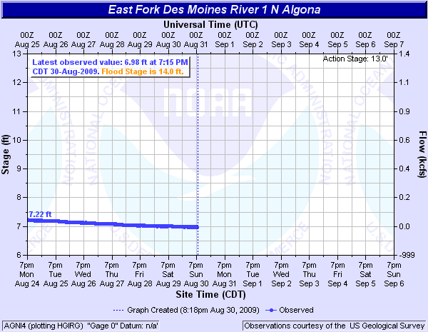
East Fk. Des Moines River (Click on an image to go to hydrograph webpage)

East Fk. Nishnabotna River (Click on an image to go to hydrograph webpage)


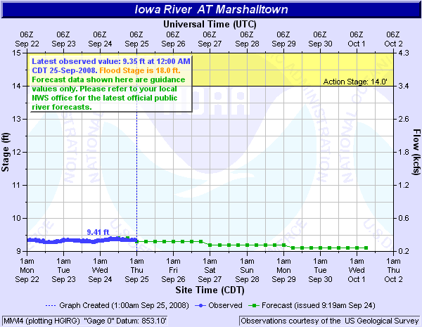
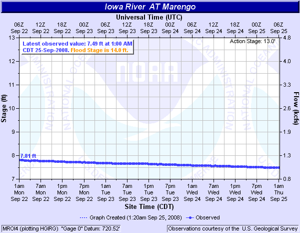
Iowa River (Click on an image to go to hydrograph webpage)
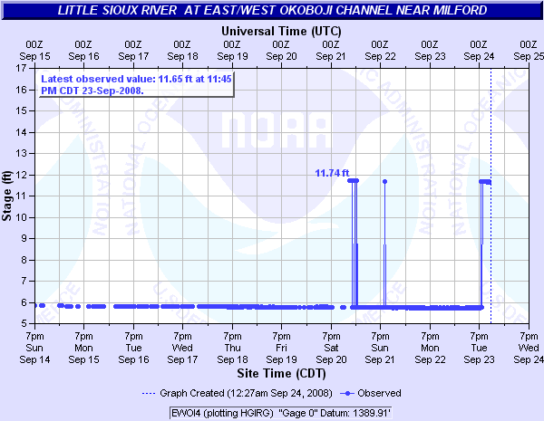
Little Sioux River (Click on an image to go to hydrograph webpage)


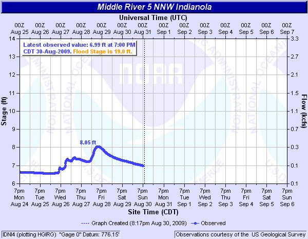
Middle River (Click on an image to go to hydrograph webpage)
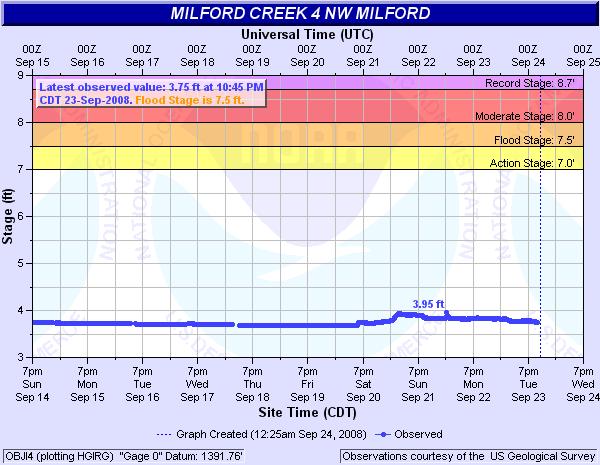
Milford Creek (Click on an image to go to hydrograph webpage)
Nishnabotna River (Click on an image to go to hydrograph webpage)

Nodaway River (Click on an image to go to hydrograph webpage)

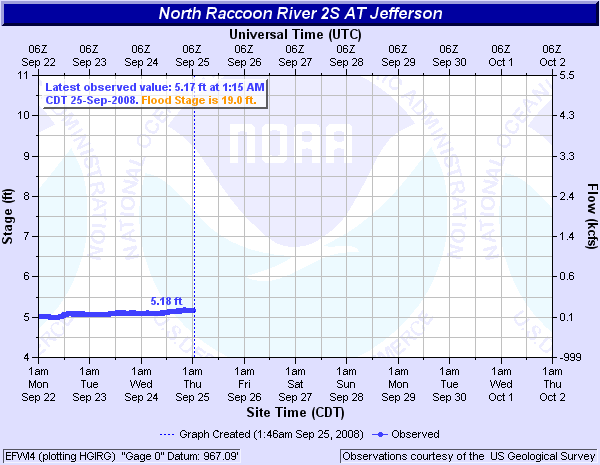
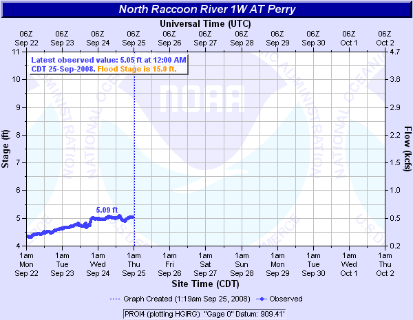
North Fork Raccoon River (Click on an image to go to hydrograph webpage)
North River (Click on an image to go to hydrograph webpage)

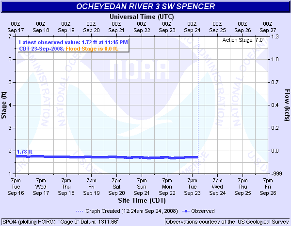
Ocheyedan River (Click on an image to go to hydrograph webpage)
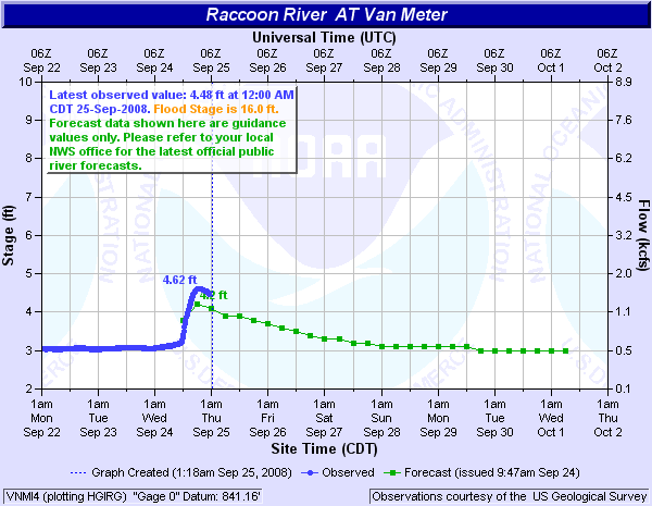
Raccoon River (Click on an image to go to hydrograph webpage)


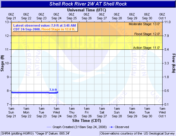
Shell Rock River (Click on an image to go to hydrograph webpage)
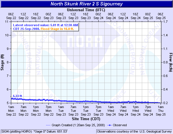
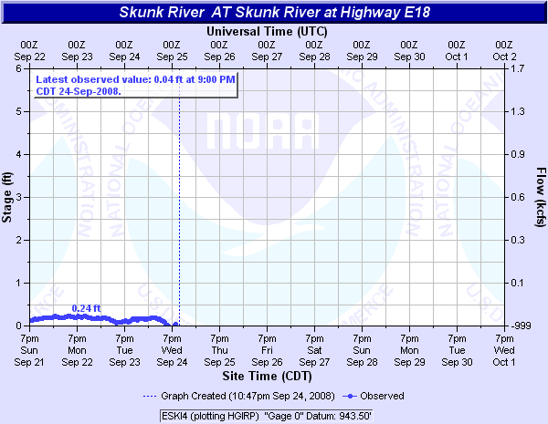
Skunk River (Click on an image to go to hydrograph webpage)

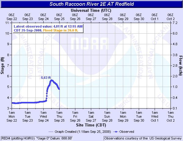
South Fork Raccoon River (Click on an image to go to hydrograph webpage)
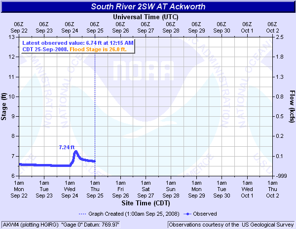
South River (Click on an image to go to hydrograph webpage)
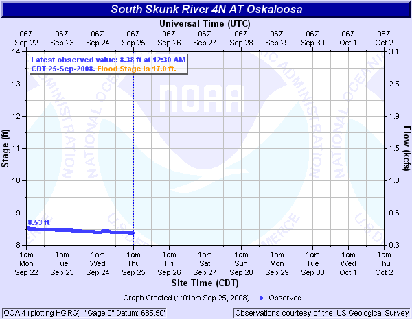
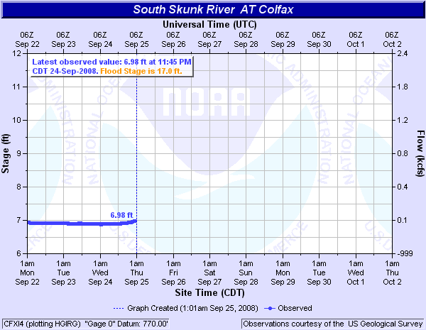
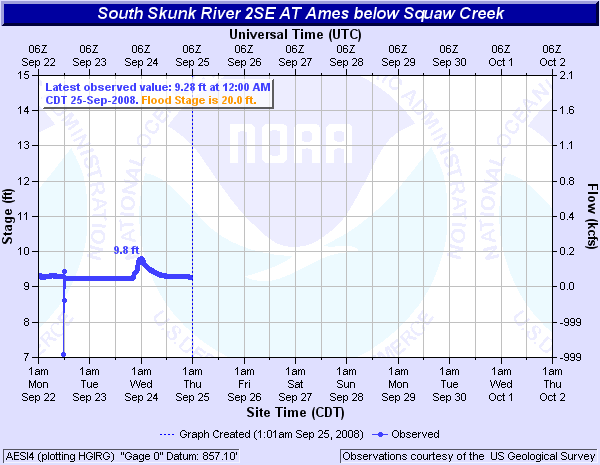
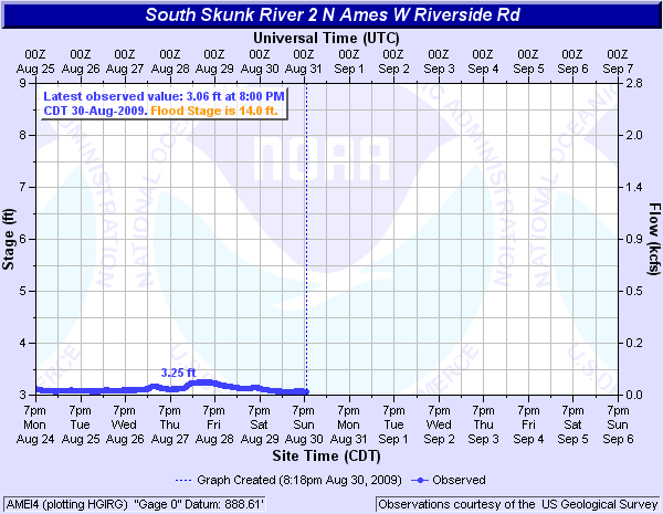
South Skunk River (Click on an image to go to hydrograph webpage)
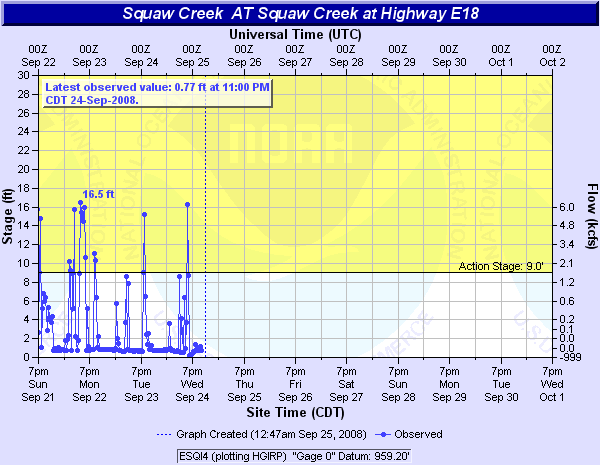
Squaw Creek (Click on an image to go to hydrograph webpage)


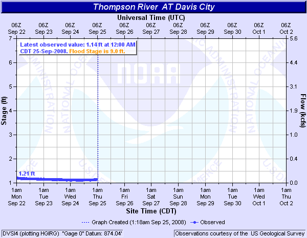
Thompson River (Click on an image to go to hydrograph webpage)
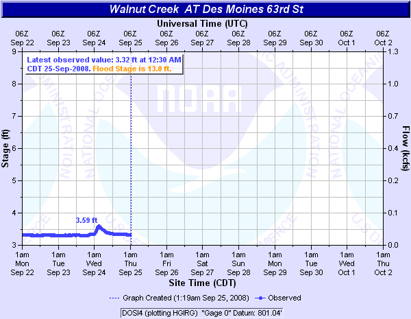
Walnut Creek (Click on an image to go to hydrograph webpage)
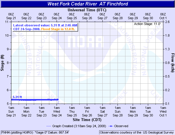
West Fk. Cedar River (Click on an image to go to hydrograph webpage)
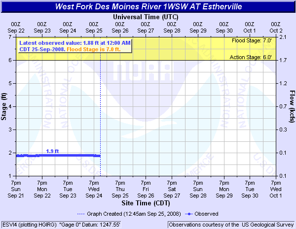
West Fk. Des Moines River (Click on an image to go to hydrograph webpage)


West Fork Nishnabotna River (Click on an image to go to hydrograph webpage)


Winnebago River (Click on an image to go to hydrograph webpage)

|