Salmon-Challis National Forest
| www.reserveusa.com -- online campsite reservations | |
| www.publiclands.org -- (information on recreation sites on public lands in the west) | |
| National Interagency Fire Center -- NIFC | |
| Evaluate
Our Service We welcome your comments on our service and your suggestions for improvement. |
Salmon-Challis National Forest (208) 756-5100 |
|
|
|
Lost River Ranger District
Camping
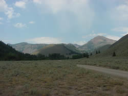
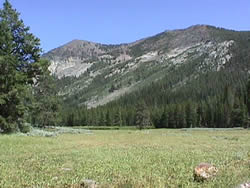
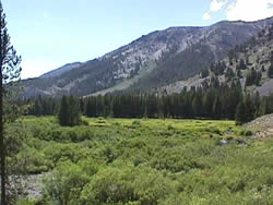
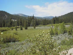
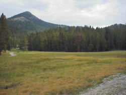
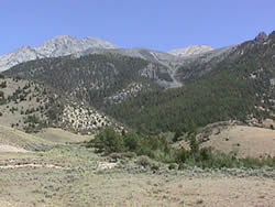
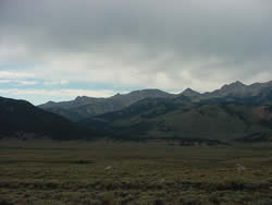
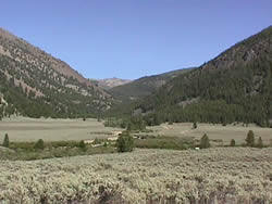
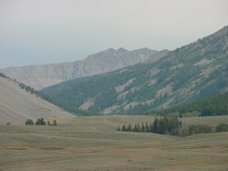
There are many camping areas on the Lost River Ranger District. These include developed fee campgrounds, a developed fee group reservation campground, developed non-fee sites, and dispersed camping areas. There are also several campgrounds near the Lost River Ranger District that are operated by the Sawtooth National Forest, Bureau of Land Management, Idaho Department of Fish and Game, Craters of the Moon National Monument, and private businesses.
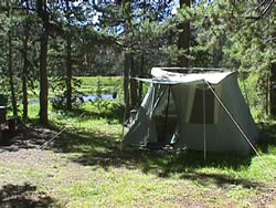
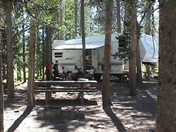
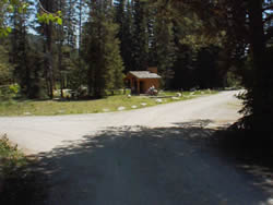
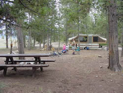
Developed Fee Campgrounds
There are six developed fee campgrounds on the district. These sites require a fee of $5.00/night. There is no charge at these areas when the water is not on, check with the Lost River Ranger District on exact dates when the water is turned on in the spring, or off in the fall due to freezing weather (208) 588-3400.
FEE CAMPGROUNDS
|
CAMPGROUND
|
|---|
| Iron Bog |
| Timber Creek |
| Park Creek |
| Phi Kappa |
| Star Hope |
| Wildhorse |
Notice: Campgrounds may be used October through June but no services are available and no fee is charged. Vehicle access to these campgrounds may be blocked by snow during this time.
Developed Fee Group Reservation Campground (Loristica)
The district has one developed reservation site. This site, known as Loristica, is located in upper Wet Creek in the Lost River Mountain Range. The site can accompany large or small groups. This site requires a reservation and a fee of $30/night. Reservations are from 2:00 P.M. to 2:00 P.M. The campground is available July through September. Weather permitting the campground may beavailable in May, June, October, and November. Summer slots fill quickly so make your reservations early. For reservations please call (208) 588-3400.
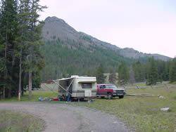
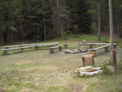
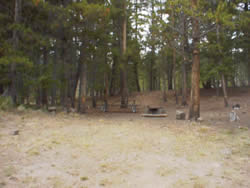
Developed Non-fee Sites
There are eight developed non-fee camping areas on the district. For more information about a specific site select from the list below.
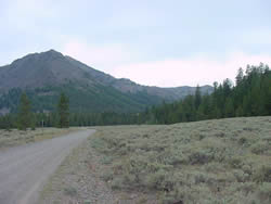
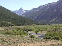
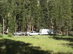
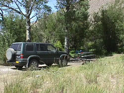
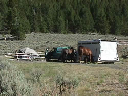
Dispersed Camping Areas
Dispersed camping areas are found throughout the district.
Developed Fee Campground Information
|
Number of Units: 21 (24 foot maximum
trailer size) Access: From Arco: Take US Highway 93 north of Arco to the Antelope Creek
Road. Turn left on the Antelope Creek Road. Follow this road 19
miles to the campground. |
|
 |
 |
| Number of Units: 12 Water: 1 Hand Pump (water is only available during the summer months) Toilets: 1 Fee: $5.00/night Other Facilities: 1 group site Elevation: 7,800 feet Setting: Heavily wooded. Adjacent to small pond General Season of Use: mid June through mid October Nearby Areas of Interest: Kane Lake, Big Fall Creek Lake, Sun Valley/Ketchum Area Access: From Mackay: Take US Highway 93 16 miles north of Mackay to the Trail Creek Road. Turn left on the Trail Creek Road. Follow this road 26 miles to the campground. From Challis: Take US Highway 93 south of Challis to the Trail Creek Road. Turn right on the Trail Creek Road. Follow this road 26 miles to the campground. From Sun Valley/Ketchum: Take Highway 75 (Main Street) to Sun Valley Road. Turn northeast onto Sun Valley Road. This road turns into the Trail Creek Road. Follow this road 26 miles to the campground. |
|
 |
 |
| Number of Units: 21 Water: 1 hand pump (please note water is naturally a rust color and is only available during the summer months) Toilets: 2 Fee: $5.00/night Other Facilities: none Elevation: 7,600 feet Setting: wooded lodge pole pine General Season of Use: mid June through mid October Nearby Areas of Interest: Kane Lake, Big Fall Creek Lake, Sun Valley/Ketchum Area Access: From Mackay: Take US Highway 93 16 miles north of Mackay to the Trail Creek Road. Turn left on the Trail Creek Road. Follow this road 23 miles to the campground. From Challis: Take US Highway 93 south of Challis to the Trail Creek Road. Turn right on the Trail Creek Road. Follow this road 23 miles to the campground. From Sun Valley/Ketchum: Take Highway 75 (Main Street) to Sun Valley Road. Turn northeast onto Sun Valley Road. This road turns into the Trail Creek Road. Follow this road 23 miles to the campground. |
|
 |
 |
| Number of Units: 21 (one
handicap accessible) Water: faucets (water is only available during the summer months) Toilets: 3 (one is handicap accessible) Fee: $5.00/night Other Facilities: hitching rail Elevation: 8,000 feet Setting: wooded General Season of Use: late June through early October Nearby Areas of Interest: Star Hope Canyon, mountain lakes in Broad Canyon, Bellas Canyon, and Lake Creek Access: From Mackay: Take US Highway 93 16 miles north of Mackay to the Trail Creek Road. Turn left on the Trail Creek Road. Follow this road 18 miles to the Copper Basin Road. Turn left onto the Copper Basin Road. Follow this road 13 miles to the Copper Basin Loop Road. Turn right onto the Copper Basin Loop Road. Follow this road 9 miles to the campground. From Challis: Take US Highway 93 south of Challis to the Trail Creek Road. Turn right on the Trail Creek Road. Follow this road to the Copper Basin Road. Turn left onto the Copper Basin Road. Follow this road 13 miles to the Copper Basin Loop Road. Turn right onto the Copper Basin Loop Road. Follow this road 9 miles to the campground. From Sun Valley/Ketchum: Take Highway 75 (Main Street) to Sun Valley Road. Turn northeast onto Sun Valley Road. This road turns into the Trail Creek Road. Follow this road to the Copper Basin Road. Turn right onto the Copper Basin Road. Follow this road 13 miles to the Copper Basin Loop Road. Turn right onto the Copper Basin Loop Road. Follow this road 9 miles to the campground. |
|
 |
 |
| Number of Units: 12 Water: 2 Faucets (water is only available during the summer months) Toilets: 1 (Handicap accessible) Fee: $5.00/night Other Facilities: 1 handicap accessible site Elevation: 7,340 feet Setting: wooded General Season of Use: early June through mid October Nearby Areas of Interest: Mill Creek Lake Access: From Mackay: Take US Highway 93 south of Mackay 7 miles to the Pass Creek Road. Turn left on the Pass Creek Road. Follow this road 28 miles to the Little Lost/Pahsimeroi Road. Turn left on the Little Lost/Pahsimeroi Road. Follow this road 0.2 miles to the Sawmill Canyon Road. Turn right on the Sawmill Canyon Road and follow this road to the Timber Creek Road. Turn left on the Timber Creek Road and follow this road to the Timber Creek Campground Road. Turn left on this road and follow it to the campground. From Arco: Take US Highway 20/26 south of Arco 8 miles to State Highway 22/33. Turn left on State Highway 22/33. Follow this road 16 miles to Howe. Continue straight through Howe onto the Little Lost/Pahsimeroi Road. Follow this road 37 miles to the Sawmill Canyon Road. Turn right on the Sawmill Canyon Road. Follow this road to the Timber Creek Road. Turn left on the Timber Creek Road. Follow this road to the Timber Creek Campground Road. Turn left on this road and follow it to the campground. From Howe: From the Little Lost Store go north on the Little Lost/Pahsimeroi Road. Follow this road 37 miles to the Sawmill Canyon Road. Turn right on the Sawmill Canyon Road. Follow this road to the Timber Creek Road. Turn left on the Timber Creek Road. Follow this road to the Timber Creek Campground Road. Turn left on this road and follow it to the campground. /td> |
|
 |
 |
| Number of Units: 12 Water: 2 hand pumps (water is only available during the summer months) Toilets: 2 Fee: $5.00/night Other Facilities: one group site Elevation: 7,400 feet Setting: wooded General Season of Use: early June through mid October Nearby Areas of Interest: mountain lakes in Fall Creek, Boulder Creek, and the head of Wildhorse Canyon, historic Wildhorse fire lookout Access: From Mackay: Take US Highway 93 16 miles north of Mackay to the Trail Creek Road. Turn left on the Trail Creek Road. Follow this road 18 miles to the Copper Basin Road. Turn left on the Copper Basin Road. Follow this road 2 miles to the Wildhorse Creek Road. Stay to the right on the Wildhorse Creek Road. Follow the Wildhorse Creek Road 5.5 miles to the campground. From Challis: Take US Highway 93 south of Challis to the Trail Creek Road. Turn right on the Trail creek Road. Follow this road 18 miles to the Copper Basin Road. Turn left on the Copper Basin Road. Follow this road 2 miles to the Wildhorse Creek Road. Stay to the right on the Wildhorse Creek Road. Follow the Wildhorse Creek Road 5.5 miles to the campground. From Sun Valley/Ketchum: Take Highway 75 (main street) to Sun Valley Road. Turn northeast onto the Sun Valley Road. This road turns into Trail Creek Road. Follow this road to the Copper Basin road. Turn right on the Copper Basin Road. Follow this road 2 miles to the Wildhorse Creek Road. Stay to the right on the Wildhorse Creek Road. Follow the Wildhorse Creek Road 5.5 miles to the campground. |
|
 |
 |
Developed Fee Group Reservation Campground
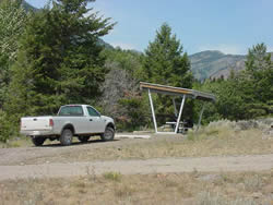
| Number of Units: 8 Water: none Toilets: 1 (handicap accessible) Fee: $30.00/night - by reservation only - Reservations for this campground are available for the months of July, August, and September. Weather permitting the campground may also be available in May, June, October, and November. Reservations are from 2:00 P.M. to 2:00 P.M. For reservations please call (208) 588-3400. Other Facilities: group meeting sight, flag pole Elevation: 8,100 feet Setting: open meadow surrounded by trees General Season of Use: early July through September (May-November weather permitting) Nearby Areas of Interest: during wet periods a small lake adjacent to campground, Hidden Mouth Cave, Pass Creek Narrows Access: From Mackay: Take US Highway 93 south of Mackay 7 miles to the Pass Creek Road. Turn left on the Pass Creek Road. Follow this road 12 miles to the Pass Creek Summit. At the Pass Creek Summit turn left onto the Loristica Road. Follow this road 1.7 miles to the fork in the road. Stay to the right and go through the gate to the campground. From Arco: Take US Highway 93 north of Arco to the Pass Creek Road. Turn right on the Pass Creek Road. Follow this road 12 miles to the Pass Creek Summit. At the Pass Creek Summit turn left onto the Loristica Road. Follow this road 1.7 miles to the fork in the road. Stay to the right and go through the gate to the campground. From Howe: At the Little Lost Store turn north onto the Little Lost/Pahsimeroi Road. Follow this road to the Wet Creek Road. Turn left onto the Wet Creek Road. Follow this road to the Pass Creek Summit. At the Pass Creek Summit turn right onto the Loristica Road. Follow this road 1.7 miles to the fork in the road. Stay to the right and go through the gate to the campground. |
|
 |
 |
 |
 |
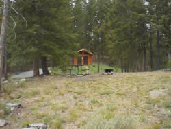
Developed Non-fee Sites
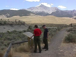
| Number of Units: 5 Water: none Toilets: 1 (handicap accessible) Fee: none Other Facilities: two safety and information signs Elevation: 7,200 feet Setting: open brush with some trees General Season of Use: May through November Borah Peak Trail: variable (see Borah Peak Page) Nearby Areas of Interest: Earthquake Interpretive Site, Chilly Slough Access: Map to the trailhead From Mackay: Take US Highway 93 20 miles north of Mackay to the Borah Peak Access Road. Follow the Borah Peak Access Road 3 miles to the trailhead. From Challis: Take Us Highway 93 south of Challis to the Borah Peak Access Road. Follow the Borah Peak Access Road 3 miles to the trailhead. From Sun Valley/Ketchum: Take Highway 75 (main street) to Sun Valley Road. Turn northeast onto Sun Valley Road. This road turns into Trail Creek Road (closed in winter). Follow this road to Highway 93. Turn left on Highway 93. Follow this road 4.5 miles to the Borah Peak Access Road. Follow the Borah Peak Access Road 3 miles to the trailhead. |
|
 |
 |
|
|
|
| Number of Units: 8 Water: none Toilets: 1 (handicap accessible) Fee: none Other Facilities: Elevation: 7,800 feet Setting: Wooded General Season of Use: late June through mid October Nearby Areas of Interest: mountain lakes in Broad Canyon and Bellas Canyon Access: From Mackay: Take US Highway 93 16 miles north of Mackay to the Trail Creek Road. Turn left on Trail Creek Road. Follow this road 18 miles to the Copper Basin Road. Turn left on the Copper Basin Road. Follow this road 13 miles to the Copper Basin Loop Road. Turn right on the Copper Basin Loop Road. Follow this road 7.5 miles to the Broad Canyon Road. Turn right on this road and follow it for 0.5 miles to the trailhead. From Challis: Take US Highway 93 south of Challis to the Trail Creek Road. Turn right on the Trail Creek Road. Follow this road 18 miles to the Copper Basin Road. Turn left on the Copper Basin Road. Follow this road 13 miles to the Copper Basin Loop Road. Turn right on the Copper Basin Loop Road. Follow this road 7.5 miles to the Broad Canyon Road. Turn right on this road and follow it for 0.5 miles to the trailhead. From Sun Valley/Ketchum: Take Highway 75 (Main Street) to Sun Valley Road. Turn northeast onto Sun Valley Road. This road turns into the Trail Creek Road (closed in winter). Follow this road to the Copper Basin Road. Turn right onto the Copper Basin Road. Follow this road 13 miles to the Copper Basin Loop Road. Turn right on the Copper Basin Loop Road. Follow this road 7.5 miles to the Broad Canyon Road. Turn right on this road and follow it for 0.5 miles to the trailhead. |
|
 |
 |
| Number of Units: DAY USE
ONLY Water: none Toilets: 1 Fee: none Other Facilities: picnic area and information signs Elevation: 6,900 feet Setting: open brush General Season of Use: April through November Nearby Areas of Interest: Borah Peak, Chilly Slough Access: From Mackay: Take US Highway 93 22 miles north of Mackay to the Doublesprings Pass Road. Turn right on the Doublesprings Pass Road. Follow this road 2.5 miles to the Earthquake Interpretive Site. From Challis: Take US Highway 93 south of Challis to the Doublesprings Pass Road. Turn left on the Doublesprings Pass Road. Follow this road 2.5 miles to the Earthquake Interpretive Site. From Sun Valley/Ketchum: Take Highway 75 (main street) to Sun Valley Road. Turn northeast onto Sun Valley Road. This road turns into Trail Creek Road (closed in winter). Follow this road to Highway 93. Turn left on Highway 93. Follow this road 6.5 miles to the Doublesprings Pass Road. Follow this road 2.5 miles to the Earthquake Interpretive Site. |
|
 |
 |
| Number of Units: dispersed
camping Water: None Toilets: 1 (Handicap accessible) Fee: none Other Facilities: Elevation: 7,200 feet Setting: open brush to wooded General Season of Use: mid June through mid October Nearby Areas of Interest: Waterfall Trail (wheelchair accessible), mountain lakes in Fall Creek, Boulder Creek, and the head of Wildhorse Canyon, historic Wildhorse fire lookout Access: From Mackay: Take US Highway 93 16 miles north of Mackay to the Trail Creek Road. Turn left on the Trail Creek Road. Follow this road 18 miles to the Copper Basin Road. Turn left on the Copper Basin Road. Follow this road 2 miles to the Wildhorse Creek Road. Stay to the right on the Wildhorse Creek Road. Follow the Wildhorse Creek Road 3.5 miles to the Fall Creek Road. Turn left on the Fall Creek Road and follow it 1.5 miles to the trailhead. From Challis: Take US Highway 93 south of Challis to the Trail Creek Road. Turn right on the Trail Creek Road. Follow this road 18 miles to the Copper Basin Road. Turn left on the Copper Basin Road. Follow this road 2 miles to the Wildhorse Creek Road. Stay to the right on the Wildhorse Creek Road. Follow the Wildhorse Creek Road 3.5 miles to the Fall Creek Road. Turn left on the Fall Creek Road and follow it 1.5 miles to the trailhead. From Sun Valley/Ketchum: Take Highway 75 (main street) to Sun Valley Road. Turn northeast onto the Sun Valley Road. This road turns into Trail Creek Road (closed in winter). Follow this road to the Copper Basin Road. Turn right on the Copper Basin Road. Follow this road 2 miles to the Wildhorse Creek Road. Stay to the right on the Wildhorse Creek Road. Follow the Wildhorse Creek Road 3.5 miles to the Fall Creek Road. Turn left on the Fall Creek Road and follow it 1.5 miles to the trailhead. |
|
|
 |
| Number of Units: 4 Water: 1 hand pump Toilets: 1 Fee: none Other Facilities: hitching rails and stock loading ramp Elevation: 8,400 feet Setting: brush to wooded General Season of Use: late June through mid October Nearby Areas of Interest: mountain lakes in Lake Creek Access: From Mackay: Take US Highway 93 16 miles north of Mackay to the Trail Creek Road. Turn left on Trail Creek Road. Follow this road 18 miles to the Copper Basin Road. Turn left on Copper Basin Road. Follow this road 18 miles to the second turnoff to the Copper Basin Loop Road (at the Copper Basin Guard Station). Turn right on the Copper Basin Loop Road. Follow this road 4 miles to the trailhead. From Challis: Take US Highway 93 south of Challis to the Trail Creek Road. Turn Right on Trail Creek Road. Follow this road 18 miles to the Copper Basin Road. Turn left on Copper Basin Road. Follow this road 18 miles to the second turnoff to the Copper Basin Loop Road (at the Copper Basin Guard Station). Turn right on the Copper Basin Loop Road. Follow this road 4 miles to the trailhead. From Sun Valley/Ketchum: Take Highway 75 (Main Street) to Sun Valley Road. Turn northeast onto Sun Valley Road. This road turns into the Trail Creek Road (closed in winter). Follow this road to the Copper Basin Road. Turn right on the Copper Basin Road. Follow this road 18 miles to the second turnoff to the Copper Basin Loop Road (at the Copper Basin Guard Station). Turn right on the Copper Basin Loop Road. Follow this road 4 miles to the trailhead. |
|
 |
 |
|
Number of Units: 4 From Arco: Take US Highway 20/26 south of Arco 8 miles to State Highway 22/33. Turn left on State Highway 22/33. Follow this road 16 miles to Howe. Continue straight through Howe onto the Little Lost/Pahsimeroi Road. Follow this road 37 miles to the Sawmill Canyon Road. Turn right on the Sawmill Canyon Road. Follow this road to the Mill Creek Road. Turn right on the Mill Creek Road. Follow this road to the Mill Creek Trailhead. From Howe: From the Little Lost Store go north onto the Little Lost/Pahsimeroi Road. Follow this road 37 miles to the Sawmill Canyon Road. Turn right on the Sawmill Canyon Road. Follow this road to the Mill Creek Road. Turn right on the Mill Creek Road. Follow this road to the Mill Creek Trailhead. NOTE: The Mill Creek Trailhead was closed in the fall of 2001.
This was done to protect and restore fish habitat in Mill Creek
which has been damaged by recreational use. Construction on a new
trailhead located about 500 feet southwest of the old location began
in the fall of 2001 and work should be completed in the early summer
of 2002. The new trailhead has six camping units (each with a fire
ring and picnic table), a parking lot, a handicap accessible toilet,
and an unloading ramp. |
|
|
 |
USDA Forest Service - Salmon-Challis National Forest
Last Modified: Tuesday, 18 December 2007 at 11:23:37 EST