Salmon-Challis National Forest
| www.reserveusa.com -- online campsite reservations | |
| www.publiclands.org -- (information on recreation sites on public lands in the west) | |
| National Interagency Fire Center -- NIFC | |
| Evaluate
Our Service We welcome your comments on our service and your suggestions for improvement. |
Salmon-Challis National Forest (208) 756-5100 |
|
|
|
Recreational Activities
Hiking
Leadore Ranger District
Leadore District has 33 trails totaling 193 miles, including 4 Nationally Designated Trails. These trails access several mountain lakes, numerous streams and large acreages of land managed as semi-primitive areas, all with outstanding scenery and opportunities for viewing wildlife, cultural and historical resources. Additional information can be obtained by contacting our office.
Bear Valley Lakes Upper Bear Valley Lakes National Recreation Trail # 6179
 6,800-9,160 feet elevation
 - 8.8 miles
- Good access
- 2-wheel motorized vehicles
- ATV's allowed only on trail
- Small campground at trailhead
- Equestrian campground 1 mile before trailhead.
- Fishing at Bear Valley Lake and at two of the upper lakes
- 1.2 mile spur trail to the upper lakes at 4.2 miles (trail ties into McKim Creek Trail on the Salmon-Cobalt Ranger District)
Allison-Bear Valley Trail #6066
- 8,720-10,120 feet elevation
- 2.1 miles
- Good access
- No motorized vehicles allowed on trail
- Trail starts 4.4 miles up # 6179
- Lem Peak looms ahead as you cross alpine meadows
- Trail ends on the Lemhi Divide at the head of Allison Creek
Buck Lake Trail # 6081
- 7,520-8,480 feet elevation
- 2.2 miles
- Good access
- 2-wheel motorized vehicles
- ATV's allowed only on trail
- Trail starts at 2.6 miles up # 6179 and ends at Buck Lake
- Fishing at Buck Lake and at one of the upper lakes (no trail)
Basin Creek-High Trail #6178
 6,820-6,800
feet elevation
6,820-6,800
feet elevation - 7.9 miles
- Good access to trailhead,
- Poor access to trail's end
- 2-wheel motorized vehicles
- ATV's allowed on first half of Basin Creek segment
- Second half of Basin Creek segment open to all vehicles
- Basin Creek travels through varying terrain with views into Basin Creek
- Trail starts .1 miles up #6179 High Trail segment (2.5 miles)
- Offers scenic view of the Bear Valley drainage
- No motorized vehicles allowed on High Trail segment
Hayden Creek Trail #6180
- 7,940-6,460 feet elevation
- 10.2 miles
- Fair access to trailhead (Kadletz Creek)
- Good access to trail's end (Tobias CreeK)
- 2-wheel motorized vehicles and ATV's allowed only on trail
- An array of hiking terrain as you hike up along Hayden Creek and cross over into Kadletz Creek
- Except for Carol Creek Trail there are no maintained trails into the numerous side drainages
Carol Creek Trail #6118
- 6,880-8,560 feet elevation
- 2.5 miles
- Good access
- 2-wheel motorized vehicles
- ATV's allowed only on trail
- Short, steep trail that offers passage up and over the Lemhi Divide into the Morse Creek drainage
- Trail begins 6.4 miles up #6180
East Fork Hayden Creek Trail #6181
- 7,440-8,800 feet elevation
- 6.6 miles
- Fair access to trailhead (East Fork Hayden Creek)
- Difficult access to trail's end (Mill Lake)
- 2-wheel motorized vehicles and ATV's allowed only on trail (East Fork Hayden Creek)
- to just before the talus crossing over to Mill Lake
- Scenic trail along the East Fork of Hayden Creek traveling up and over talus ridge into Mill Lake
Patterson Trail #6185
- 7,520-9,280 feet elevation
- 5.6 miles
- Fair access
- 2-wheel motorized vehicles and ATV's allowed only on trail.
- Starts at Big Eightmile Campground.
- An old wagon road with high motorcycle and ATV use crosses the Lemhi Divide (end) into the East Fork of Patterson Creek which leads down to Patterson.
Big Eightmile Trail #6183
- 7,700-10,200 feet elevation
- 6.3 miles Fair access from Big Eightmile Campground
- 2-wheel motorized vehicles and ATV's allowed only on trail.
- Follow along Big Eightmile Creek up onto beautiful alpine meadows. A sweeping view can be seen at the top.
Big Eightmile Lake Trail #6341
- 8,900-9,000 feet elevation
- .8 miles
- Fair access
- 2-wheel motorized vehicles and ATV's allowed only on trail.
- Trail starts 3.8 miles up #6185
- High mountain lake with fishing a couple of hundred yards beyond trails end.
North Fork Little Timber Creek Trail #6027
- 7,400-8,450 feet elevation
- 2.8 miles
- Poor access
- No motorized use allowed on trail and surrounding area
- Some fish have been seen in the lake at the trail's end
- Good route for those wanting to climb Gunsight Peak
Middle Fork Little Timber Creek Trail #6187
- 8,000-9,520 feet elevation
- 3.6 miles
- Fair access
- 2-wheel motorized vehicles and ATV's allowed only on trail.
- Popular trail climbing to the Lemhi Divide offering access to other trails and a couple of lakes
Big Timber Creek Trail #6183.1
- 7,460-9,740 feet
- 10.8 miles
- Fair access
- 2-wheel motorized vehicles allowed only on trail
- Main trail following closely along Big Timber Creek
- ATV's allowed to second gate (2.3 miles from trailhead)
- Access route to several trails in the side drainages
Rocky Creek Trail #6184
- 7,320-9,560 feet elevation
- 4.7 miles
- Fair access
- 2-wheel motorized vehicles allowed only on trail
- Scenic canyon trail topping off in high meadows on the Lemhi Divide
- Yellow Peak boasts of a panoramic view of the Lemhi's.
- Starts 2.6 miles up #6183.1
Lake Creek Trail #6239
- 7,680-8,160 feet elevation
- 2.0 miles
- Fair access
- No motorized vehicles allowed on trail and surrounding area
- Short, easy hike through small meadows and thick lodgepole pine stands
- Trail begins .9 miles up #6186
- Ends in large meadow
Trail Creek Trail #6186
- 7,360-9,300 feet elevation
- 5.5 miles
- Fair access
- No motorized vehicles allowed on trail and surrounding area
- Scenic route up to the Lemhi Divide and into the head of Little Lost River country
- Trail also runs a short ways along the Lemhi Divide before it ties into #6127
- Begins 4.1 miles up #6183.1
Cabin Creek Trail #6127
- 7,660-9,300 feet elevation
- 3.6 miles
- Fair access
- 2-wheel motorized vehicles allowed only on trail
- Meadow filled route along Cabin Creek
- Starts 5.1 miles up #6183.1
- Makes nice loop trail with #6186
Flatiron Mountain Loop Trail #6196
- 7,700-8,200 feet elevation
- 5.1 miles
- Fair access
- No motorized vehicles allowed on trail and surrounding area
- Start from 5.9 miles up #6183.1
- Follow Squirrel Creek up to the ridge
- Impressive view of Big Creek Peak and Flatiron Mountain
- Descend into Falls and Prospect Creeks Trail
- Ends at 7.3 miles on #6183.1
Nez Perce Lake Trail #6212
- 7,320-8,880 feet elevation
- 2.2 miles
- Poor access
- No motorized vehicles allowed on second half of trail and surrounding area
- Steep trail to Nez Perce Lake
- A cascading creek creates a scenic backdrop to the lake
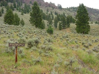
Meadow Lake Interpretive Trail #6342
- 9,160-9,140 feet elevation
- 1.0 miles
- Good access
- No motorized vehicles, bicycles, or stock allowed on trail
- Trail starts and ends in Meadow Lake Campground
- Handicap accessible with fine crush graveled tread
- Beautiful views of Meadow Lake and surrounding terrain
Deer Creek Trail #6160
- 8,160-8,880 feet elevation
- 1.4 miles
- Difficult access
- No motorized vehicles allowed on trail and surrounding area.
- There are a few fish in the lake at the trail's end
- Scenic area
Meadow Lake Trail #6057
- 9,160-10,200 feet elevation
- 1.3 miles
- Good access
- No motorized vehicles allowed on trail and surrounding area
- Climb steadily from Meadow Lake Campground to Lemhi Divide
- Spectacular view of the Little Lost River drainage and the fire that occurred there in 1988 burning 6,572 acres.
Hawley Creek Trail #6190
- 7,840-8,960 feet elevation
- 1.8 miles
- Difficult access
- All motorized vehicles allowed on trail but not on the surrounding area
- 4-wheel drive road maintained as a trail for access to the CDNST
- Open grasslands toward the top
Nez Perce (Nee-Me-Poo) National Historic Trail #6244
- 6,320-7,680 feet elevation
- 9.5 miles
- Easy access
- Route currently follows Highway 29 from Bannock Pass to the mouth of Canyon Creek Canyon
Little Eightmile Trail #6185
- 7,100-8,490 feet elevation
- 4.7 miles
- Poor access
- All motorized vehicles allowed between June 16 and September 24 on trail and surrounding area
- Narrow canyon opens up into open sagebrush and grasslands
- Leads up to the Continental Divide and ties into the CDNST
 Lewis
and Clark National Historic Trail #6238
Lewis
and Clark National Historic Trail #6238

- 7,730-6,400 feet elevation
- 2.5 miles
- Good access
- Motorized vehicles allowed on trail segment of Lewis and Clark's historic journey where they crossed the Continental Divide into Idaho at Lemhi Pass
Trails Undergoing Condition Surveys
The following list of trails is currently receiving trail condition surveys to verify if they need maintenance to remain open and/or stay on the district trail roster.
| Trail | Number | Miles |
|---|---|---|
| Haynes | 6069 |
8.0 |
| Way 91 | 6099 |
9.6 |
| Cheney | 6119 |
4.5 |
| Mulkey Cr | 6233 |
4.0 |
| Harmony | 6345 |
1.5 |
USDA Forest Service - Salmon-Challis National Forest
Last Modified: Tuesday, 18 December 2007 at 11:23:36 EST