Hurricane Isabel Genesis
|
This animation follows Hurricane Isabel (2003) from its birthplace in the Ethiopian Highlands of East Africa, across the Atlantic Ocean, to the United States. Atlantic hurricanes are often formed as winds over the Gulf of Aden intersect with the Ethiopian Highlands. This animation zooms into the Ethiopian Highlands and shows several storms being formed. Then, the animation dissolves in a reticle to focus in specifically on the formation of Hurricane Isabel. The reticle follows the storm across Africa and into the Atlantic. The path and intensity of Hurricane Isabel is depicted by a colored path. Blue represents the genesis of the storm. Green is a Tropical Depression where winds are less than 39 miles per hour. Yellow is a Tropical Storm where winds are between 39 and 73 miles per hour. Red is a category 1 hurricane where winds are between 74 and 95 miles per hour. Light Red is a category 2 hurricane with winds between 96 and 110 miles per hour. Magenta is a category 3 hurricane with winds between 111 and 130 miles per hour. Light magenta is a category 4 hurricane with winds between 131 and 154 miles per hour. White represents a category 5 hurricane where winds are greater than 155 miles per hour. Note how Isabel gains size and speed over the warm waters of the Atlantic.
|
|
|
|
This animation follows Hurricane Isabel (2003) from its birthplace in the Ethiopian Highlands of East Africa, across the Atlantic Ocean, to the United States. Atlantic hurricanes are often formed as winds over the Gulf of Aden intersect with the Ethiopian Highlands.
Duration: 53.0 seconds
Available formats:
720x486 (30 fps)
Frames
1280x720 (60 fps)
Frames
640x480 (30 fps)
MPEG-1
28 MB
320x240 (30 fps)
MPEG-1
7 MB
320x240
JPEG
5 KB
80x40
PNG
7 KB
320x240
JPEG
5 KB
How to play our movies
|
|
|
|
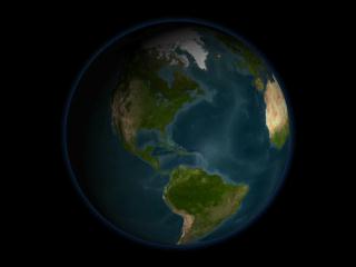
This is where Hurricane Isabel was born on August 25, 2003. The movie follows the storm from this point until it makes landfall on September 18, 2003 in North Carolina.
Duration: 46.0 seconds
Available formats:
160x80
PNG
69 KB
2560x1920
TIFF
6 MB
320x240
JPEG
15 KB
720x480 (29.97 fps)
MPEG-2
45 MB
How to play our movies
|
|

|
|
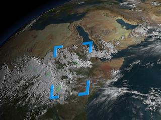
The Ethiopian Highlands in East Africa is the birthplace for many Atlantic hurricanes.
Available formats:
2560 x 1920
TIFF
9 MB
160 x 80
PNG
26 KB
320 x 240
JPEG
16 KB
|
|
|
|
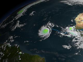
Hurricane Isabel is classified as a Tropical Storm on September 6, 2003.
Available formats:
2560 x 1920
TIFF
5 MB
320 x 240
JPEG
12 KB
|
|

|
|
Hurricane makes landfall in North Carolina on September 18, 2003.
Available formats:
2560 x 1920
TIFF
7 MB
320 x 240
JPEG
17 KB
|
|
|
|
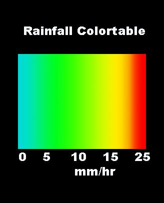
Rainfall Colorbar
Available formats:
328 x 406
JPEG
11 KB
80 x 40
PNG
3 KB
|
|
|
Back to Top
|

