Skip all navigation and jump to content Jump to site navigation Jump to section navigation.
NASA Logo - Goddard Space Flight Center + Visit NASA.gov
HOME PROJECTS RESOURCES SEARCH MAP

+ Advanced Search
Home
Home
View Most Recently Released Imagery
View Gallery of Imagery: A topical collection of SVS Imagery
Search Imagery by the keywords assigned to it
Search Imagery by the instruments that supplied data for a visualization product
Search Imagery by the series of visualizations that have been produced
Search Imagery by the scientist providing the data used in a visualization product
Search Imagery by the animator that created the product
Search Imagery by the identification number assigned to the visualization product
See other search options
Learn about the SVS Image Server
  + About the Server
  + Animation List
  + How to Use the Server


  + RSS Feeds
  + Podcasts


  + Opportunities
blank image
Previous Animation
Next Animation
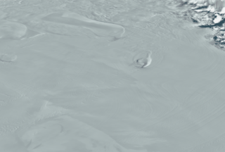
MODIS Mosaic of Antarctica sees the Ross Ice Shelf

NASA has released a digital image map of the Antarctic continent and surrounding islands. The Moderate Resolution Imaging Spectroradiometer (MODIS) Mosaic of Antarctica (MOA) image map is a composite of 260 swaths comprised of both Terra and Aqua MODIS images acquired between November 20, 2003 and February 29, 2004. MOA provides a cloud-free view of the ice sheet, ice shelves, and land surfaces at a grid scale of 125 m and an estimated resolution of 150 m. All land areas south of 60° S that are larger than a few hundred meters are included in the mosaic. Also included are several persistent fast ice areas and grounded icebergs.

The MODIS Mosaic of Antarctica reveals the dynamic crevasses and ice flows in the Ross Ice Shelf.    The MODIS Mosaic of Antarctica reveals the dynamic crevasses and ice flows in the Ross Ice Shelf.
Duration: 9.0 seconds
Available formats:
  720x480 (29.97 fps) MPEG-2   8 MB
  720x480 (30 fps) MPEG-1   6 MB
  720x486 (29.97 fps) Frames
  320x216     PNG           72 KB
  160x80       PNG           15 KB
  80x40         PNG           4 KB
  2560x1920 TIFF         3 MB
How to play our movies

Animation Number:3295
Completed:2005-11-30
Animator:Lori Perkins (NASA/GSFC) (Lead)
Scientist:Bob Bindschadler (NASA/GSFC)
Platforms/Sensors/Data Sets:Aqua/MODIS
 Terra/MODIS
 ICESat/GLAS/L1B Global Elevation Data (GLA06)
Data Collected:2003-11-20 through 2004-2-29
Series:MODIS Mosaic of Antarctica (MOA)
Keywords:
GCMD >> EARTH SCIENCE >> Cryosphere >> Glaciers/Ice Sheets
 
 
Please give credit for this item to
Haran, T., J. Bohlander, T. Scambos, and M. Fahnestock compilers. 2005. MODIS mosaic of Antarctica (MOA) image map. Boulder, CO, USA: National Snow and Ice Data Center. Digital media.

NASA/Goddard Space Flight Center Scientific Visualization Studio


Back to Top

USA.gov logo - the U.S. Government's official Web portal. + Privacy Policy and Important Notices
+ Reproduction Guidelines
NASA NASA Official:
SVS Contact:
Curator: