ICESat First Light Release: A Closer View of the Coast
|
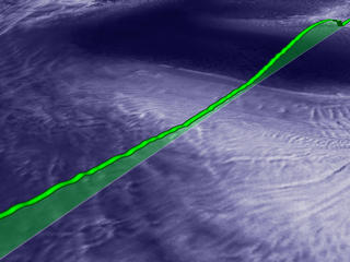
Elevation data from ICESat's GLAS instrument is quite detailed, as can be seen in this close-up view of a profile that passes near the Banzare Coast in Antarctica. (The green elevation profile in this animation is exaggerated vertically by a factor of 10x for aesthetic purposes.)
|
|
|
|
Animation showing one ICESat elevation data pass near Antarcticas Banzare Coast.
Duration: 20.0 seconds
Available formats:
320x240 (30 fps)
MPEG-1
2 MB
320x214
JPEG
9 KB
720x486 (29.97 fps)
Frames
720x480 (29.97 fps)
DV
72 MB
How to play our movies
|
|
|
|
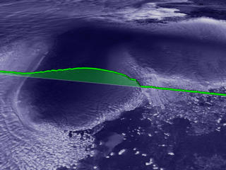
A slice of ICESat elevation data (170 meter post-spaced) near Antarcticas Banzare Coast laying over a flat RADARSAT texture.
Available formats:
2560 x 1920
TIFF
14 MB
160 x 80
PNG
21 KB
320 x 240
JPEG
14 KB
80 x 40
PNG
5 KB
|
|

|
|
Another slice of elevation data (170 meter post-spaced) near Antarcticas Banzare Coast.
Available formats:
2560 x 1920
TIFF
14 MB
320 x 240
JPEG
13 KB
|
|
|
|
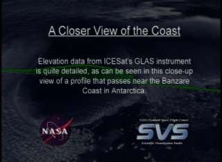
Slate from video tape reads 'A Closer View of the Coast; Elevation data from ICESat's GLAS instrument is quite detailed, as can be seen in this close-up view of a profile that passes near the Banzare Coast in Antarctica.'
Available formats:
720 x 528
JPEG
116 KB
320 x 234
PNG
358 KB
|
| Animation Number: | 2743 |
| Animators: | Alex Kekesi (Lead) |
| | Greg Shirah |
| Studio: | NASA |
| Completed: | 2003-05-23 |
| Scientists: | Chris Shuman (NASA/GSFC) |
| | Jay Zwally (NASA/GSFC) |
| Instruments: | ICESat/GLAS
|
| | RADARSAT-1/SAR |
| | Terra/MODIS |
| Data set: | ICESat/GLAS Elevation |
| Data Collected: | ICESat/GLAS:2003/02/21, Terra/MODIS:2001/06-2001/09, RADARSAT:1997/09/26-1997/11/04 |
| Series: | ICESat |
| Video: | SVS2003-0015 * |
Keywords:
DLESE
>> Climatology
DLESE
>> Cryology
SVS
>> Laser
|
|
Please give credit for this item to
NASA/Goddard Space Flight Center
Scientific Visualization Studio, Canadian Space Agency, RADARSAT International Inc. |
*Please note: the SVS does not fulfill requests for copies of the tapes in our library. On some of our animation pages, there is a direct link to a video distribution service from which tapes, handled by the Public Affairs Office (PAO)/Goddard TV, including some of our animations may be ordered. General information on this service can be found here. |
|
Back to Top
|

