ICESat First Light Release: From Sea Ice to Ice Streams
|
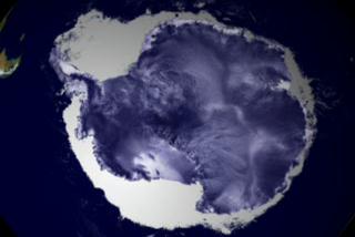
The following profile shows the dramatic change in elevation from coastal Antarctica, which is covered in sea ice for most of the year, to the center of the continent. It starts near the Amundsen Sea and travels inward, ending over the West Antarctic Ice Streams where we get a look at this dynamic portion of the polar landscape. (The green elevation profile in this animation is exaggerated vertically by a factor of 10x.)
|
|
|
|
Animation showing one ICESat elevation data pass starting near the Amundsen Sea ending over the West Antarctic Ice Streams.
Duration: 37.0 seconds
Available formats:
320x240 (30 fps)
MPEG-1
5 MB
320x214
JPEG
9 KB
720x486 (29.97 fps)
Frames
720x480 (29.97 fps)
DV
133 MB
How to play our movies
|
|
|
|
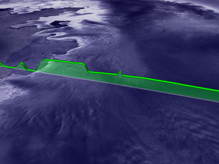
A slice of ICESat elevation data (170 meter post-spaced) near the Amundsen Sea coastline laying over a flat RADARSAT texture.
Available formats:
2560 x 1920
TIFF
14 MB
320 x 240
JPEG
11 KB
|
|
|
|
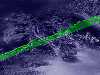
Another slice of elevation data passing over the West Antarctic Ice Streams.
Available formats:
2560 x 1920
TIFF
14 MB
160 x 80
PNG
26 KB
320 x 240
JPEG
18 KB
80 x 40
PNG
7 KB
|
|
|
|
None
Available formats:
720 x 528
JPEG
133 KB
320 x 234
PNG
357 KB
|
| Animation Number: | 2742 |
| Animators: | Alex Kekesi (Lead) |
| | Greg Shirah |
| Studio: | NASA |
| Completed: | 2003-05-23 |
| Scientists: | Chris Shuman (NASA/GSFC) |
| | Jay Zwally (NASA/GSFC) |
| Instruments: | ICESat/GLAS
|
| | RADARSAT-1/SAR |
| | Terra/MODIS |
| Data set: | ICESat/GLAS Elevation |
| Data Collected: | ICESat/GLAS:2003/02/21,
Terra/MODIS:2001/06-2001/09, RADARSAT:1997/09/26-1997/11/04 |
| Series: | ICESat |
| Video: | SVS2003-0015 * |
Keywords:
SVS
>> Laser
|
|
Please give credit for this item to
NASA/Goddard Space Flight Center
Scientific Visualization Studio, Canadian Space Agency, RADARSAT International Inc. |
*Please note: the SVS does not fulfill requests for copies of the tapes in our library. On some of our animation pages, there is a direct link to a video distribution service from which tapes, handled by the Public Affairs Office (PAO)/Goddard TV, including some of our animations may be ordered. General information on this service can be found here. |
|
Back to Top
|

