Great Zoom into Seattle, WA: The Space Needle
|
Using data from different spacecraft and some powerful computer technology, visualizers at the Goddard Space Flight Center present you with a collection of American cities in a way you have never seen them before. Starting with our camera high above the Earth, we rush in towards the surface at what would be an impossible speed for any known vehicle. Passing though layers of atmosphere, the colors of our destinations shimmer with their own unique characteristics, and suddenly we find ourselves floating in virtual space just above the ground.
|
|
|
|
A seamless zoom from space to the ground, using data from Terra-MODIS, Landsat-ETM+, and IKONOS, and ending at the Space Needle in Seattle, Washington
Duration: 38.0 seconds
Available formats:
352x240 (29.97 fps)
MPEG-1
4 MB
320x238
JPEG
6 KB
1280x720 (30 fps)
MPEG-2
84 MB
How to play our movies
|
|
|
|
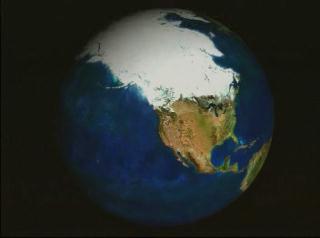
Full globe view
Available formats:
2560 x 1920
TIFF
2 MB
160 x 80
PNG
20 KB
320 x 240
JPEG
5 KB
80 x 40
PNG
5 KB
|
|
|
|
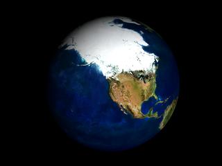
Western North America view
Available formats:
2560 x 1920
TIFF
7 MB
320 x 240
JPEG
13 KB
|
|
|
|
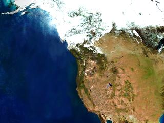
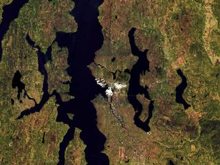
Pacific Northwest view
Available formats:
2560 x 1920
TIFF
8 MB
320 x 240
JPEG
18 KB
|
|
|
|
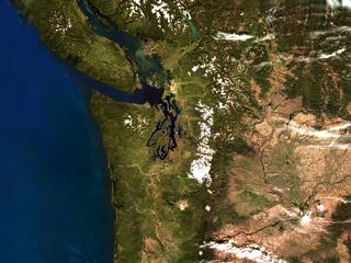
Puget Sound view
Available formats:
2560 x 1920
TIFF
12 MB
320 x 240
JPEG
19 KB
|
|

|
|
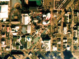
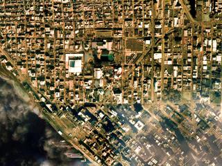
Downtown Seattle view
Available formats:
2560 x 1920
TIFF
12 MB
320 x 240
JPEG
29 KB
|
|
|
|
The Space Needle
Available formats:
2560 x 1920
TIFF
9 MB
320 x 240
JPEG
27 KB
|
| Animation Number: | 2247 |
| Animators: | Greg Shirah (SVS) (Lead) |
| | Horace Mitchell (SVS) |
| | Marte Newcombe (SVS) |
| Completed: | 2001-08-02 |
| Scientist: | Darrel Williams (NASA/GSFC) |
| Instruments: | IKONOS
|
| | Landsat-7/ETM+ |
| | Terra/MODIS |
| Data Collected: | Terra/MODIS: 2000/09/25, Landsat: 2000/04/18, Landsat: 2000/09/25, IKONOS: 2000/03/26, IKONOS: 2000/02/19 |
| Series: | Great Zooms |
| Video: | SVS2001-0024 * |
| Goddard TV Tapes: | G2001-065 |
| | G2003-046 |
Keywords:
SVS
>> HDTV
DLESE
>> Human geography
DLESE
>> Physical geography
SVS
>> Zoom
|
|
Please give credit for this item to
NASA/Goddard Space Flight Center
Scientific Visualization Studio |
*Please note: the SVS does not fulfill requests for copies of the tapes in our library. On some of our animation pages, there is a direct link to a video distribution service from which tapes, handled by the Public Affairs Office (PAO)/Goddard TV, including some of our animations may be ordered. General information on this service can be found here. |
|
Back to Top
|

