Zoom into Boulder, Colorado, using Landsat Imagery (WMS)
|
The WMS Global Mosaic data set was developed at NASA's Jet Propulstion Laboratory (JPL). This global mosaic was produced from visual and near infrared bands taken by the Landsat-7 satellite. Using the panchromatic band to sharpen the final image, a final resolution of 0.5 arc seconds (about 15 meters) can be achieved. This mosaic is available through the Web Mapping Services (WMS) protocol at JPL. This series of images was obtained using a software program called the Digital Earth PC which can use the WMS protocol to obtain images covering an arbitrary region of the earth. These images can be arranged in such a way with the Digital Earth PC software that a nearly continuous zoom effect can be achieved.
|
|

|
|
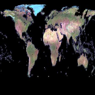
Global pseudo-color Landsat image from the JPL WMS server.
Available formats:
512 x 512
PNG
237 KB
320 x 320
JPEG
15 KB
80 x 40
PNG
7 KB
|
|
This product is available through our Web Map Service.
Click here to learn more.
|
|
|
|
Landsat view of the central United States.
Available formats:
512 x 512
PNG
550 KB
320 x 320
JPEG
16 KB
|
|
This product is available through our Web Map Service.
Click here to learn more.
|
|

|
|
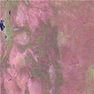
Landsat image of central Colorado.
Available formats:
512 x 512
PNG
578 KB
320 x 320
JPEG
18 KB
|
|
This product is available through our Web Map Service.
Click here to learn more.
|
|

|
|
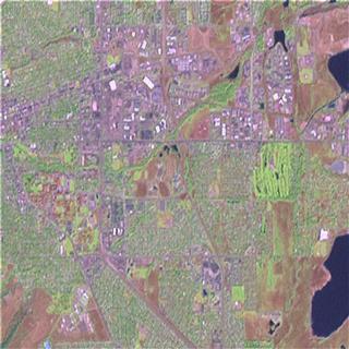
Landsat image of the region around Boulder, Colorado.
Available formats:
512 x 512
PNG
559 KB
320 x 320
JPEG
21 KB
|
|
This product is available through our Web Map Service.
Click here to learn more.
|
|
|
|
Highest detail image of Boulder, Colorado from Landsat.
Available formats:
512 x 512
PNG
558 KB
320 x 320
JPEG
23 KB
|
|
This product is available through our Web Map Service.
Click here to learn more.
|
|
|
Back to Top
|

