Atlanta Land Use
|
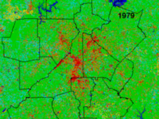
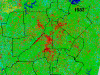
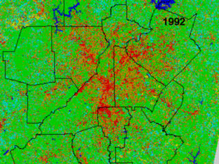
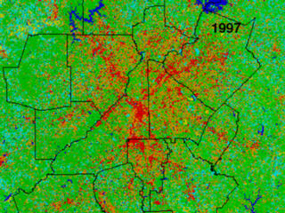
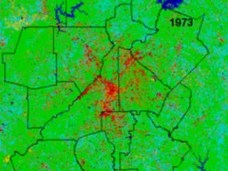
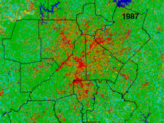
Classification map of Atlanta Land use for the years 1973, 1979, 1983, 1987, 1992, 1997.
|
|

|
|
A timelapse of land use in the Atlanta region from 1973 to 1997 from Landsat data
Duration: 23.0 seconds
Available formats:
352x240 (29.97 fps)
MPEG-1
3 MB
320x240
JPEG
29 KB
How to play our movies
|
|

|
|
Atlanta Land Use 1973
Available formats:
230 x 173
TIFF
116 KB
320 x 240
JPEG
29 KB
80 x 40
PNG
7 KB
|
|
|
|
Atlanta Land Use 1979
Available formats:
230 x 173
TIFF
116 KB
320 x 240
JPEG
28 KB
80 x 40
PNG
7 KB
|
|
|
|
Atlanta Land Use 1983
Available formats:
230 x 173
TIFF
116 KB
320 x 240
JPEG
29 KB
80 x 40
PNG
7 KB
|
|

|
|
Atlanta Land Use 1987
Available formats:
384 x 288
TIFF
324 KB
320 x 240
JPEG
43 KB
80 x 40
PNG
7 KB
|
|
|
|
Atlanta Land Use 1992
Available formats:
384 x 288
TIFF
324 KB
320 x 240
JPEG
44 KB
80 x 40
PNG
7 KB
|
|
|
|
Atlanta Land Use 1997
Available formats:
384 x 288
TIFF
324 KB
160 x 80
PNG
31 KB
320 x 240
JPEG
45 KB
80 x 40
PNG
7 KB
|
|

|
|
The legend for land use images
Available formats:
1659 x 199
TIFF
967 KB
320 x 38
JPEG
5 KB
|
| Animation Number: | 1055 |
| Animators: | Tom Bridgman (Lead) |
| | Greg Shirah |
| Studio: | NASA |
| Completed: | 2000-02-21 |
| Scientist: | Dale Quattrochi (NASA/MSFC) |
| Instrument: | Landsat |
| Data Collected: | 1973, 1979, 1983, 1987, 1992, 1997 |
| Series: | AAAS |
| Video: | SVS2000-0002 * |
Keywords:
SVS
>> Atlanta
SVS
>> Sprawl
SVS
>> Urban
|
More Information on this topic available at:
stories/AAAS/index.html
|
|
Please give credit for this item to
NASA/Goddard Space Flight Center
Scientific Visualization Studio |
*Please note: the SVS does not fulfill requests for copies of the tapes in our library. On some of our animation pages, there is a direct link to a video distribution service from which tapes, handled by the Public Affairs Office (PAO)/Goddard TV, including some of our animations may be ordered. General information on this service can be found here. |
|
Back to Top
|

