Galileo Earth Views (WMS)
|
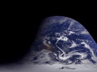
The Galileo spacecraft was launched from the Space Shuttle Atlantis on October 18, 1989 on a six-year trip to Jupiter. On the way, the trajectory of the spacecraft took it past Venus once and Earth twice. Galileo took the Earth images in this animation just after the first flyby of the Earth, on December 11 and 12, 1990. This six-hour sequence of images taken two minutes apart clearly shows how the Earth looks from space and how fast (or slow) the cloud features change when looked at from a distance. The path of the sun can be seen crossing Australia by its reflection in the nearby ocean, and the terminator region between night and day can be seen moving across the Indian Ocean. In the original images, the Earth's rotation is so dominant that cloud movement is hard to see, but these images have been mapped to the Earth is such a way that a viewer can watch just the clouds move in the ocean around Antarctica or across the Australian land mass. In this animation, New Zealand can ony be seen as a stationary disturbance under a moving cloud bank. The black area with the sharp boundary to the north and east of Australia is the side of the Earth that could not be seen from Galileo's position.
|
|
|
|
This animation shows the portion of the Earth visible from the Galileo spacecraft.
Duration: 7.0 seconds
Available formats:
720x480 (29.97 fps)
MPEG-2
2 MB
320x240 (29.97 fps)
MPEG-1
1 MB
80x40
PNG
4 KB
320x240
JPEG
8 KB
How to play our movies
|
|
This product is available through our Web Map Service.
Click here to learn more.
|
|

|
|
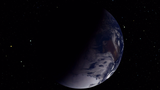
This animation shows the imagery as taken from the Galileo Solid-State Imaging Camera. An artificial star field background with correct star positions has been added for depth. This animation plays at 1200 times real time.
Duration: 20.0 seconds
Available formats:
1280x720 (29.97 fps)
MPEG-2
37 MB
1280x720 (29.97 fps)
MPEG-4
17 MB
720x480 (29.97 fps)
MPEG-2
13 MB
320x180
PNG
187 KB
1280x720 (29.97 fps)
Frames (Rotate)
How to play our movies
|
|
|
|
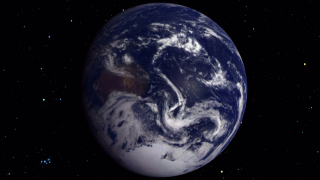
This animation shows the Galileo imagery from a point of view that rotates with the Earth. An artificial star field background with correct star positions has been added for depth. This animation plays at 1200 times real time.
Duration: 21.0 seconds
Available formats:
1280x720 (29.97 fps)
MPEG-2
37 MB
1280x720 (29.97 fps)
MPEG-4
17 MB
720x480 (29.97 fps)
MPEG-2
7 MB
1280x720 (29.97 fps)
Frames (NoRotate)
1280x720 (29.97 fps)
Frames (Stars)
320x180
PNG
121 KB
How to play our movies
|
|
|
Back to Top
|


