

|
|
Indicator Maps |
The U.S. Drought Monitor is an interagency drought monitoring tool that is issued weekly.U.S. Drought Monitor Animation: 6-week or 12-week |
|
This page has been created to help in the preparation of the U.S. Drought Monitor. (The graphics linked to from this page are operational products produced by several different organizations and agencies. The quality control applied to these graphics varies from graphic to graphic and some of the graphics are experimental.)
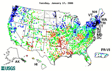
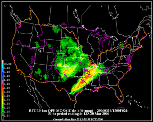
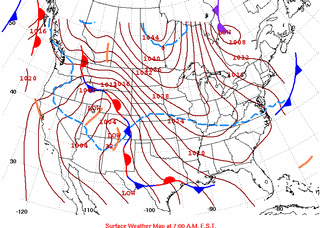
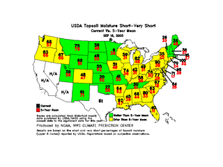
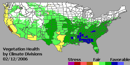
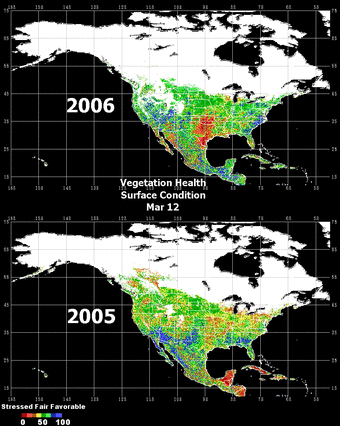
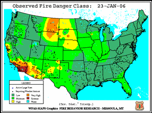
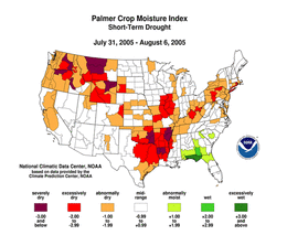
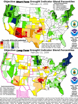
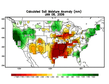
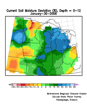
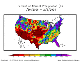
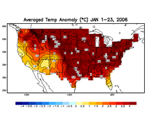
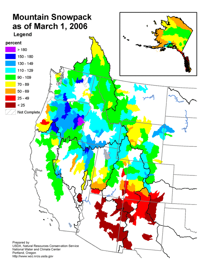
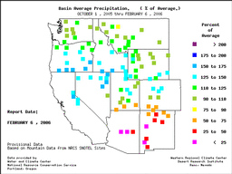
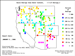
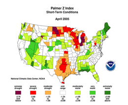
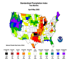
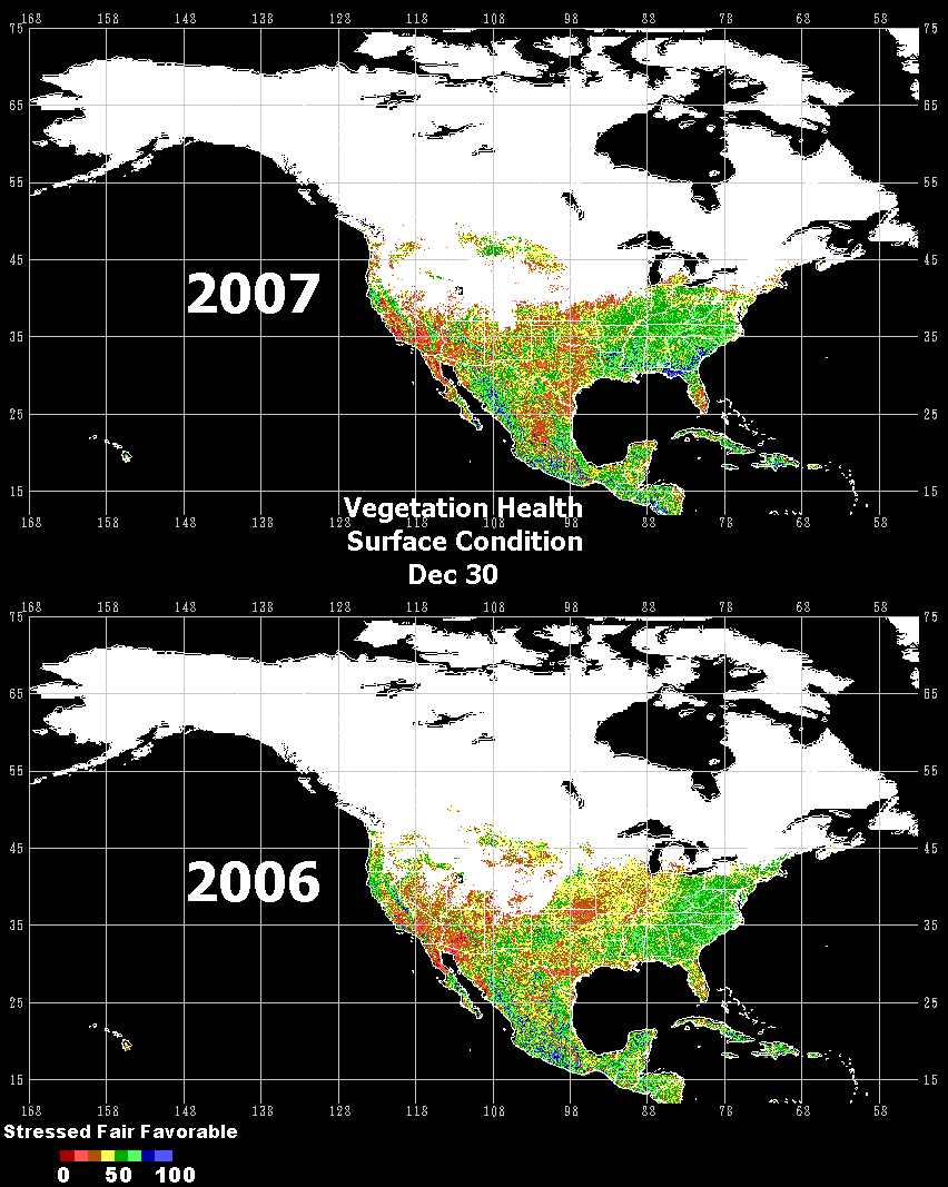
Some of the indicators that are examined to produce the U.S. Drought Monitor include the following: |

 For all climate questions other than questions concerning this report, please contact the National Climatic Data Center's Climate Services Division:
Climate Services Division For all climate questions other than questions concerning this report, please contact the National Climatic Data Center's Climate Services Division:
Climate Services DivisionNOAA/National Climatic Data Center 151 Patton Avenue Asheville, NC 28801-5001 fax: 828-271-4876 phone: 828-271-4800 email: ncdc.info@noaa.gov For further information on the animated climate maps presented on this page, contact: Richard Heim NOAA/National Climatic Data Center 151 Patton Avenue Asheville, NC 28801-5001 fax: 828-271-4328 email: Richard.Heim@noaa.gov -or- Jay Lawrimore NOAA/National Climatic Data Center 151 Patton Avenue Asheville, NC 28801-5001 fax: 828-271-4328 email: Jay.Lawrimore@noaa.gov
|
   Downloaded Sunday, 21-Sep-2008 08:18:14 EDT Last Updated Tuesday, 12-Jun-2007 13:05:09 EDT by Alvin.l.McGahee@noaa.gov Please see the NCDC Contact Page if you have questions or comments. |
