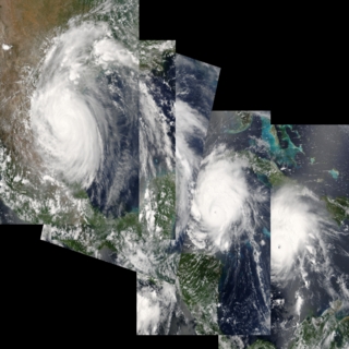
Progression of Hurricane Emily, 2005 (WMS)
|
Emily was a record-setting storm for many reasons. When it formed on July 11, Emily became the earliest fifth named storm on record. As it moved through the Caribbean, Emily intensified into a powerful Category 4 storm with winds over 250 kilometers per hour (150 mph) and gusts as high as 300 kilometers per hour (184 mph), making it the most powerful storm to form before August. The previous record was set by Hurricane Dennis, which ripped through the Caribbean during the first week of July 2005. Emily's Category 4 status also made 2005 the only year to produce two Category 4 storms before the end of July.
|
|
|
|
This is a composite image of all of the available individual images together.
Available formats:
1024x1024
TIFF
1 MB
1024x1024
PNG
1 MB
Sequence
320x320
JPEG
68 KB
80x40
PNG
8 KB
How to play our movies
|
|
This product is available through our Web Map Service.
Click here to learn more.
|
|
|
|
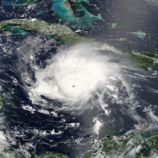
In this image, Emily is a category 4 hurricane and is moving away from the Cayman Islands, heading towards Mexico's Yucatan Peninsula.
Available formats:
1024 x 1024
TIFF
2 MB
320 x 320
JPEG
88 KB
|
|
|
|
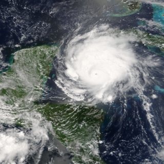
Emily was heading straight toward the Yucatan Peninsula, and crossed it later that day.
Available formats:
1024 x 1024
TIFF
2 MB
320 x 320
JPEG
89 KB
|
|
|
|
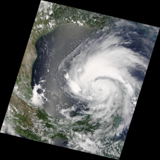
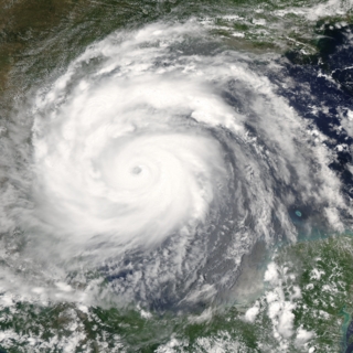
Having passed over part of Mexico's Yucatan Peninsula, Emily here headed over the Gulf of Mexico toward the border between Texas and Mexico.
Available formats:
1024 x 1024
TIFF
1 MB
320 x 320
JPEG
63 KB
|
|
|
|
In the Gulf of Mexico, Emily strengthened to a category 4 hurricane with winds of 150 kilometers per hour.
Available formats:
1024 x 1024
TIFF
2 MB
320 x 320
JPEG
83 KB
|
|
|
|
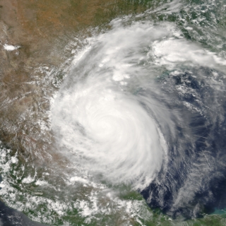
Hurricane Emily reached land just south of the border between Texas and Mexico.
Available formats:
1024 x 1024
TIFF
2 MB
320 x 320
JPEG
83 KB
160 x 80
PNG
26 KB
|
|
|
Back to Top
|


