 NCDC / Climate Mon. /
Climate-2008 / Aug / U.S. Drought / Indicators / Help NCDC / Climate Mon. /
Climate-2008 / Aug / U.S. Drought / Indicators / Help
Climate of 2008 - August
U.S. Drought Indicators
National Climatic Data Center, 15 September 2008
|
Global Analysis /
Global Hazards /
United States /
Extremes
Use these links to access detailed analyses of Global and U.S. data.
 The data presented in this drought report are preliminary. Ranks, anomalies, and percent areas may change as more complete data are received and processed.
Several climate indicators are used to monitor drought in the United States. These indicators include:
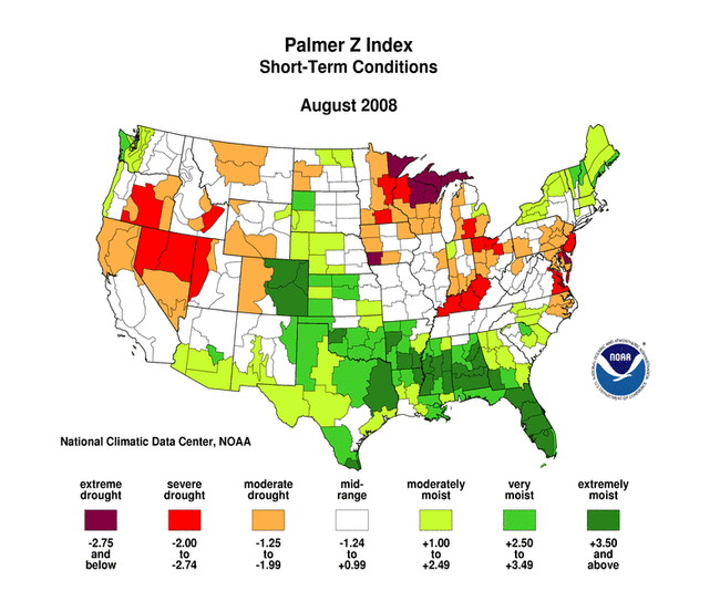
- the Palmer Z Index,
Palmer Drought Severity Index, and
Palmer Hydrological Drought Index
- the
one-month,
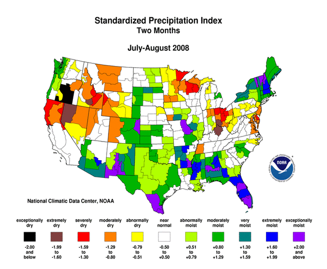
two-month,
three-month,
six-month,
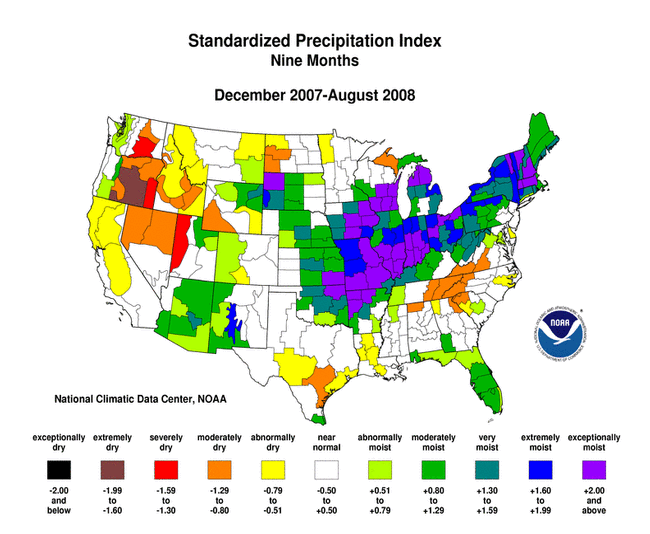
nine-month,
12-month, and
24-month Standardized Precipitation Index
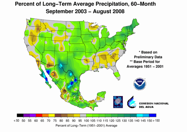
- maps showing the long-term
(6-month,
12-month,
24-month,
36-month,
48-month,
and 60-month) percent of normal precipitation
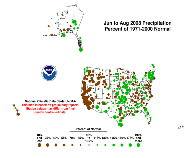
- maps showing the percent of normal precipitation for airport stations for the current month, year-to-date, and last three months
- the statewide precipitation ranks for current month (short-term) and 3-months, 6-months, and 12 months (longer-term)
- the
1-month,
3-month,
6-month,
12-month,
24-month,
36-month,
percent of normal precipitation maps, based on Cooperative Network and other station reports, provided by the NOAA Regional Climate Centers (HPRCC)
- the percent of average precipitation map for the water year to date for the SNOTEL stations in the western mountains provided by the Western Regional Climate Center
- satellite observations of vegetation health are most effective during the warm season months.
NOAA satellite observations of vegetation health:
North America:
Vegetation Health Index - Vegetation Condition Index
VegDRI satellite vegetation health index:
- modeled runoff, evaporation, and soil moisture conditions as calculated by the National Weather Service
- modeled soil moisture conditions as calculated by the National Weather Service Leaky Bucket Model:
- modeled soil moisture conditions in the top and deeper soil layers as calculated by the Midwest Regional Climate Center
- short and very short (dry to very dry) topsoil moisture conditions observed by the USDA and mapped by the Climate Prediction Center for the current month and comparison to 5-year and 10-year averages:
- the percent of pasture and range land in poor or very poor condition, based on observations by the USDA and mapped by the Climate Prediction Center for the current month and compared to a long period mean:
- the USGS daily streamflow and monthly (28-day: August 6-September 2) mean streamflow maps
|

- For further information, please contact:
Climate Services and Monitoring Division
NOAA/National Climatic Data Center
151 Patton Avenue
Asheville, NC 28801-5001
fax: +1-828-271-4876
phone: +1-828-271-4800
email: ncdc.info@noaa.gov
To request climate data, please E-mail: ncdc.orders@noaa.gov
|
NCDC / Climate Mon. /
Climate-2008 / Aug / U.S. Drought / Indicators / Help
|


