 |
 | |
  | |
|
|
|
|
Pictured Rocks National Lakeshore
Natural Features & Ecosystems
|
|
|
|
|
|
 |
 |
| NPS photo | |
 |
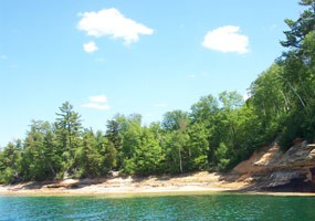
Pictured Rocks National Lakeshore is located along the south shore of Lake Superior, between the communities of Munising and Grand Marais, in the north woods of Michigan's Upper Peninsula. It was authorized by Congress as the first national lakeshore on October 15, 1966, "to preserve for the benefit, inspiration, education, recreational use, and enjoyment of the public a significant portion of the diminishing shoreline of the United States and its related geographic and scientific features" (P.L. 89-668). The "diminishing shoreline" refers to public access to Great Lakes shores lost to private ownership. Formal establishment of the national lakeshore came on October 6, 1972.
The 71,397 acres of the park are divided approximately equally by the enabling legislation into two distinct ownership and management zones. The federally-owned Shoreline Zone was established for the traditional national park reasons of preserving natural and cultural resources and providing for recreation.
The non-federal Inland Buffer Zone (IBZ) was created "to stabilize and protect the existing character and uses of the land, waters, and other properties within such zone." Congress intended that the buffer zone serve to preserve the setting of the Lake Superior shoreline and inland lakes, and protect the watersheds and streams. Sustained yield timber harvesting and other resource management activities compatible with preservation and recreational use were permitted in the IBZ. Consumptive resource use, however, was intended to be subordinate to public recreation and the protection of "the usefulness and attractiveness of the lakeshore." The IBZ is comprised of national and state forest land, extensive private commercial forest, and small private parcels.
The park boundary extends one-quarter mile out over the surface of Lake Superior along the length of the park. National Park Service authority is limited to the surface waters within this one-quarter mile.
|
|  |  |

|
 |
|
|
|
|
|
 |
|
Did You Know?
Pictured Rocks National Lakeshore is home to three arctic disjuncts, plants whose normal range is far to the north. Arctic crowberry, Pitcher's thistle, and thimbleberry thrive because of the cool and moist microclimates caused by Lake Superior.
more...
|
|
|
|
Last Updated: December 04, 2006 at 13:59 EST |


