 |
 | |
  | |
|
|
|
|
Pictured Rocks National Lakeshore
Maritime Sites
|
|
|
|
|
| |
 |
|
 |
| NPS photo | | Au Sable Light Station |
 |
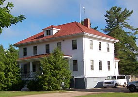
Au Sable Light Station
Located at the Au Sable Point, 12 miles west (drive) of Grand Marais to the Hurricane River Campground then 1.5 miles (walk) east.
In 1872, Congress appropriated $40,000 to build at lighthouse at Au Sable Point. The light station began operation on August 19, 1874. The light tower is 86 feet high, and shines its beacon 18 miles out on Lake Superior.
In 1958, the Coast Guard converted the light station to an automatic unattended light, and discontinued the fog signal.
In January 1968, the U.S. Coast Guard transferred the property to the National Park Service. The Coast Guard still maintains an active aid to navigation on the light tower. more ...
|
 |
| NPS photo | | Munising U.S. Coast Guard Station |
 |
Munising U.S. Coast Guard Station
Located at N8391 Sand Point Road, Munising, Michigan
Construction began in 1932 at an original cost of about $15,000, and included the station, watch tower, and boathouse with accompanying wharf and launchway. The station officially opened on May 16, 1933, with a crew of ten.
Decommissioned in 1960, the station became Park Headquarters for Pictured Rocks National Lakeshore in the late 1960s.
|
 |
| NPS photo | | Munising Front Range Light and Auxiliary Station |
 |
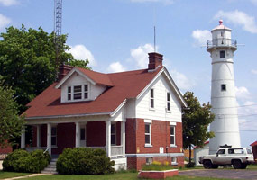
Munising Front Range Light and Auxiliary Station
Located at 604 West Munising Avenue, Munising, Michigan
In 1907, Congress appropriated $15,000 for construction of the station. The front range light and its accompanying rear range light became operation on October 30, 1908. The front range tower stands at 58 feet overlooking Munising Bay with a focal plane of 79 feet.
The accompanying auxiliary station now serves as offices for the Science and Natural Resources Division, Pictured Rocks National Lakeshore.
|
 |
| NPS photo | | Munising Rear Range Light |
 |
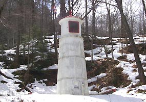
Munising Rear Range Light
Located two blocks south of the Front Range Light, at the end of Hickory Street
The Rear Range Light is nestled on the hillside overlooking Munising Bay. The steel tower is 33 feet, and provides a focal plane of 107 feet.
The Munising Range Lights were built to aid vessels navigating through the narrow passage east and south of Grand Island into the main harbor. The lights remain an active aid to navigation.
|
 |
| NPS photo by Ed Lasich | | Grand Marais Ranger Station |
 |
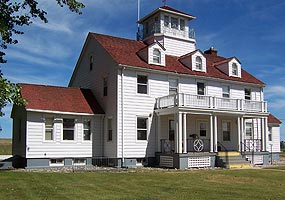
Grand Marais U.S. Coast Guard Station
Located at E22030 Coast Guard Point Road, Grand Marais, Michigan
The U.S. Coast Guard opened this station in 1938, replacing a structure built in 1899 by the U.S. Life Saving Service. The Coast Guard deactivated the station in 1981, and transferred the property to the National Park Service.
The three story wood frame building overlooks Lake Superior, and currently serves as a ranger station for Pictured Rocks National Lakeshore. A keepers quarters is nearby as well as the Harbor of Refuge building.
|
 |
| NPS photo | | Grand Marais Harbor of Refuge |
 |
Grand Marais Harbor of Refuge
Located at the end of Coast Guard Point Road, Grand Marais, Michigan
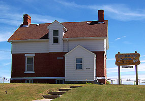
The Harbor of Refuge house was built in 1908 by the U.S. Life Saving Service as the Lightkeeper's dwelling. It was constructed at a cost of $5,000, and is a duplicate to the station at the Munising Range Lights. U.S. Coast Guard families lived in the house until the station closed in 1981.
In 1984, the U.S. Coast Guard transferred its Grand Marais property to the Pictured Rocks National Lakeshore. The Grand Marais Historical Society leases the building from the National Park Service, and operates the Lightkeepers House Museum.
|
 |
| NPS photo | | Shipwreck remains near Hurricane River |
 |
Shipwrecks
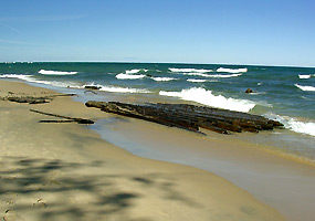
The shipwrecks of Lake Superior's "Graveyard Coast" represent many eras of shipping. They are relatively well preserved because they have been spared from the human pressures of population and industry.
While most shipwreck remains can only be seen by scuba diving or a , some are visible along the shoreline.
Much of the shoreline of Pictured Rocks National Lakeshore lies within the , which ensures its further preservation. Shipwreck site bulletin - pdf
|
|  |  |
|
|

Alger Underwater Preserve
was designated to protect shipwrecks.
more... | | 
Michigan Lighthouse Conservancy
All about Michigan lighthouses
more... | | 
East Channel Lighthouse
stands at the entrance to Munising Bay.
more... | | 
Lighthouses of Lake Superior
lights on the largest Great Lake
more... | |
|
|
|
|
|
|
|
 |
|
Did You Know?
The North Country National Scenic Trail connects outstanding scenic, natural, and cultural sites in seven northern states from Crown Point, New York, to Lake Sakakawea in North Dakota. The trail was established on March 5, 1980. Pictured Rocks National Lakeshore is home to 42 miles of the NCNST.
more...
|
|
|
|
Last Updated: March 19, 2008 at 09:52 EST |


