 |
 | |
  | |
|
|
|
|
Pictured Rocks National Lakeshore
Road Construction
|
|
|
|
|
| |
 |
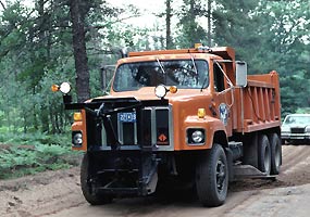
During 2008-2009, the Alger County Road Commission will re-construct and pave 10 miles of Alger County Road H-58 from Buck Hill (near the entrance to Little Beaver Lake Campground) to just south of Kingston Lake Campground. Construction will require closure of the road between these two points. The project will begin on July 21, 2008. Projected completion date is August 1, 2009.
Effective July 21, H-58 will be closed from Kingston Corners (junction of H-58 and Adams Trail) north to Kingston Lake.
Effective August 6, H-58 will be closed from Buck Hill (near the entrance to Little Beaver Lake Campground) to Kingston Corners.
Information is also available at the page on the Alger County Road Commission website. Only local traffic is permitted in the construction zone. Snowmobile travel will be allowed during the winter.
Visitors entering the lakeshore from the east (Grand Marais)
will be able to travel as far as the Kingston Lake Campground. To access the western portion of the lakeshore (such as Little Beaver Lake Campground, Miners Castle, and Sand Point), visitors must travel to Munising on M-77 and M-28, then travel east on H-58.
Visitors entering the lakeshore from the west (Munising)
will be able to access areas up to and including the Little Beaver Lake Campground and Michigan DNR campgrounds (Ross, Canoe, Cusino, North and South Gemini Lakes). In order to reach the attractions in the eastern portion of the Lakeshore (including Kingston Lake, Hurricane River, and Twelvemile Beach Campgrounds), visitors must travel to Grand Marais on M-28 and M-77 then travel west on H-58.
2008-2009 H-58 Construction Closure (pdf)
|
 |
| NPS photo | | Alger County Road Commission Truck |
 |
During 2009 and 2010, the Alger County Road Commission anticipates completion of their project to pave Alger County Road H-58 between the Munising and Grand Marais. Construction is planned on two road sections.
1. A half mile road section from the upper Hurricane River Campground to west of lower Hurricane River Campground. This project includes constructing a new bridge over the Hurricane River.
2. From one mile south of Kingston Lake State Forest Campground to just west of the Hurricane River Campground (about 7 miles).
Road closures and detours for these projects will be announced at a later date.
|
|  |  |
|
|

Au Sable Light Station
a 1.5 mile hike from Hurricane River Campground.
more... | | 
Drive-in campgrounds
are open May 10 to October 31.
more... | | 
Miners Castle
Drive directly to the Pictured Rocks at Miners Castle.
more... | | 
Tahquamenon Falls State Park
is one of many nearby attractions.
more... | |
|
|
|
|
|
|
|
 |
|
Did You Know?
Located within Pictured Rocks National Lakeshore, the Au Sable Light Station is on the National Register of Historic Places. Constructed in 1874, the station beacon still shines over Lake Superior's frigid waters. The lamp is now solar powered.
more...
|
|
|
|
Last Updated: July 21, 2008 at 14:15 EST |


