 |
 | |
  | |
|
|
|
|
Pictured Rocks National Lakeshore
Accessibility
|
|
|
|
|
| |
 |

|
| NPS photo |
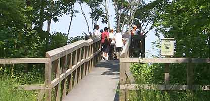
| Visitors at the Log Slide overlook |
|
|
|
The Interagency Visitor Center, Munising Falls Interpretive Center, and Miners Castle Information Station in Munising plus the Grand Sable Visitor Center in Grand Marais are all disabled accessible.
Each drive-in campground has at least one handicapped accessible campsite. Campsites include an extended picnic table, boardwalk, pedestal fire grate, and close proximity to rest rooms. These campsites are reserved for disabled campers until 6 p.m. each day. After 6 p.m., they are open to anyone for one night only and must be vacated the next morning. Holders of (62 and older) and (disabled) receive a 50 percent discount on the campground user fee.
The trail to the Log Slide overlook is densely packed gravel and is accessible. The overlook is also accessible. Trail length is approximately 200 yards.
Trails to all overlooks at Miners Castle are paved. The first 100 yards of the level trail lead to two overlooks of the cliffs and Miners Castle. CAUTION! The trail to the lower overlooks includes stairs and a very steep decline.
The 800 foot long trail to the Munising Falls viewing platform is paved and fully accessible.
The half-mile disabled accessible boardwalk at the Sand Point Marsh Trail is a delight to nature lovers. The trail meanders through cattail swamp, open bog, spruce-tamarack, and white cedar wetlands. A large print trail guide is available at the trailhead.
At Sand Point, the beach parking area and sidewalks are paved. One picnic table is fully accessible with a pedestal fire grate. A section of boardwalk enables visitors to go part of the way to the Lake Superior shoreline.
|
|  |
|
|

Construction on Alger County Road
H-58 in 2008 and 2009
more... | | 
Please check the regulations
concerning where pets are allowed.
more... | | 
Poison ivy
is found at several places within the lakeshore.
more... | | 
The latest NOAA weather forecast
for Munising, Michigan.
more... | |
|
|
|
|
|
|
|
 |
|
Did You Know?
Pictured Rocks National Lakeshore shares a visitor center with the Hiawatha National Forest. The interagency visitor center was dedicated in 1988, and serves over 40,000 people annually. Other federal interagency visitor centers are located in Alaska, Utah, California, and Idaho.
more...
|
|
|
|
Last Updated: July 26, 2006 at 15:48 EST |


