 |
 | |
  | |
|
|
|
|
Sunset Crater Volcano National Monument
Frequently Asked Questions
|
|
|
|
|
|
 |
|
Where’s the meteor crater?
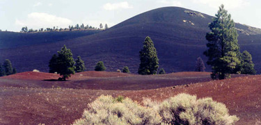
If you’re looking for a giant hole in the ground, that would be Meteor Crater, a National Landmark about 40 miles east of Flagstaff. At Sunset Crater, “crater” refers to the vent at the top of the volcano, 1000 feet above the surrounding landscape.
When did Sunset Crater erupt?
For many years, we believed that it erupted in 1064 and continued for 200 years – a very long time for a cinder cone volcano. More recent evidence indicates that the eruption began sometime between 1040 and 1100 and lasted, more typically, only a few months or years.
Will it erupt again?
Probably not. Activity in the surrounding San Francisco Volcanic Field has moved slowly during the past 6 million years. The next eruption, if one occurs, is likely to be somewhere to the east of Sunset Crater.
Why can’t we climb the volcano?
The trail to the top of Sunset Crater was closed in 1973, due to the deep ruts and erosion caused by the feet of thousands of hikers. The scars have proved impossible to erase, even after 30+ years. As an alternative, you can climb to the top of another cinder cone by taking the Lenox Crater Trail. You can also hike a Forest Service trail up O’Leary Peak, and look down into Sunset Crater.
|
|  |  |

|
 |
|
|
|
|
|
 |
|
Did You Know?
The Sunset Crater penstemon (Penstemon clutei) is found only on cinder deposits within the San Francisco Volcanic Field, including Sunset Crater Volcano National Monument, in northern Arizona.
|
|
|
|
Last Updated: August 21, 2006 at 13:38 EST |


