Quick Links
Real-Time Streamflow Table
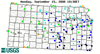
Continuous Real-Time Water Quality Data
Kansas Water Data Retrieval
Surface Water data and studies
Water Quality data and studies
Ground Water data and studies
Kansas Water Program(PDF)
News Releases
Media
Other Links
FAQs
Obtaining USGS Water Data via Automated Methods
This Month in Kansas Water History
Get Kansas Water Info by County

Highlights
Kansas Water Information by County (KWIN) Link to National Streamflow Conditions Map
Kansas Water Information by County (KWIN) National Streamflow Conditions Map
Kansas Drought Watch Kansas Flood Watch
Cowskin Creek Flood Watch National Flood Summary Reports
Wichita, Kansas, Cowskin Creek area flood information. National Flood Summary Reports
Other USGS KS Information The Nation's Topographic Map
Other USGS KS Information Kansas Hydrologic Unit Map
For additional information, please write or call:
U.S. Geological Survey
4821 Quail Crest Place
Lawrence, KS 66049-3839
Telephone: (785) 842-9909
FAX: (785) 832-3500
email: GS-W-KS_info@usgs.gov
07188000: Flow=23500cfs,Stage=17.57ft,Floodstage=20.0ft,2008-09-15 17:00,High,Spring River near Quapaw, OK 07186000: Flow=11700cfs,Stage=14.69ft,Floodstage=19.0ft,2008-09-15 17:30,High,Spring River near Waco, MO 07184000: Flow=5390cfs,Stage=15.80ft,2008-09-15 17:30,High,LIGHTNING C NR MCCUNE, KS 07182250: Flow=20800cfs,Stage=33.35ft,Floodstage=32.0ft,2008-09-15 17:00,High,COTTONWOOD R NR PLYMOUTH, KS 07180500: Flow=277cfs,Stage=5.47ft,2008-09-15 17:00,High,CEDAR C NR CEDAR POINT, KS 07170700: Flow=386cfs,Stage=7.70ft,2008-09-15 17:00,High,BIG HILL C NR CHERRYVALE, KS 07151500: Flow=1760cfs,Stage=5.65ft,Floodstage=10.0ft,2008-09-15 17:00,High,CHIKASKIA R NR CORBIN, KS 07147800: Flow=35200cfs,Stage=28.60ft,Floodstage=18.0ft,2008-09-15 17:45,High,WALNUT R AT WINFIELD, KS 07147070: Flow=2900cfs,Stage=11.61ft,Floodstage=22.0ft,2008-09-15 17:00,High,WHITEWATER R AT TOWANDA, KS 07146500: Flow=25900cfs,Stage=19.00ft,Floodstage=17.0ft,2008-09-15 17:45,High,ARKANSAS R AT ARKANSAS CITY, KS 07144550: Flow=8480cfs,Stage=6.81ft,Floodstage=12.0ft,2008-09-15 17:00,High,ARKANSAS R AT DERBY, KS 06888500: Flow=258cfs,Stage=4.41ft,Floodstage=21.0ft,2008-09-15 17:45,High,MILL C NR PAXICO, KS 07185000: Flow=32000cfs,Stage=19.04ft,Floodstage=15.0ft,2008-09-15 17:00,>90,Neosho River near Commerce, OK 07183500: Flow=27500cfs,Stage=25.42ft,Floodstage=21.0ft,2008-09-15 17:00,>90,NEOSHO R NR PARSONS, KS 07183000: Flow=2730cfs,Stage=8.54ft,Floodstage=15.0ft,2008-09-15 17:00,>90,NEOSHO R NR IOLA, KS 07180400: Flow=850cfs,Stage=4.86ft,Floodstage=22.0ft,2008-09-15 17:00,>90,COTTONWOOD R NR FLORENCE, KS 07179795: Flow=15cfs,Stage=5.05ft,2008-09-15 17:00,>90,N COTTONWOOD R BL MARION LK, KS 07179730: Flow=284cfs,Stage=4.26ft,Floodstage=26.0ft,2008-09-15 17:15,>90,NEOSHO R NR AMERICUS, KS 07172000: Flow=862cfs,Stage=3.13ft,2008-09-15 17:00,>90,CANEY R NR ELGIN, KS 07170500: Flow=5280cfs,Stage=11.85ft,Floodstage=30.0ft,2008-09-15 17:00,>90,VERDIGRIS R AT INDEPENDENCE, KS 07167500: Flow=248cfs,Stage=4.09ft,2008-09-15 17:00,>90,OTTER C AT CLIMAX, KS 07166500: Flow=2500cfs,Stage=7.86ft,Floodstage=19.0ft,2008-09-15 17:45,>90,VERDIGRIS R NR ALTOONA, KS 07149000: Flow=220cfs,Stage=1.90ft,Floodstage=10.0ft,2008-09-15 17:00,>90,MEDICINE LODGE R NR KIOWA, KS 07145700: Flow=90cfs,Stage=6.75ft,2008-09-15 17:00,>90,SLATE C AT WELLINGTON, KS 07145500: Flow=1670cfs,Stage=6.66ft,Floodstage=17.0ft,2008-09-15 17:00,>90,NINNESCAH R NR PECK, KS 07145200: Flow=379cfs,Stage=4.73ft,2008-09-15 17:00,>90,SF NINNESCAH R NR MURDOCK, KS 07144780: Flow=368cfs,Stage=8.32ft,2008-09-15 13:30,>90,NF NINNESCAH R AB CHENEY RE, KS 07144300: Flow=5550cfs,Stage=8.96ft,2008-09-15 17:15,>90,ARKANSAS R AT WICHITA, KS 07144200: Flow=2300cfs,Stage=9.01ft,2008-09-15 17:00,>90,L ARKANSAS R AT VALLEY CENTER, KS 07143665: Flow=1450cfs,Stage=10.84ft,Floodstage=22.0ft,2008-09-15 17:45,>90,L ARKANSAS R AT ALTA MILLS, KS 07143300: Flow=285cfs,Stage=8.35ft,Floodstage=18.0ft,2008-09-15 17:00,>90,COW C NR LYONS, KS 06917380: Flow=1310cfs,Stage=7.60ft,2008-09-15 17:00,>90,MARMATON R NR MARMATON, KS 06917000: Flow=1470cfs,Stage=8.65ft,Floodstage=22.0ft,2008-09-15 17:45,>90,L OSAGE R AT FULTON, KS 06916600: Flow=19200cfs,Stage=23.86ft,Floodstage=25.0ft,2008-09-15 17:00,>90,MARAIS DES CYGNES R NR KS-MO ST LINE, KS 06913500: Flow=5120cfs,Stage=16.82ft,Floodstage=31.0ft,2008-09-15 17:00,>90,MARAIS DES CYGNES R NR OTTAWA, KS 06913000: Flow=1420cfs,Stage=6.45ft,2008-09-15 17:15,>90,MARAIS DES CYGNES R NR POMONA, KS 06911900: Flow=31cfs,Stage=8.33ft,2008-09-15 17:00,>90,DRAGOON C NR BURLINGAME, KS 06910800: Flow=137cfs,Stage=3.25ft,Floodstage=19.0ft,2008-09-15 17:30,>90,MARAIS DES CYGNES R NR READING, KS 06893080: Flow=61cfs,Stage=4.71ft,Floodstage=16.0ft,2008-09-15 17:30,>90,BLUE R NR STANLEY, KS 06892000: Flow=3400cfs,Stage=17.48ft,Floodstage=23.0ft,2008-09-15 17:30,>90,STRANGER C NR TONGANOXIE, KS 06891500: Flow=258cfs,Stage=6.17ft,Floodstage=23.0ft,2008-09-15 17:00,>90,WAKARUSA R NR LAWRENCE, KS 06890900: Flow=1520cfs,Stage=31.66ft,2008-09-15 17:00,>90,DELAWARE R AT PERRY, KS 06879100: Flow=6960cfs,Stage=10.24ft,Floodstage=21.0ft,2008-09-15 17:15,>90,KANSAS R AT FORT RILEY, KS 06877600: Flow=6480cfs,Stage=16.34ft,2008-09-15 17:15,>90,SMOKY HILL R AT ENTERPRISE, KS 06876900: Flow=2720cfs,Stage=15.62ft,Floodstage=24.0ft,2008-09-15 17:15,>90,SOLOMON R AT NILES, KS 06876700: Flow=195cfs,Stage=8.39ft,Floodstage=18.0ft,2008-09-15 17:45,>90,SALT C NR ADA, KS 06875900: Flow=377cfs,Stage=9.48ft,2008-09-15 17:30,>90,SOLOMON R NR GLEN ELDER, KS 06874000: Flow=147cfs,Stage=5.58ft,Floodstage=14.0ft,2008-09-15 17:00,>90,SF SOLOMON R AT OSBORNE, KS 06869500: Flow=1670cfs,Stage=16.52ft,Floodstage=25.0ft,2008-09-15 17:15,>90,SALINE R AT TESCOTT, KS 06868200: Flow=246cfs,Stage=6.80ft,2008-09-15 17:45,>90,SALINE R AT WILSON DAM, KS 07169800: Flow=272cfs,Stage=4.53ft,2008-09-15 17:00,76-90,ELK R AT ELK FALLS, KS 07169500: Flow=348cfs,Stage=4.56ft,Floodstage=17.0ft,2008-09-15 17:00,76-90,FALL R AT FREDONIA, KS 07144795: Flow=1.3cfs,Stage=1.33ft,2008-09-15 16:00,76-90,NF NINNESCAH R AT CHENEY DAM, KS 07143330: Flow=823cfs,Stage=4.35ft,Floodstage=10.0ft,2008-09-15 17:00,76-90,ARKANSAS R NR HUTCHINSON, KS 07141900: Flow=13cfs,Stage=3.64ft,Floodstage=24.0ft,2008-09-15 18:00,76-90,WALNUT C AT ALBERT, KS 07141780: Flow=11cfs,Stage=6.84ft,Floodstage=29.0ft,2008-09-15 16:00,76-90,WALNUT C AT NEKOMA, KS 06893500: Flow=299cfs,Stage=5.42ft,Floodstage=34.0ft,2008-09-15 17:45,76-90,Blue River at Kansas City, MO 06893300: Flow=41cfs,Stage=6.04ft,Floodstage=14.00ft,2008-09-15 17:15,76-90,INDIAN C AT OVERLAND PARK, KS 06893000: Flow=75200cfs,Stage=15.42ft,Floodstage=32.0ft,2008-09-15 17:45,76-90,Missouri River at Kansas City, MO 06892350: Flow=15700cfs,Stage=10.38ft,Floodstage=26.0ft,2008-09-15 17:45,76-90,KANSAS R AT DESOTO, KS 06891000: Flow=13100cfs,Stage=6.74ft,Floodstage=17.0ft,2008-09-15 17:00,76-90,KANSAS R AT LECOMPTON, KS 06890100: Flow=131cfs,Stage=3.10ft,Floodstage=27.0ft,2008-09-15 17:30,76-90,DELAWARE R NR MUSCOTAH, KS 06889500: Flow=90cfs,Stage=1.27ft,Floodstage=29.0ft,2008-09-15 18:00,76-90,SOLDIER C NR TOPEKA, KS 06889200: Flow=35cfs,Stage=8.11ft,Floodstage=26.0ft,2008-09-15 17:30,76-90,SOLDIER C NR DELIA, KS 06889000: Flow=8190cfs,Stage=9.35ft,Floodstage=26.0ft,2008-09-15 17:45,76-90,KANSAS R AT TOPEKA, KS 06888000: Flow=24cfs,Stage=5.33ft,2008-09-15 17:30,76-90,VERMILLION C NR WAMEGO, KS 06887500: Flow=8880cfs,Stage=7.41ft,Floodstage=19.0ft,2008-09-15 17:45,76-90,KANSAS R AT WAMEGO, KS 06885500: Flow=149cfs,Stage=5.35ft,Floodstage=19.0ft,2008-09-15 17:00,76-90,BLACK VERMILLION R NR FRANKFORT, KS 06884400: Flow=768cfs,Stage=5.59ft,2008-09-15 17:00,76-90,L BLUE R NR BARNES, KS 06884200: Flow=67cfs,Stage=2.50ft,Floodstage=18.0ft,2008-09-15 17:45,76-90,MILL C AT WASHINGTON, KS 06884025: Flow=333cfs,Stage=2.99ft,Floodstage=19.0ft,2008-09-15 17:00,76-90,Little Blue River at Hollenberg, KS 06882000: Flow=683cfs,Stage=5.01ft,Floodstage=20.0ft,2008-09-15 15:00,76-90,Big Blue River at Barneston, Nebr. 06878000: Flow=50cfs,Stage=5.23ft,Floodstage=19.0ft,2008-09-15 17:45,76-90,CHAPMAN C NR CHAPMAN, KS 06873000: Flow=21cfs,Stage=1.97ft,Floodstage=7.0ft,2008-09-15 17:15,76-90,SF SOLOMON R AB WEBSTER RE, KS 06872500: Flow=70cfs,Stage=4.44ft,Floodstage=15.0ft,2008-09-15 17:00,76-90,NF SOLOMON R AT PORTIS, KS 06871500: Flow=6.1cfs,Stage=3.62ft,Floodstage=9.0ft,2008-09-15 17:45,76-90,BOW C NR STOCKTON, KS 06871000: Flow=18cfs,Stage=3.52ft,Floodstage=11.0ft,2008-09-15 17:30,76-90,NF SOLOMON R AT GLADE, KS 06867000: Flow=96cfs,Stage=5.09ft,Floodstage=18.0ft,2008-09-15 17:00,76-90,SALINE R NR RUSSELL, KS 06865500: Flow=1020cfs,Stage=7.21ft,2008-09-15 17:00,76-90,SMOKY HILL R NR LANGLEY, KS 06864500: Flow=479cfs,Stage=3.80ft,Floodstage=20.0ft,2008-09-15 17:00,76-90,SMOKY HILL R AT ELLSWORTH, KS 06864050: Flow=139cfs,Stage=3.44ft,2008-09-15 17:15,76-90,SMOKY HILL R NR BUNKER HILL, KS 06857100: Flow=550cfs,Stage=6.92ft,2008-09-15 17:00,76-90,REPUBLICAN R AT JUNCTION CITY, KS 06856600: Flow=2040cfs,Stage=10.37ft,Floodstage=15.0ft,2008-09-15 17:00,76-90,REPUBLICAN R AT CLAY CENTER, KS 06856000: Flow=1020cfs,Stage=6.92ft,Floodstage=15.0ft,2008-09-15 17:00,76-90,REPUBLICAN R AT CONCORDIA, KS 06853800: Flow=7.0cfs,Stage=1.78ft,Floodstage=16ft,2008-09-15 17:45,76-90,WHITE ROCK C NR BURR OAK, KS 06815000: Flow=322cfs,Stage=5.08ft,Floodstage=23.0ft,2008-09-15 15:00,76-90,Big Nemaha River at Falls City, Nebr. 06814000: Flow=28cfs,Stage=2.49ft,Floodstage=21.0ft,2008-09-15 17:45,76-90,TURKEY C NR SENECA, KS 07156900: Flow=24cfs,Stage=2.04ft,2008-09-15 14:30,10-24,Cimarron River near Forgan, OK 07140000: Flow=1.2cfs,Stage=5.47ft,Floodstage=12.0ft,2008-09-15 17:00,10-24,ARKANSAS R NR KINSLEY, KS 06824000: Flow=7.7cfs,Stage=1.11ft,2008-09-15 16:45,10-24,Rock Creek at Parks, Nebr. 06813500: Flow=33000cfs,Stage=8.01ft,Floodstage=17.0ft,2008-09-15 17:15,10-24,Missouri River at Rulo, NE 07182510: Flow=271cfs,Stage=6.54ft,Floodstage=27.0ft,2008-09-15 17:15,25-75,NEOSHO R AT BURLINGTON, KS 07179500: Flow=11cfs,Stage=8.11ft,2008-09-15 17:00,25-75,NEOSHO R AT COUNCIL GROVE, KS 07157500: Flow=6.7cfs,Stage=2.71ft,Floodstage=6.5ft,2008-09-15 17:30,25-75,CROOKED C NR ENGLEWOOD, KS 07142575: Flow=11cfs,Stage=11.99ft,Floodstage=17.0ft,2008-09-15 15:00,25-75,RATTLESNAKE C NR ZENITH, KS 07142300: Flow=2.8cfs,Stage=3.12ft,Floodstage=9.0ft,2008-09-15 16:00,25-75,RATTLESNAKE C NR MACKSVILLE, KS 07141300: Flow=75cfs,Stage=1.85ft,Floodstage=12.0ft,2008-09-15 17:30,25-75,ARKANSAS R AT GREAT BEND, KS 07138000: Flow=98cfs,Stage=3.74ft,Floodstage=10.0ft,2008-09-15 17:15,25-75,ARKANSAS R AT SYRACUSE, KS 07137500: Flow=103cfs,Stage=2.86ft,Floodstage=8.0ft,2008-09-15 17:15,25-75,ARKANSAS R NR COOLIDGE, KS 07137000: Flow=20cfs,Stage=10.90ft,2008-09-15 17:45,25-75,FRONTIER DITCH NR COOLIDGE, KS 06915000: Flow=18cfs,Stage=2.22ft,2008-09-15 17:00,25-75,BIG BULL C NR HILLSDALE, KS 06912500: Flow=19cfs,Stage=2.91ft,2008-09-15 17:45,25-75,HUNDRED AND TEN MILE C NR QUENEMO, KS 06887000: Flow=1590cfs,Stage=3.51ft,2008-09-15 17:00,25-75,BIG BLUE R NR MANHATTAN, KS 06866900: Flow=0.91cfs,Stage=2.75ft,Floodstage=13.0ft,2008-09-15 16:00,25-75,SALINE R NR WAKEENEY, KS 06866500: Flow=422cfs,Stage=6.09ft,Floodstage=16.0ft,2008-09-15 17:15,25-75,SMOKY HILL R NR MENTOR, KS 06863500: Flow=2.9cfs,Stage=4.75ft,Floodstage=26.0ft,2008-09-15 17:45,25-75,BIG C NR HAYS, KS 06862700: Flow=0.82cfs,Stage=3.07ft,2008-09-15 17:30,25-75,SMOKY HILL R NR SCHOENCHEN, KS 06861000: Flow=0.57cfs,Stage=0.52ft,Floodstage=7.0ft,2008-09-15 17:30,25-75,SMOKY HILL R NR ARNOLD, KS 06860000: Flow=0.01cfs,Stage=3.64ft,Floodstage=9.0ft,2008-09-15 17:30,25-75,SMOKY HILL R AT ELKADER, KS 06853500: Flow=186cfs,Stage=2.64ft,Floodstage=11.0ft,2008-09-15 17:15,25-75,REPUBLICAN R NR HARDY, NE 06852500: Flow=15cfs,Stage=0.45ft,2008-09-15 17:15,25-75,Courtland Canal at Nebraska-Kansas Stateline 06847900: Flow=1.5cfs,Stage=3.46ft,2008-09-15 17:45,25-75,PRAIRIE DOG C AB KEITH SEBELIUS LAKE, KS 06844900: Flow=0.04cfs,Stage=4.68ft,2008-09-15 14:00,25-75,SF SAPPA C NR ACHILLES, KS 06827500: Flow=2.2cfs,Stage=1.23ft,Floodstage=9.0ft,2008-09-15 16:30,25-75,South Fork Republican River near Benkelman, Nebr. 06821500: Flow=4.3cfs,Stage=6.79ft,Floodstage=8.0ft,2008-09-15 16:30,25-75,Arikaree River at Haigler, Nebr. 06818000: Flow=36500cfs,Stage=8.01ft,Floodstage=17.0ft,2008-09-15 17:45,25-75,Missouri River at St. Joseph, MO 390857096430600: Stage=6.15ft,2008-09-15 17:15:00,Not ranked,SEVEN MILE C AT E ENGINEER RD, FORT RILEY, KS 390439096445000: Stage=1036.67ft,2008-09-15 17:00:00,Not ranked,KANSAS R AT FP99-32 FT RILEY, KS 07187600: Stage=11.22ft,2008-09-15 17:30,Not ranked,SPRING R NR BAXTER SPRINGS, KS 07185090: Flow=175cfs,Stage=9.41ft,2008-09-15 17:15,Not ranked,Tar Creek near Commerce, OK 07180200: Stage=5.90ft,2008-09-15 17:00:00,Not ranked,COTTONWOOD R AT MARION, KS 07179710: Stage=12.37ft,2008-09-15 17:00:00,Not ranked,NEOSHO R NR DUNLAP, KS 07170990: Flow=8400cfs,Stage=11.39ft,2008-09-15 17:45,Not ranked,VERDIGRIS R AT COFFEYVILLE, KS 07155590: Flow=0.00cfs,Stage=6.18ft,Floodstage=12.0ft,2008-09-15 14:00,Not ranked,CIMARRON R NR ELKHART, KS 07147900: Stage=20.79ft,2008-09-15 17:45:00,Floodstage=18.0ft,Not ranked,WALNUT R AT ARKANSAS CITY, KS 07147190: Stage=15.59ft,2008-09-15 17:45:00,Not ranked,WHITEWATER R AT AUGUSTA, KS 07144910: Flow=7.0cfs,2008-09-11 08:00,Not ranked,SF NINNESCAH R NR PRATT, KS 07144485: Flow=402cfs,Stage=8.25ft,2008-09-15 14:00,Not ranked,COWSKIN C AT MAPLE ST, WICHITA, KS 07144480: Flow=191cfs,Stage=11.54ft,Floodstage=18.0ft,2008-09-15 17:30,Not ranked,COWSKIN C AT 119TH ST AT WICHITA, KS 07144470: Stage=13.56ft,2008-09-15 16:00:00,Not ranked,COWSKIN C AT 29TH ST NORTH OF WICHITA, KS 07144301: Flow=63cfs,Stage=6.63ft,2008-09-15 14:51,Not ranked,FLOODWAY AT ARKANSAS R AT WICHITA, KS 07144201: Flow=863cfs,Stage=5.77ft,2008-09-15 15:00,Not ranked,FLOODWAY AT L ARKANSAS R AT VALLEY CENTER, KS 07144100: Flow=3720cfs,Stage=13.40ft,Floodstage=22.0ft,2008-09-15 15:00,Not ranked,L ARKANSAS R NR SEDGWICK, KS 07143680: Stage=11.28ft,2008-09-15 12:00:00,Not ranked,L ARKANSAS R AT HALSTEAD, KS 07143672: Flow=2840cfs,Stage=17.13ft,Floodstage=25.0ft,2008-09-15 14:00,Not ranked,L ARKANSAS R AT HWY 50 NR HALSTEAD, KS 07143375: Flow=2950cfs,Stage=8.80ft,2008-09-15 17:00,Not ranked,ARKANSAS R NR MAIZE, KS 07143350: Stage=13.74ft,2008-09-15 17:00:00,Not ranked,ARKANSAS R NR BENTLEY, KS 07143310: Stage=5.47ft,2008-09-15 17:45:00,Not ranked,COW C NR HUTCHINSON, KS 07142680: Flow=243cfs,Stage=9.92ft,2008-09-15 17:00,Not ranked,ARKANSAS R NR NICKERSON, KS 07142020: Flow=39cfs,Stage=10.53ft,2008-09-15 14:00,Not ranked,WALNUT C BLW CHEYENNE BTMS DV NR GREAT BEND, KS 07142019: Stage=1.88ft,2008-09-15 17:00:00,Not ranked,CHEYENNE BOTTOMS DV NR GREAT BEND, KS 07141770: Flow=2.6cfs,Stage=1.55ft,Floodstage=31.0ft,2008-09-12 06:30,Not ranked,WALNUT C NR ALEXANDER, KS 07141220: Flow=20cfs,Stage=3.74ft,2008-09-15 18:00,Not ranked,ARKANSAS R NR LARNED, KS 07141200: Flow=0.00cfs,Stage=6.02ft,Floodstage=31.0ft,2008-09-15 17:30,Not ranked,PAWNEE R AT ROZEL, KS 07141175: Flow=0.00cfs,Stage=4.02ft,Floodstage=16.0ft,2008-09-15 17:30,Not ranked,BUCKNER C NR BURDETT, KS 07140850: Flow=0.15cfs,Stage=2.78ft,Floodstage=30.0ft,2008-09-15 14:00,Not ranked,PAWNEE R NR BURDETT, KS 07139500: Stage=6.01ft,2008-09-15 17:00:00,Floodstage=11.0ft,Not ranked,ARKANSAS R AT DODGE CITY, KS 07139000: Flow=0.00cfs,Stage=5.33ft,Floodstage=10.0ft,2008-09-15 17:30,Not ranked,ARKANSAS R AT GARDEN CITY, KS 07138075: Flow=21cfs,Stage=2.61ft,2008-09-15 17:15,Not ranked,FARMERS DITCH NR DEERFIELD, KS 07138070: Flow=34cfs,Stage=6.59ft,2008-09-15 17:45,Not ranked,ARKANSAS R AT DEERFIELD, KS 07138063: Flow=3.2cfs,2008-09-05 23:00,Stage=1.18ft,2008-09-15 16:00:00,Not ranked,SOUTHSIDE DITCH NR LAKIN, KS 07138050: Flow=8.4cfs,2008-08-26 09:00,Stage=2.13ft,2008-09-15 16:00:00,Not ranked,AMAZON GREAT EASTERN DITCH NR LAKIN, KS 07138020: Flow=110cfs,Stage=6.14ft,2008-09-15 17:45,Not ranked,ARKANSAS R AT KENDALL, KS 07134990: Flow=0.48cfs,Stage=1.68ft,2008-09-15 16:30,Not ranked,WILD HORSE CREEK ABOVE HOLLY, CO 06917630: Flow=5.8cfs,Stage=1.80ft,2008-09-15 17:15,Not ranked,East Drywood Creek at Prairie State Park, MO 06917560: Flow=9390cfs,Stage=26.88ft,2008-09-15 17:15,Not ranked,Marmaton River near Richards, MO 06917240: Flow=216cfs,Stage=2.40ft,2008-09-15 17:00,Not ranked,MARMATON R NR UNIONTOWN, KS 06915800: Flow=17500cfs,Stage=27.73ft,Floodstage=25.0ft,2008-09-15 17:15,Not ranked,MARAIS DES CYGNES R AT LA CYGNE, KS 06914990: Flow=8.3cfs,Stage=3.29ft,2008-09-15 17:30,Not ranked,L BULL C NR SPRING HILL, KS 06914950: Flow=16cfs,Stage=2.54ft,2008-09-15 17:00,Not ranked,BIG BULL C NR EDGERTON, KS 06914100: Flow=2400cfs,Stage=13.47ft,Floodstage=23.0ft,2008-09-15 17:45,Not ranked,POTTAWATOMIE C NR SCIPIO, KS 06911490: Flow=93cfs,Stage=1.06ft,2008-09-15 17:30,Not ranked,SALT C AT LYNDON, KS 06911000: Stage=2.37ft,2008-09-15 17:00,Not ranked,MARAIS DES CYGNES R AT MELVERN, KS 06893578: Flow=746cfs,Stage=7.43ft,2008-09-15 17:30,Not ranked,Blue River at Stadium Drive in Kansas City, MO 06893563: Stage=1.21ft,2008-09-15 17:00:00,Not ranked,Town Fork Creek at Satchel Paige Mem Stad, in KC 06893562: Flow=6.5cfs,Stage=4.52ft,2008-09-15 17:45,Not ranked,Brush Creek at Rockhill Road in Kansas City, MO 06893560: Stage=13.21ft,2008-09-15 15:00:00,Not ranked,Brush Creek at Kansas City, MO 06893557: Flow=24cfs,Stage=36.28ft,Floodstage=47.0ft,2008-09-15 17:15,Not ranked,Brush Creek at Ward Parkway in Kansas City, MO 06893400: Flow=118cfs,Stage=83.49ft,2008-09-15 17:30,Not ranked,Indian Creek at 103rd St in Kansas City, MO 06893390: Flow=103cfs,Stage=10.69ft,2008-09-15 17:30,Not ranked,INDIAN C AT STATE LINE RD, LEAWOOD, KS 06893150: Flow=163cfs,Stage=25.42ft,Floodstage=35.0ft,2008-09-15 17:00,Not ranked,Blue River at Blue Ridge Blvd Ext in KC, MO 06893100: Flow=92cfs,Stage=6.21ft,2008-09-15 17:30,Not ranked,BLUE R AT KENNETH RD, OVERLAND PARK, KS 06892950: Stage=17.43ft,2008-09-15 17:30:00,Floodstage=33.0ft,Not ranked,KANSAS R AT KANSAS CITY, KS 06892513: Flow=102cfs,Stage=49.45ft,2008-09-15 17:30,Not ranked,MILL C AT JOHNSON DRIVE, SHAWNEE, KS 06892495: Flow=120cfs,Stage=58.16ft,2008-09-15 17:45,Not ranked,CEDAR C NR DESOTO, KS 06892360: Flow=59cfs,Stage=5.61ft,2008-09-15 17:30,Not ranked,KILL C AT 95TH ST NR DESOTO, KS 06891810: Flow=128cfs,Stage=4.35ft,2008-09-15 17:30,Not ranked,STRANGER C NR POTTER, KS 06891260: Flow=162cfs,Stage=5.05ft,2008-09-15 17:30,Not ranked,WAKARUSA R NR RICHLAND, KS 06888700: Stage=7.59ft,2008-09-15 17:30:00,Floodstage=25.0ft,Not ranked,CROSS C AT ROSSVILLE, KS 06888350: Flow=8930cfs,Stage=9.57ft,Floodstage=20.0ft,2008-09-15 17:30,Not ranked,KANSAS R NR BELVUE, KS 06884700: Stage=17.97ft,2008-09-15 17:00:00,Floodstage=26.0ft,Not ranked,BIG BLUE R AT BLUE RAPIDS, KS 06882510: Flow=862cfs,Stage=13.04ft,Floodstage=35.0ft,2008-09-15 17:00,Not ranked,BIG BLUE R AT MARYSVILLE, KS 06879820: Stage=10.01ft,2008-09-15 17:00:00,Not ranked,KANSAS R AT MANHATTAN, KS 06879650: Flow=7.2cfs,Stage=4.11ft,2008-09-15 17:45,Not ranked,KINGS C NR MANHATTAN, KS 06879102: Stage=1037.08ft,2008-09-15 17:00:00,Not ranked,THREE MILE C, MIDDLE, AT FORT RILEY, KS 06876070: Stage=9.46ft,2008-09-15 14:00:00,Not ranked,SOLOMON R NR SIMPSON, KS 06873460: Flow=30cfs,Stage=5.11ft,Floodstage=8.0ft,2008-09-15 17:30,Not ranked,SF SOLOMON R AT WOODSTON, KS 06870300: Stage=5.83ft,2008-09-15 17:00:00,Floodstage=15.0ft,Not ranked,GYPSUM C NR GYPSUM, KS 06870200: Stage=12.92ft,2008-09-15 17:30:00,Floodstage=27.0ft,Not ranked,SMOKY HILL R AT NEW CAMBRIA, KS 06869950: Flow=46cfs,Stage=4.18ft,2008-09-15 17:00,Not ranked,MULBERRY C NR SALINA, KS 06863475: Stage=4.91ft,2008-09-15 14:00:00,Floodstage=20.0ft,Not ranked,BIG C NR YOCEMENTO, KS 06863000: Flow=47cfs,Stage=1.94ft,2008-09-15 18:00,Not ranked,SMOKY HILL R AT PFEIFER, KS 06862850: Flow=1.6cfs,Stage=2.24ft,Floodstage=11.0ft,2008-09-15 17:00,Not ranked,SMOKY HILL R BL SCHOENCHEN, KS 06854000: Stage=1.25ft,2008-09-15 17:45:00,Not ranked,WHITE ROCK C AT LOVEWELL, KS 06853020: Flow=104cfs,Stage=4.24ft,Floodstage=11.0ft,2008-09-15 16:30,Not ranked,Republican River at Guide Rock, Nebr. 06848500: Flow=0.00cfs,Stage=1.89ft,Floodstage=22.0ft,2008-09-15 17:00,Not ranked,PRAIRIE DOG C NR WOODRUFF, KS 06846500: Flow=0.00cfs,Stage=2.75ft,Floodstage=16.0ft,2008-09-15 15:00,Not ranked,BEAVER C AT CEDAR BLUFFS, KS 06846000: Flow=0.00cfs,Stage=2.69ft,Floodstage=9.0ft,2008-09-15 15:00,Not ranked,BEAVER C AT LUDELL, KS 06845110: Flow=0.89cfs,Stage=4.64ft,Floodstage=17.0ft,2008-09-15 17:30,Not ranked,SAPPA C NR LYLE, KS 06827000: Flow=35cfs,Stage=4.89ft,2008-09-15 17:45,Not ranked,SF REPUBLICAN R NR CO-KS ST LINE, KS 06823500: Flow=2.9cfs,2008-09-09 16:45,Not ranked,Buffalo Creek near Haigler, Nebr. 06820475: Stage=744.24ft,2008-09-15 15:30:00,Not ranked,Missouri River at Leavenworth, KS Go to WaterWatch (offsite) for a larger map with additional options
Streamflow Conditions Map
Streamflow conditions map
wet-dry bar


Hot Topics  
New: Characterization of Suspended-Sediment Loading to and from John Redmond Reservoir, East-Central Kansas, 2007-2008

new: Precipitation-Frequency and Discharge-Frequency Relations for Basins Less than 32 Square Miles in Kansas

new: Groundwater Availability in the U.S.

WaterQualityWatch -- USGS web site providing access to real time water-quality. WaterQualityWatch --
USGS web site providing access
to real time water-quality.