Cle Elum NOAA Weather Radio
|
|
Station Call Sign: WXN-21, Frequency: 162.400
|
Broadcast Program
- Regional Weather Synopsis
- Zone Forecasts for
- East Slopes of Southern Washington Cascades (Cle Elum, Easton, Roslyn)
- Kittitas Valley (Ellensburg, Thorp)
- West Slopes of Central Washington Cascades and Passes (Snoqualmie Summit)
- Forecast for Western Washington
- 3-5 Day Extended Forecast for Eastern Washington
- 6-10 Day Outlook
- Hourly Weather Updates
- Special Weather Statements, Watches, and Warnings as Needed
- Road Conditions from Washington State Department of Transportation
- Climatological Information
|
|
|
NOAA Weather Radio (NWR) station WXN-21 provides weather information and forecasts for the headwater areas of the Yakima River and the East Slopes of the Cascade Mountains in Kittitas County, Washington.
Cle Elum NWR is a cooperative effort between NOAA's National Weather Service (NWS) and Kittitas County, Washington. The broadcast originates from the National Weather Service (NWS) in Pendleton and transmits on a frequency of 162.400 MHz from Sky Meadows, Washington near Cle Elum.
The Cle Elum NOAA Weather Radio Transmitter is located at Sky Meadows, Washington at an elevation of 3409 feet.
|
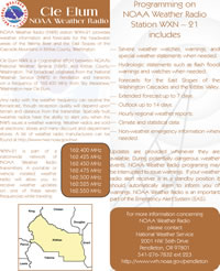
Brochure
(Select image for full size .pdf version.)
|
Other Transmitters
|