Seasonal Landcover Change over the Eastern United States
|
The Blue Marble Next Generation data set provides a monthly global cloud-free true-color picture of the Earth's land cover at a 500-meter spatial resolution. This visualization of the data set shows seasonal variations such as snowfall, spring greening and droughts in a seamless fashion, thereby heightening awareness of changes in the Earth's climate. Here we focus on the seasonal land cover changes over the Eastern United States. This data set is derived from imagery taken in 2004 by the MODIS instrument on the Terra satellite.
|
|
|
|
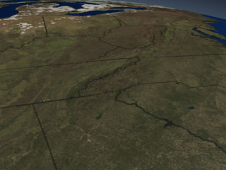
This animation shows how the landcover changes with the seasons as we fly over the Eastern United States, from Florida to Maine.
Duration: 28.0 seconds
Available formats:
320x240
JPEG
14 KB
80x40
PNG
5 KB
160x80
PNG
18 KB
320x240 (30 fps)
MPEG-1
3 MB
640x480 (30 fps)
MPEG-1
15 MB
720x480 (29.97 fps)
MPEG-2
24 MB
720x486 (29.97 fps)
Frames (Landcover)
How to play our movies
|
|
|
|
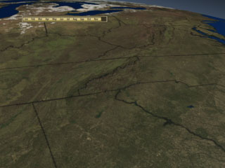
This animation shows how the landcover changes with the seasons as we fly over the Eastern United States, from Florida to Maine. This version has a date bar indicating the month being shown.
Duration: 28.0 seconds
Available formats:
320x240 (30 fps)
MPEG-1
3 MB
640x480 (30 fps)
MPEG-1
15 MB
720x480 (29.97 fps)
MPEG-2
24 MB
320x240
JPEG
14 KB
160x80
PNG
18 KB
80x40
PNG
5 KB
720x486 (29.97 fps)
Frames (DateOverlay)
720x486 (29.97 fps)
Frames (LandcoverWdate)
How to play our movies
|
|
|
|
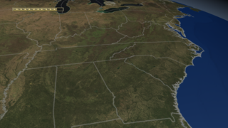
This animation shows how the landcover changes with the seasons as we fly over the Eastern United States, from Florida to Maine. This version is in HD widescreen format and has light-colored state boundaries.
Duration: 29.0 seconds
Available formats:
640x360 (59.94 fps)
MPEG-1
15 MB
1280x720 (59.94 fps)
Frames (Landcover)
1280x720 (59.94 fps)
Frames (LandcoverWdate)
320x180
PNG
84 KB
1280x720 (59.94 fps)
Frames (DateOverlay)
1280x720 (60 fps)
MPEG-2
63 MB
How to play our movies
|
|

|
|
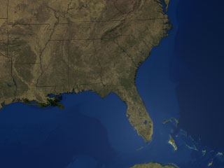
This still image shows landcover over the Southeastern US in January 2004.
Available formats:
320 x 240
JPEG
11 KB
80 x 40
PNG
5 KB
160 x 80
PNG
17 KB
2560 x 1920
TIFF
6 MB
|
|
|
Back to Top
|

