- NASA Home
- | Centers
- | Dryden Home
- | News
- | X-Press
- | Stories
- | 2008
Feature
COA: Before it Flies in the Same Skies as Piloted Aircraft, the Ikhana Must Have an FAA-Approved Flight Plan
07.07.08
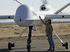
 Ikhana crew chief Joe Kinn gives the aircraft a final check. NASA Photo / Tony Landis.
Meeting complex requirements for the Ikhana to enter the national airspace, where piloted aircraft fly, has become Greg Buoni's area of expertise.
Buoni, the Ikhana project's lead operations engineer, has become skilled at determining the right steps to take to fulfill Federal Aviation Administration requirements for a special-permission Certificate of Waiver or Authorization known as a COA. A COA is required in order for uninhabited aircraft systems, such as the Ikhana, to be permitted to fly in national airspace.
The Ikhana, a General Atomics Aeronautical Systems Predator B adapted for civil science and research missions, flies in the national airspace with a COA in place describing its operations, ground station and telemetry system. The COA also contains information, Buoni said, about what the aircraft is specifically tasked with doing, and what happens should the pilot controlling it from a cockpit in the ground control station lose contact with the aircraft.
Buoni is honing his ability to secure a COA quickly and efficiently in the event Dryden is asked to provide the Ikhana for use in fire missions again this summer. Acquiring the first COA, for the 2006 fire missions, took six months. Dryden officials' diligence in obtaining COAs before they are needed coupled with a series of wildfire emergencies during the past two summers is leading to a more streamlined process, Buoni said.
Esperanza Mission, November 2006
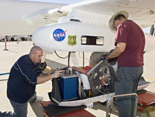
 Dryden Ikhana ground crewmen Gus Carreno, left, and James Smith load the thermal-infrared imaging scanner pallet into the Ikhana's underwing payload pod. NASA Photo / Tom Tschida.
Long before the Ikhana was delivered to NASA or flew its first fire mission, Dryden was working with FAA officials to secure a COA for a General Atomics Aeronautical Systems Altair aircraft. Dryden leased an Altair, essentially a civil variant of the Predator B, for use on missions until the Ikhana was ready for delivery. That effort provided a solid foundation for accelerating COA procurement in emergency situations.
On Oct. 28, 2006, the California Governor's Office of Emergency Services and the Esperanza Fire Incident Command Center requested Dryden's assistance with imaging and fire mapping to help fight the Southern California blaze. In the aftermath of Hurricane Katrina, the FAA had developed an emergency COA process that could result in issuance of a COA amendment within 24 hours. The Esperanza wildfire spurred one of the first requests to use the new process, Buoni said.
Soon after the Esperanza fires broke out and lives were being lost, "Despite issues with time zones, the COA was approved by early evening because there was danger to life and limb - it was a real emergency," he said.
Within 24 hours of the request the Altair was ready to fly.
The suspected arson fire, which claimed the lives of five firefighters and was driven by powerful Santa Ana winds, spread over 40,200 acres, or roughly 62 square miles, destroying 34 homes and 20 other structures.
From an altitude of 43,000 feet, over a 16-hour period on Oct. 28 and 29 the Altair's wildfire sensor collected and sent 100 images and more than 20 data files containing the location of the Esperanza fire's perimeter. Data from the NASA system were used at the Fire Incident Command Center to map the fire's location and behavior and direct resources to critical areas.
Western States Wildfires, 2007
In anticipation of 2007 fire missions, the Ikhana team began working in late 2006 to prepare a COA request. The 2007 COA request was based on the successful 2006 COA effort. Because of the larger geographic area identified in the request, negotiations and further agreements were required. The agreement gelled, but approval didn't come until well into fire season.
The COA request covered flights made at any time, from the Mexican border to the Canadian border and from the Pacific Ocean to central Colorado, wherever the wildfire happened to be - those were the requirements defined in connection with the Ikhana's use, Buoni said.
"This was referred to as 'the mother of all COAs,'" Buoni recalled. "Getting the COAs was one of the things we were on pins and needles about. There were good lessons learned and [the FAA] did issue a COA to do most of the things we were asking to do."
Creating the COA application became even more complicated when the FAA changed from a paper system to an online application process, though the online system undoubtedly made the FAA review process more efficient. Dryden submitted an application for a 2007 COA at the end of February in hopes of obtaining it by July, ahead of the anticipated need for it in August.
The approved COA had its limitations, however.
"The approved geographic area was somewhat limited in comparison to the request, and the flight plan had to be submitted three days in advance. Three days is a long time when wildfires move and change. For that reason, we were mostly limited to [flying missions during] the big fires," Buoni said.
But FAA air traffic controllers were very accommodating when the wildfires moved and changes in flight plans were requested, Buoni added.
The first phase of the four flights began Aug. 16 as the Ikhana captured images of California wildfires, including the Zaca Fire in Santa Barbara County. The aircraft carried the NASA Ames-developed Autonomous Modular Sensor configured for wildfire sensing, which collected data while flying more than 1,200 miles over a 10-hour period.
Subsequent flights in this phase provided support to firefighters in Oregon, Washington, Utah, Idaho, Montana and Wyoming. The longest flight was more than 3,200 miles and took about 20 hours to complete.
In the second phase, the Ikhana team flew four flights over Southern California wildfires Oct. 24-28 and captured thermal-infrared imagery to aid firefighters battling the blazes. The Ikhana took off from Dryden for missions of about nine hours each.
Officials from the California Office of Emergency Services and the National Interagency Fire Center in Boise, Idaho, requested the flights, including those over the Santiago Fire mentioned in the lead story.
"The Ikhana team knew the data we sent to firefighters on the ground could help them save lives and homes. These missions were very fulfilling. We're hoping the Forest Service is able to acquire and use this technology in the future," Buoni said.
Developing New Rules
For uninhabited aircraft and aircraft systems, hard-and-fast certification requirements like those for commercial and general aviation aircraft are not yet in place. And, Buoni said, the very content of what will constitute those rules is being studied and debated throughout the nation and the world because of concerns about flying remotely piloted aircraft in national airspace.
Ironically, manned aircraft may be the key to making UAS flights safe, he noted. Dryden is expected to engage in flight research using an F-16 recently loaned to Dryden from the Air Force for a series of missions that would examine the potential of collision-avoidance systems.
Automated Collision Avoidance Technology is one concept being explored to test how well a system works for automatically avoiding contact with the ground and potentially for detecting and avoiding other aircraft.
To provide see-and-avoid capability, current FAA policy requires a manned aircraft to accompany UASs flying below 18,000 feet. Above that altitude, air traffic controllers are responsible for monitoring aircraft and ensuring that they fly safe distances apart, Buoni explained.
Until new rules are approved, Dryden officials will continue taking steps to simplify the COA application process. More than 280 potential landing sites, for example, were identified for use in the event an emergency landing was required in the requested COA area.
Together with Lt. Cdr. Phil Hall of the National Oceanic and Atmospheric Administration, Dryden's Kathleen Howell, Jeri Myers, Range Safety Office and a crew of interns looked at available routes and compiled results into a large database detailing potential landing sites.
Information includes location and composition of the landing area (for example, whether it is paved or dirt) as well as Google Earth images of viable approaches to each site. The information was produced in a notebook that pilots could reference during each flight.
The net result of all the work undertaken since 2006 is a simple one - if Dryden is called to assist in fire missions this summer, the Ikhana team will be ready to fly.
X-Press Editor