|
|
|
|
Grand Canyon National Park
Places To Go
|
|
|
|
|
|
 |
 |
| Grand Canyon Village |
 |
South Rim
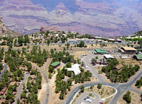
Canyon Grand Canyon Village is the center of activity and the transportation hub for the South Rim of the park. The village is the only place where the railroad reaches the rim of the canyon. Free shuttle busses connect the lodges, campground, restaurants, and shops, with the business center (Market Plaza) and Visitor Information Center. (Canyon View Plaza) The shuttles also stop at many canyon overlooks.
Download the
Fall 2008 South Rim Village Shuttle Route Map (466kb PDF File)
Shows Shuttle Bus Routes, Parking and Points of Interest.
In the Village you will find the Historic District, that was built by the Santa Fe Railroad during the first half of the 20th Century. Take a walking tour and imagine yourself back when President Teddy Roosevelt and artist Thomas Moran visited the park.
Market Plaza is the Business Center of the Village. Here you will find a general store and deli, the bank, post office, and a cafeteria at Yavapai Lodge. Market Plaza has a large parking lot and is in a central location. It is a good place to park and ride the park's free shuttle busses.
Yavapai Observation Station - located one mile east of Market Plaza provides spectacular views of Grand Canyon. Geological displays include three-dimensional models, powerful photographs, and interpretive panels which allow park visitors to see and understand the complicated geologic story of the area. The Yavapai exhibits explain the deposition of the rock layers, the uplift of the Colorado Plateau, and the carving of the Grand Canyon.
Canyon View Information Plaza has a visitor center, a large bookstore, and ample restrooms. Several outdoor exhibits provide a variety of information about Grand Canyon National Park and what to do once you are here. Canyon View Information Center can be reached by riding the free shuttle bus or walking the short distance from Mather Point. You can not drive to Canyon View Information Plaza.
Download the
Fall 2008 South Rim Village Shuttle Route Map (466kb PDF File)
Shows Shuttle Bus Routes, Parking and Points of Interest.
|
 |
| The Desert View Watchtower |
 |
Desert View
The Desert View Drive or East Rim Drive (Highway 64) leaves Grand Canyon Village and follows the canyon rim east for 26 miles to Desert View - at the east entrance to the park
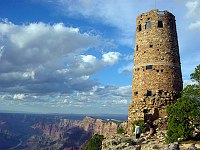
The Desert View Watchtower, constructed in 1932 as a replica of a prehistoric Indian tower, commands a magnificent view of the Grand Canyon, the Painted Desert to the east and the San Fransico Peaks to the south. This seventy-foot tower is the highest point on the South Rim. The interior walls of the tower feature murals by Hopi artist Fred Kabotie.
A visit to Tusayan Ruin and Museum provides a glimpse of Pueblo Indian life some 800 years ago. Tusayan Ruin is located three miles west of Desert View and is open daily 9:00 a.m. to 5:00 p.m.
Download the Desert View Map Here (235kb PDF File)
|
 |
| View from Grand Canyon Lodge |
 |
North Rim
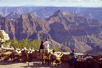
A worthwhile trip for those who enjoy the road less traveled, the North Rim, or "other side" of the Grand Canyon is visited by only 10% of all Grand Canyon visitors. There is only one lodge, the Grand Canyon Lodge (now managed by Forever Resorts) and one developed campground on the North Rim.
The Hike across the canyon from South Rim to North Rim is 21 miles / 34 km. However, traveling from the South Rim to the North Rim by automobile requires a five-hour drive of 220 miles / 354 km.
Lodging and camping are available at the canyon's North Rim from mid-May through mid-October. During winter months, the North Rim is closed due to snow.
The North Rim Visitor Center, located adjacent to the parking lot on Bright Angel Peninsula provides park and regional information, maps, brochures, exhibits, and a bookstore. Open mid-May through mid-October, from 8am to 6pm, daily. Interpretive programs are offered seasonally. Public restrooms are located in back of the building.
(266kb PDF File)
(289kb PDF File)
Most visitors make a stop at Bright Angel Point, at the southern end of the entrance road. From the parking area it is a short, easy walk to Grand Canyon Lodge and a classic view of the canyon. This facility is wheelchair accessible. A paved, half-mile (round-trip) trail leads from the lodge, out the spine of the ridge, to the point. This trail is steep in places, with drop-offs and stairs, but provides dramatic views into Roaring Springs and Bright Angel Canyons.
Point Imperial and Cape Royal are reached via a winding scenic drive. The trip to both points, with short walks at each and several stops at pullouts along the way, can easily take half a day.
Point Imperial, the highest point on the North Rim at 8,803 feet, overlooks the Painted Desert and the eastern end of Grand Canyon. Here the canyon transforms as the narrow walls of Marble Canyon, visible only as a winding gash, open dramatically to become “grand.” Layers of red and black Precambrian rocks, not visible at Bright Angel Point, add contrast and color. Part of the viewpoint is accessible.
Cape Royal provides a panorama up, down, and across the canyon. With seemingly unlimited vistas to the east and west, it is popular for both sunrise and sunset. The sweeping turn of the Colorado River at Unkar Delta is framed through the natural arch of Angels Window. Look for the Desert View Watchtower across the canyon on the South Rim. This popular viewpoint is accessible via a paved, level trail.
|
|
Tuweep
The view from Toroweap Overlook, 3000 vertical feet above the Colorado River, is a breathtaking sheer drop. This remote and primitive area, known as both Tuweep and Toroweap, is on the northwest rim of the Grand Canyon on the Arizona Strip. A visit to this area can be challenging, but rewarding.
Since the National Park Service manages the area for its primitive values, improvements and services are minimal. more
|
|  |  |

|
 |
|
|


