Mineral Resources On-Line Spatial Data
by The United States Geological Survey
U.S. Geological Survey Open-File Report 2004-1001
Version 5.0
Updated 2008 September 30: Version 5.0 contains new data, analyzed in 2008, in the states of Alaska, Louisiana, Minnesota, Nebraska, Ohio, Pennsylvania, South Dakota, Tennessee, and Utah, plus the territory of Guam, the Federated States of Micronesia, and the Commonwealth of the Northern Marianas Islands.
Version 4.0
Updated 2007 July 21: Version 4.0 contains new data, analyzed in 2007, in collaboration with the states of Arkansas, California, Kansas, Kentucky, Maine, Minnesota, Missouri, Nebraska, North Dakota, Oregon, Texas, Washington, and Wisconsin.
Version 3.0
Updated 2006 October 13: Version 3.0 contains new data, analyzed in 2006, in collaboration with the states of Arkansas, California, Illinois, Indiana, Iowa, Kansas, Kentucky, Maine, Minnesota, Missouri, Nebraska, New York, North Dakota, Ohio, Oregon, Pennsylvania, Texas, Washington, and Wisconsin.
Version 2.0
Updated 2006 February: Version 2.0 contains new data, analyzed in 2004 and 2005, in collaboration with the states of Alaska, Arkansas, California, Hawaii, Illinois, Indiana, Iowa, Kentucky, Maine, Minnesota, North Dakota, Ohio, Oregon, Pennsylvania, South Dakota, Texas, Washington, and Wisconsin. All databases and maps have been updated.
|
Abstract. The USGS, in collaboration with other federal and state
government agencies, industry, and academia, is conducting the National Geochemical Survey (NGS)
to produce a body of geochemical data for the United
States based primarily on stream sediments, analyzed using a consistent set of
methods. These data will compose a complete, national-scale geochemical coverage of the US, and will enable
construction of geochemical maps, refine estimates of baseline concentrations of
chemical elements in the sampled media, and provide context for a wide variety of studies in the
geological and environmental sciences. The goal of the NGS is to analyze at least one
stream-sediment sample in every 289 km2
area by a single set of analytical methods across the entire nation, with other
solid sample media substituted where necessary. The NGS incorporates geochemical data from a variety of
sources, including existing analyses in USGS databases, reanalyses of samples in USGS archives, and analyses of newly collected samples.
At the
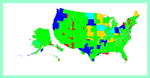
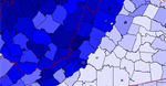
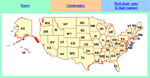
present time, the NGS includes data covering ~89% of the land area of the US, including samples in all 50 states. This version of the online report provides complete access to NGS data, describes the history of the project, the methodology used, and presents preliminary geochemical maps for all analyzed elements. Future editions of this and other related reports will include the results of analysis of variance studies, as well as interpretive products related to the NGS data. |
|
The National Geochemical Survey Team |
||
| Principal author of this report; database design and data processing; development of geochemical mapping methods; development of computer methods in support of geochemical sampling. | Project concept, design, and leadership; development and supervision of sampling protocols and field methods; development of collaborative activities between the USGS and other agencies. | |
| Development of data retrieval software; website programming. | GIS support; report generation; sample site maps; sample preparation. | |

![]() U.S. Department of the Interior |
U.S. Geological Survey
U.S. Department of the Interior |
U.S. Geological Survey
URL: http://tin.er.usgs.gov/geochem/doc/home.htm
Page Contact Information: Peter Schweitzer
Page Last Modified: Wednesday, 01-Oct-2008 09:11:18 EDT