Warnings & Forecasts Graphical Forecasts National Maps Climate Radar Rivers Satellite & Upper Air
National Satellite Image
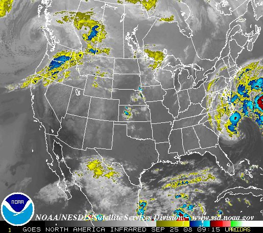
Infrared satellite image of the United States.
   24 Hour Loop   |   12 hour Loop   |   6 hour Loop   |   3 hour Loop  


Satellite Data

GOES-East Images:
 
Full Size East CONUS IR Image
Infrared

(color curves: 1, 2, 3, 4)
Image Loop (MPEG)
Hemispheric Image
Full Size East CONUS VIS 
	  Image
Visible


Image Loop (MPEG)
Hemispheric Image
Full Size East CONUS WV Image
Water Vapor

(color curves: 1, 2, 3, 4)
Image Loop
GOES-West Images:
Full Size West CONUS IR Image
Infrared

(color curves: 1, 2, 3, 4)
Image Loop (MPEG)
Hemispheric Image
Full Size West CONUS VIS Image
Visible


Image Loop (MPEG)
Hemispheric Image
Full Size West CONUS WV Image
Water Vapor

(color curves: 1, 2, 3, 4)
Image Loop (MPEG)
For more satellite pictures, go to NOAA's GOES Homepage
A complete listing of other Satellite Data sites (UCAR)

Profiler Data

Latest Wind Profiler Data for Winchester, IL (UCAR)

Wind Profiler Images for Sites across the US

Upper Air Data

Latest Upper Air sounding for Lincoln, IL   (UCAR)

Upper Air Sounding Archive North America  (Univ. of WY)

Other Upper Air soundings  (UCAR)

National Upper Air Analyses: (UCAR)
850 mb700 mb 500 mb
Jet Stream Levels: 300 mb250 mb200 mb


  • NOAA's National Weather Service
  • Central Illinois Weather Forecast Office
  • 1362 State Route 10
  • Lincoln, IL 62656
  • 217-732-3089 (8:30 am to 4 pm weekdays)
  • Page Author: ILX Webmaster
  • Web Master's E-mail: w-ilx.webmaster@noaa.gov
  • Page last modified: 17-May-2007 2:13 PM UTC
USA.gov is the U.S. government's official web portal to all federal, state and local government web resources and services.