|
Preliminary Report on Tornadoes and Hail Storms in Eastern Idaho
Thunderstorms moved through Eastern Idaho during mid-afternoon and evening
of April 28, 2003 (4/28/2150 - 4/29/0200 UTC). The severe thunderstorms
produced three tornadoes (all rated as F0) and numerous accounts of nickel
to golfball sized hail.
Very little damage has been noted at this time.
An outbuilding was blown over by rear flank downdraft winds near Fort Hall
on Ballard Road. No deaths or injuries have been reported from this event.
Several tornado and severe thunderstorm warnings were issued by the
National Weather Service with an average lead time of approximately fourteen minutes
before the severe weather occurred.
Tornado Roundup
Rupert Tornado, FO, on ground for 1/4 mile, approximately 3 minutes, no damage - in open fields
Indian Springs Tornado, F0, on ground for 1/4 mile, approximately 3 minutes - in open fields
Arbon Valley Tornado, F0, on ground for 2 1/2 miles, approximately 8 minutes. Numerous pictures taken.
(Data collected from ground surveys conducted by the National Weather Service and discussions with county emergency managers)
Editor's Notes:
If you have any comments, suggestions or questions about the Severe Weather,
please call Vernon Preston or Jim Meyer at (208) 232-9306. You can also e-mail your questions.
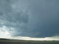
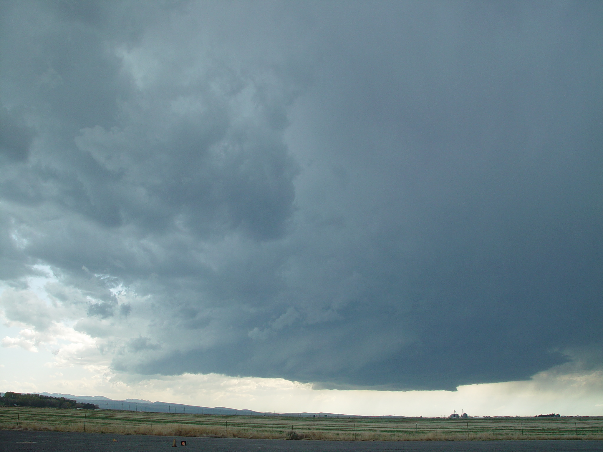
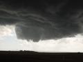
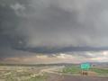
Wall cloud development in the Arbon Valley, looking Southwest from the Pocatello, Idaho Airport |
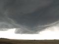
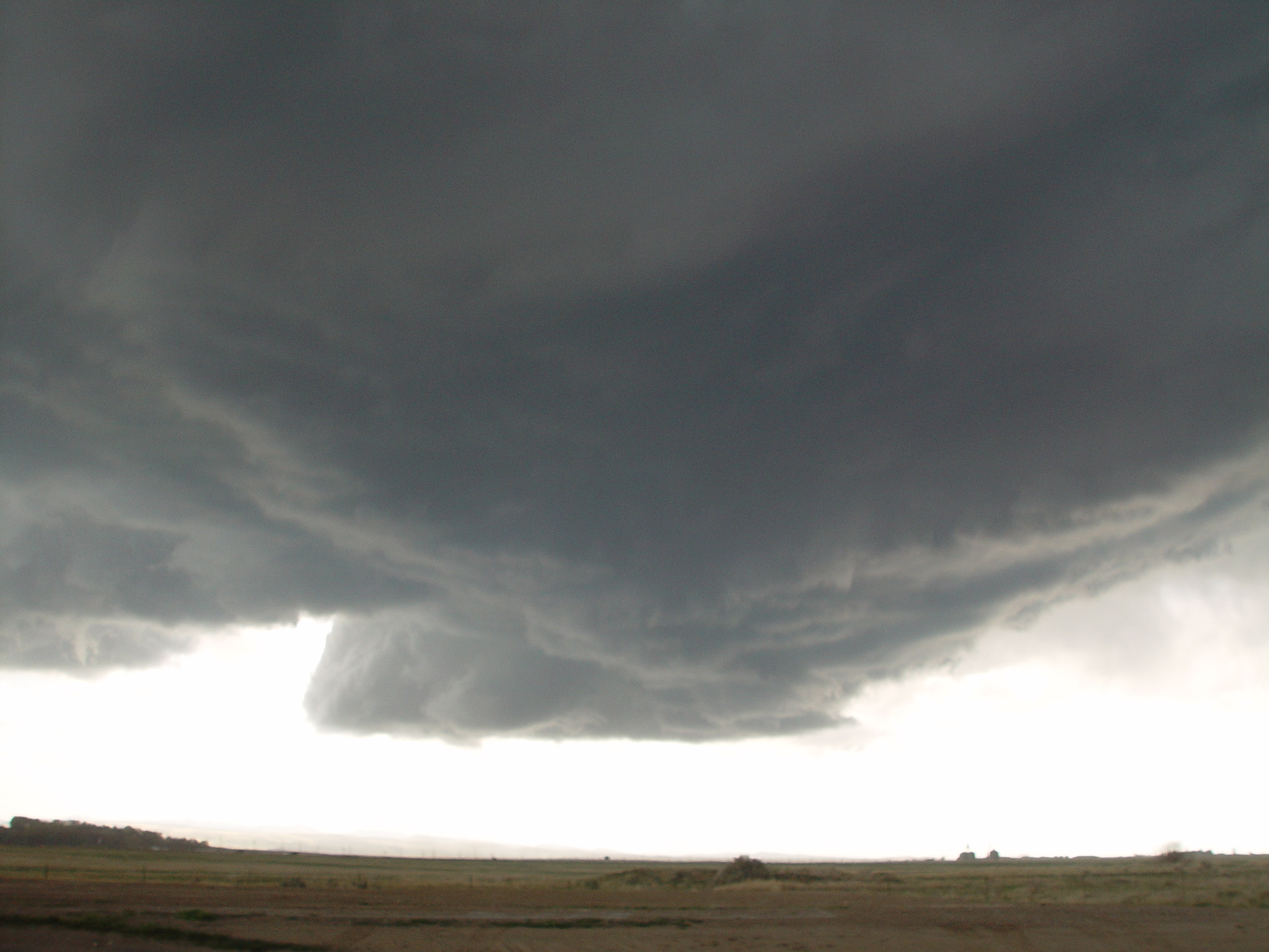
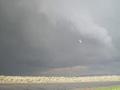
Rear flank downdraft cutting into the wall cloud |
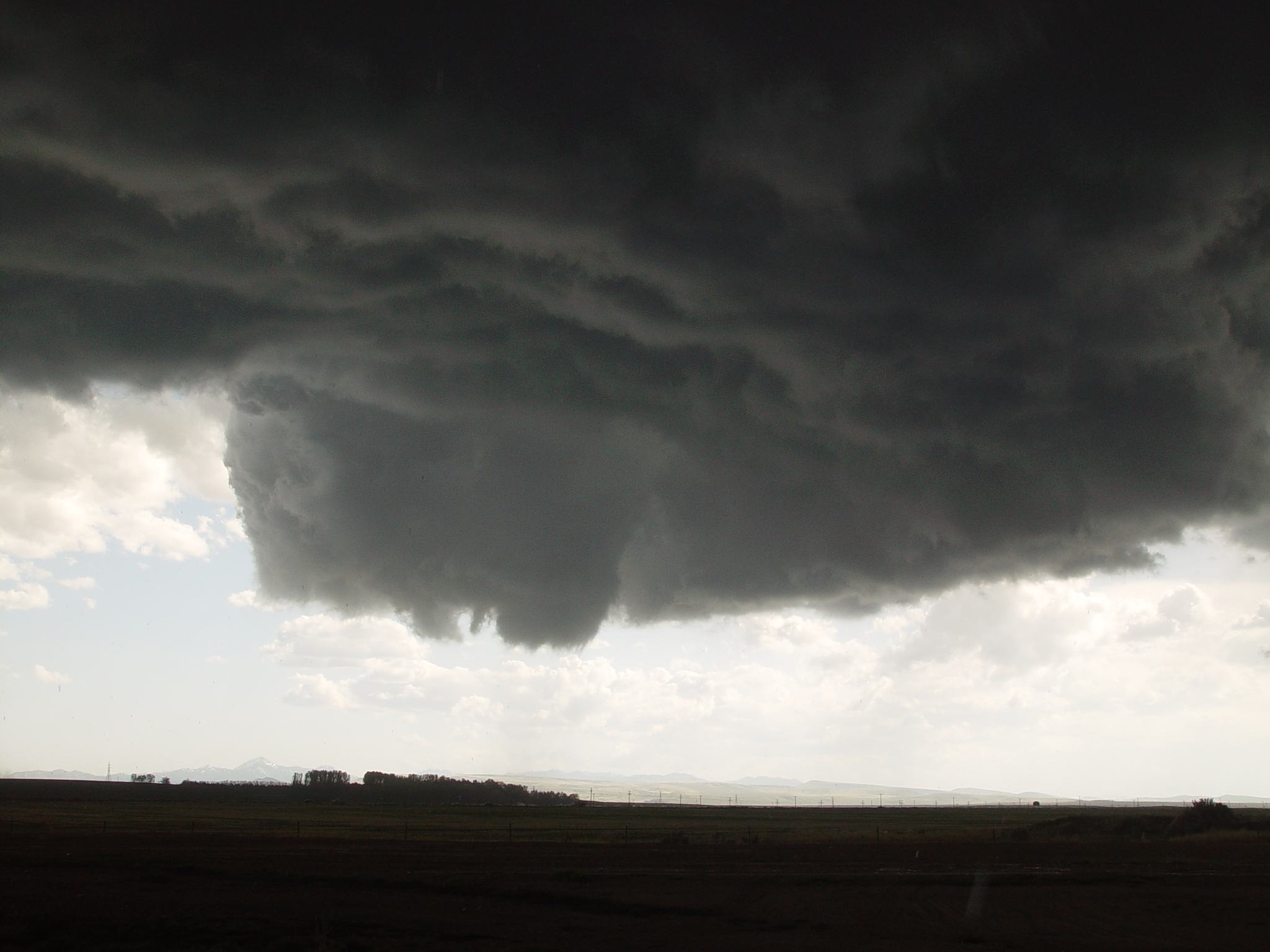
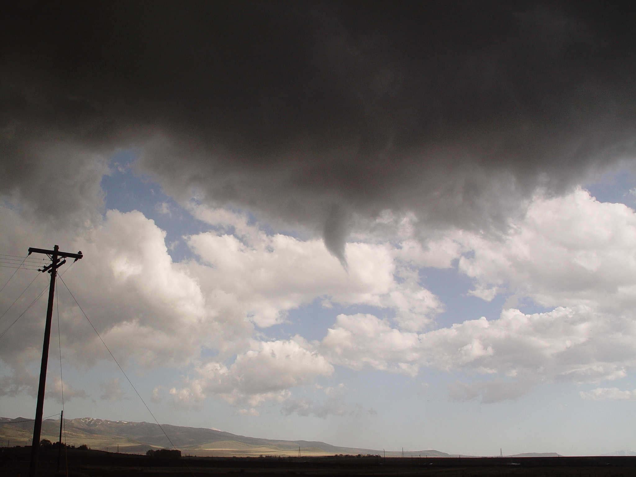
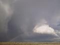
Funnel cloud develops out of the wall cloud |
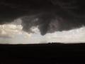
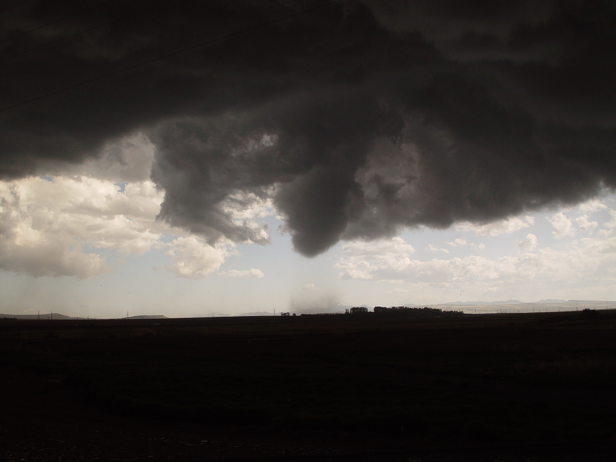
Tornado develops with dust debris on the ground |
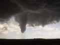
Full extent of tornado |
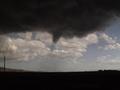
Tornado dissipation |

Remaining funnel cloud |
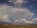
Wall cloud reforms as it moves towards Pocatello |
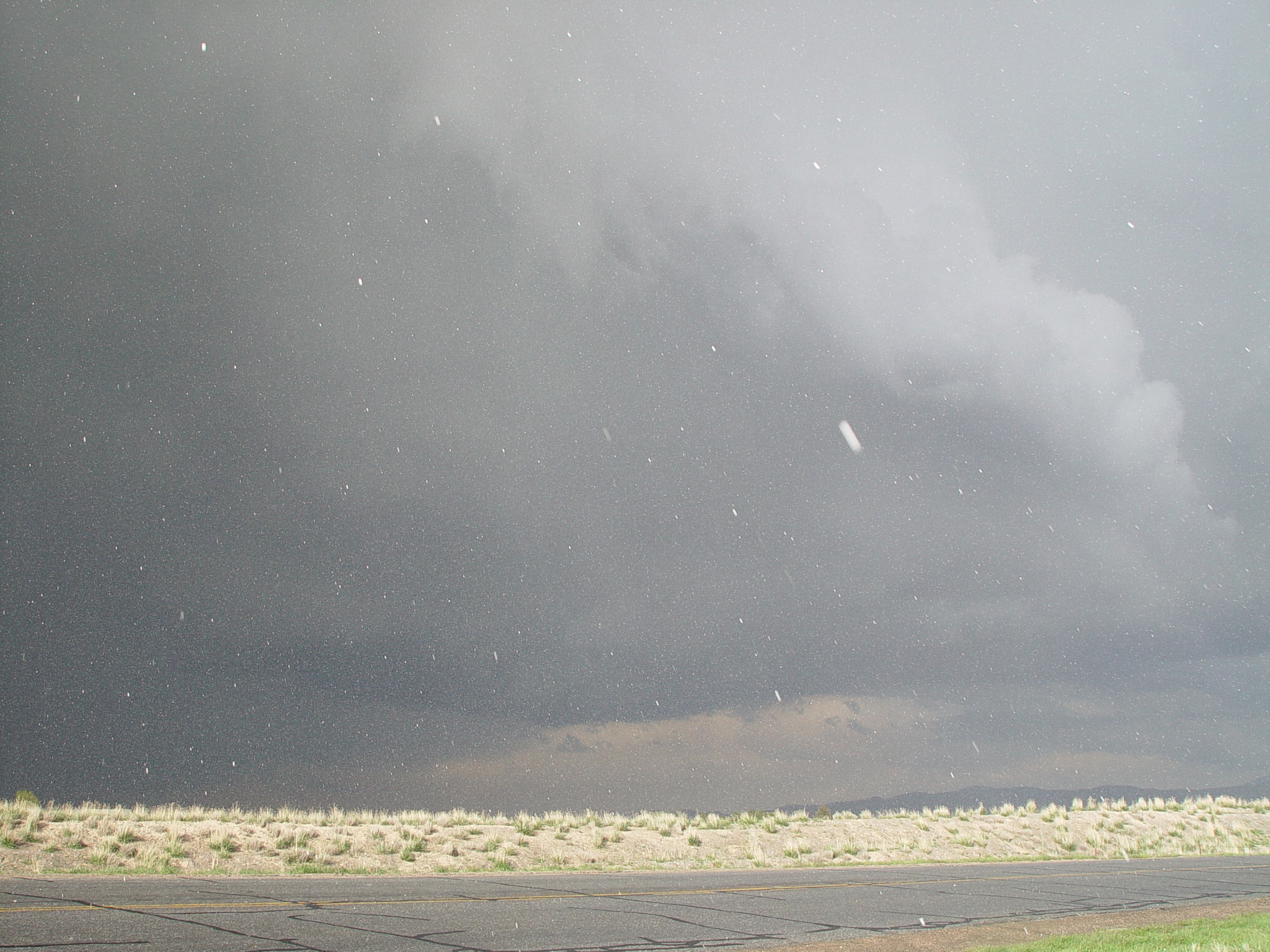
Large hail (quarter size) falls on the back side of the wall cloud looking towards Pocatello |
Rainbow looking at strong updraft as storm passes northeast of Pocatello |
Storm moves into mountains northeast of Pocatello |
|
All pictures courtesy of Vernon Preston, National Weather Service, Pocatello ID
|
|