| Home >> | Advanced Search >> |
 |
|
Astronaut Photography of Earth - Display Record
ISS010-E-5072

Low-resolution Browse Image
(Most browse images are not color adjusted.)Images
Conditions for Use of Images >>Image Transformation Tutorial >> Saving, Color Adjusting, and Printing Images >>
Images to View on Your Computer Now
| File Name | File Size (bytes) | Width | Height | Annotated | Cropped | Purpose | Comments | |
|---|---|---|---|---|---|---|---|---|
| View | ISS010-E-5072.JPG | 64567 | 639 | 435 | No | No | ||
| View | ISS010-E-5072.JPG | 281766 | 540 | 357 | Yes | Yes | NASA's Earth Observatory web site | |
| View | ISS010-E-5072.JPG | 281766 | 540 | 357 | Yes | Yes | Earth From Space collection | |
| View | ISS010-E-5072.JPG | 794400 | 1000 | 661 | No | Yes | NASA's Earth Observatory web site |
Large Images to Request for Downloading
| File Name | File Size (bytes) | Width | Height | Annotated | Cropped | Purpose | Comments | |
|---|---|---|---|---|---|---|---|---|
| Request | ISS010-E-5072.JPG | 794400 | 1000 | 661 | No | Yes | Earth From Space collection | |
| Request | ISS010-E-5072.JPG | 890144 | 3032 | 2064 | No | No |
Download a Keyhole Markup Language (KML) file for use in Google Earth.
Electronic Image Data
Camera Files >> No sound file available.Identification
Mission: ISS010 Roll: E Frame: 5072 Mission ID on the Film or image: ISS010Country or Geographic Name: ARGENTINA
Features: IBERA SWAMP, LAKES, ROAD,GLINT
Center Point Latitude: -28.7 Center Point Longitude: -58.4 (Negative numbers indicate south for latitude and west for longitude)
Stereo: (Yes indicates there is an adjacent picture of the same area)
ONC Map ID: JNC Map ID:
Camera
Camera Tilt: 2Camera Focal Length: 800mm
Camera: E4: Kodak DCS760C Electronic Still Camera
Film: 3060E : 3060 x 2036 pixel CCD, RGBG array.
Quality
Film Exposure:Percentage of Cloud Cover: 10 (0-10)
Nadir
Date: 20041025 (YYYYMMDD)GMT Time: 163712 (HHMMSS)Nadir Point Latitude: -28.7, Longitude: -58.3 (Negative numbers indicate south for latitude and west for longitude)
Nadir to Photo Center Direction: West
Sun Azimuth: 316 (Clockwise angle in degrees from north to the sun measured at the nadir point)
Spacecraft Altitude: 195 nautical miles (361 km)
Sun Elevation Angle: 69 (Angle in degrees between the horizon and the sun, measured at the nadir point)
Orbit Number: 1881
Captions
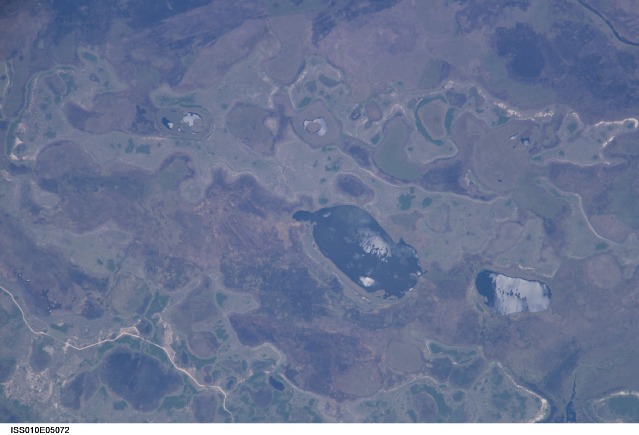
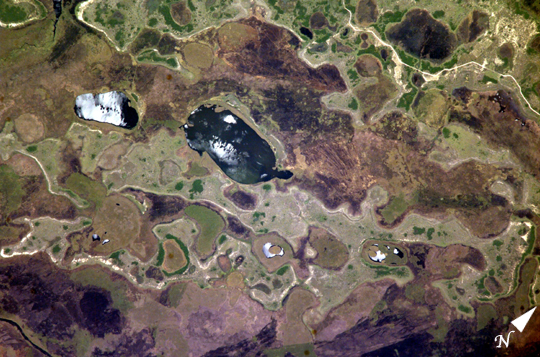
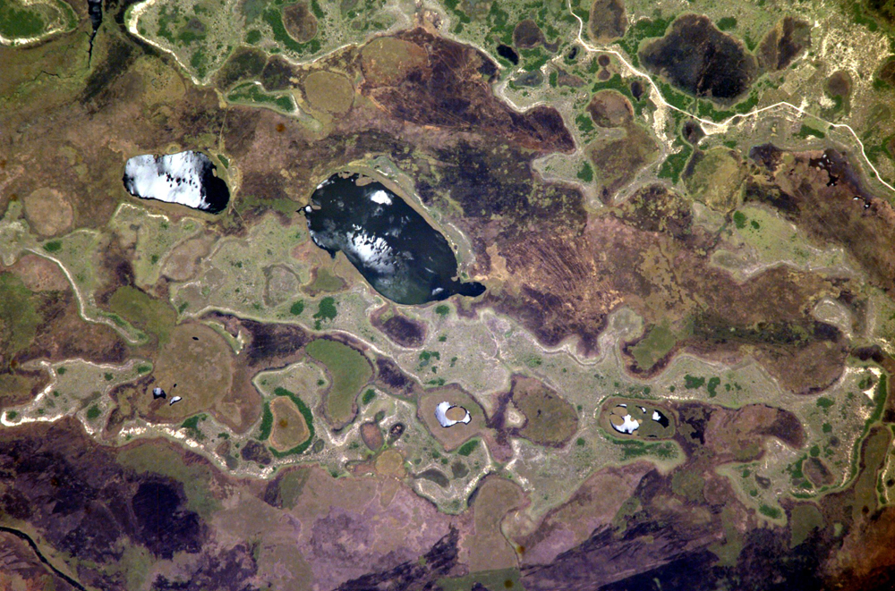
Iberá Swamp Topography, NE ArgentinaThe central lake in this astronaut photograph is one of hundreds in the Iberá swamplands that were formed by South America’s second largest river, the Paraná. Although this great river now lies 120 kilometers to the north of this area today, its channel has swung over a great “inland delta” in the recent geological past.
This and other lakes were captured by the astronaut in the camera’s sunglint region (the area where the Sun reflects directly back toward the camera ) as the International Space Station passed over this remote but vast swampland in northeast Argentina. The glint pattern gives the lakes a slivery appearance, and shows winds ruffling the water surfaces. The lakes in this image lie within side channels of the Paraná that formed when the river flowed through the region from the northeast. The center coordinates of this enhanced image are 28.7°S 58.4°W. The central lake in the image is about 2 km long.
Forest, swamp, and prairie vegetation outline the low topography which consists of lakes, low swells, and depressions. The rounded shape of the topography probably relates to the effects of wind. Evidence from areas both north and south of the swamps suggests that these parts of South America were climatically drier during several periods in the last couple of million years (while North America and Europe were experiencing glaciations). Aridity allows the effects of wind to become pronounced. Wind builds elliptical sand dunes and scours out rounded depressions. Wind also generates waves on lakes that smooth sandy and muddy lake shores.
Download Packaged File.
This option downloads the following items, packaged into a single file, if they are available:
- Browse image
- Cataloged information with captions
- Camera file
- Sound file
Server: 2 |
This service is provided by the International Space Station program. |
Recommended Citation: |
||

