| Home >> | Advanced Search >> |
 |
|
Astronaut Photography of Earth - Display Record
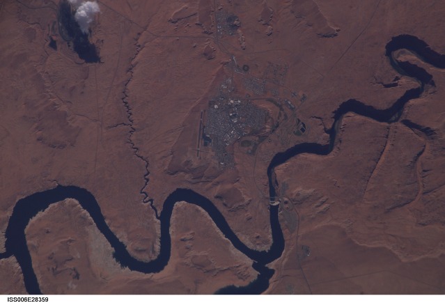
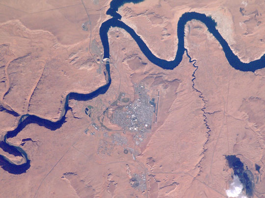
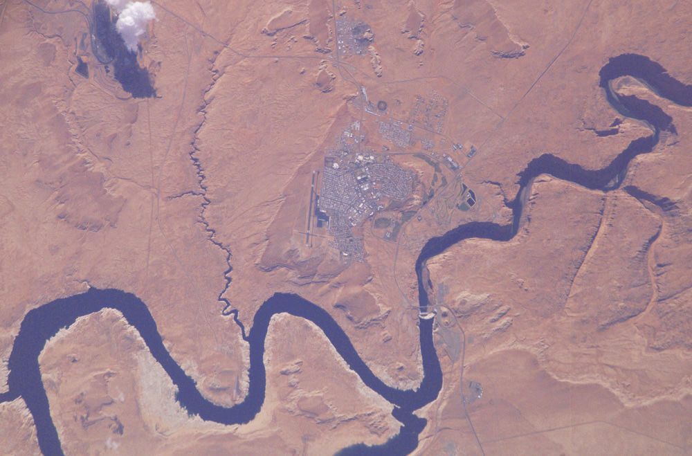
ISS006-E-28359
Low-resolution Browse Image
(Most browse images are not color adjusted.)Images
Conditions for Use of Images >>Image Transformation Tutorial >> Saving, Color Adjusting, and Printing Images >>
Images to View on Your Computer Now
| File Name | File Size (bytes) | Width | Height | Annotated | Cropped | Purpose | Comments | |
|---|---|---|---|---|---|---|---|---|
| View | ISS006-E-28359.JPG | 59101 | 540 | 405 | Photographic Highlights | (540 px resized images) | ||
| View | ISS006-E-28359.JPG | 59161 | 639 | 435 | No | No | ||
| View | ISS006-E-28359.JPG | 83913 | 540 | 356 | Yes | No | NASA's Earth Observatory web site | |
| View | ISS006-E-28359.JPG | 260084 | 1000 | 659 | No | No | NASA's Earth Observatory web site |
Large Images to Request for Downloading
| File Name | File Size (bytes) | Width | Height | Annotated | Cropped | Purpose | Comments | |
|---|---|---|---|---|---|---|---|---|
| Request | ISS006-E-28359.JPG | 191587 | 1024 | 768 | Photographic Highlights | (actual files used) | ||
| Request | ISS006-E-28359.JPG | 954037 | 3032 | 2064 | No | No |
Download a Keyhole Markup Language (KML) file for use in Google Earth.
Electronic Image Data
Camera Files >> No sound file available.Identification
Mission: ISS006 Roll: E Frame: 28359 Mission ID on the Film or image: ISS006Country or Geographic Name: USA-ARIZONA
Features: PAGE, GLEN CANYON DAM
Center Point Latitude: 37.0 Center Point Longitude: -111.5 (Negative numbers indicate south for latitude and west for longitude)
Stereo: (Yes indicates there is an adjacent picture of the same area)
ONC Map ID: JNC Map ID:
Camera
Camera Tilt: 21Camera Focal Length: 800mm
Camera: E4: Kodak DCS760C Electronic Still Camera
Film: 3060E : 3060 x 2036 pixel CCD, RGBG array.
Quality
Film Exposure:Percentage of Cloud Cover: 10 (0-10)
Nadir
Date: 20030215 (YYYYMMDD)GMT Time: 180857 (HHMMSS)Nadir Point Latitude: 36.1, Longitude: -112.5 (Negative numbers indicate south for latitude and west for longitude)
Nadir to Photo Center Direction: Northeast
Sun Azimuth: 151 (Clockwise angle in degrees from north to the sun measured at the nadir point)
Spacecraft Altitude: 213 nautical miles (394 km)
Sun Elevation Angle: 37 (Angle in degrees between the horizon and the sun, measured at the nadir point)
Orbit Number: 206
Captions
This isolated community near the northern Arizona border is of special interest because of its origin and location. Unlike other towns in the area, Page was created in 1957 to house workers and their families during the construction of nearby Glen Canyon Dam on the Colorado River. Its 17-square-mile site was obtained in a land exchange with the Navajo Indian tribe. The town is perched atop Manson Mesa at an elevation of 4,300 feet above sea level and 600 feet above Lake Powell.After the dam was completed in the 1960s, the town grew steadily to today’s population of 6,200. Because of the new roads and bridge built for use during construction, it has become the gateway to the Glen Canyon National Recreation Area and Lake Powell, attracting more than 3 million visitors per year. Page is also the home of two of the largest electrical generation units in the western United States. Glen Canyon Dam has a 1,288,000 kilowatts capacity when fully online. The other power plant to the southeast is the Navajo Generating Station, a coal-fired steam plant with an output capability of 2,250,000 kilowatts.
Download Packaged File.
This option downloads the following items, packaged into a single file, if they are available:
- Browse image
- Cataloged information with captions
- Camera file
- Sound file
Server: 2 |
This service is provided by the International Space Station program. |
Recommended Citation: |
||

