| Home >> | Advanced Search >> |
 |
|
Astronaut Photography of Earth - Display Record
STS092-343-18
Low-resolution Browse Image
(Most browse images are not color adjusted.)Images
Conditions for Use of Images >>Image Transformation Tutorial >> Saving, Color Adjusting, and Printing Images >>
Images to View on Your Computer Now
| File Name | File Size (bytes) | Width | Height | Annotated | Cropped | Purpose | Comments | |
|---|---|---|---|---|---|---|---|---|
| View | STS092-343-18.JPG | 21021 | 515 | 342 | No | No | From ISD highres, sharpened |
Large Images to Request for Downloading
| File Name | File Size (bytes) | Width | Height | Annotated | Cropped | Purpose | Comments | |
|---|---|---|---|---|---|---|---|---|
| Request | STS092-343-18.JPG | 427702 | 3070 | 2044 | No | No | From ISD CD TIFF images | |
| Request | STS092-343-18_2.JPG | 796220 | 3000 | 2008 | No | No | From ISD CD TIFF images |
Download a Keyhole Markup Language (KML) file for use in Google Earth.
Electronic Image Data
Camera files only apply to electronic still cameras.No sound file available.
Identification
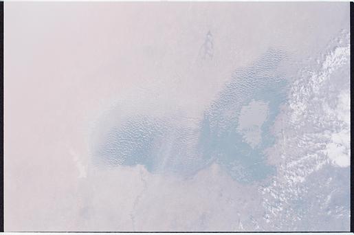
Mission: STS092 Roll: 343 Frame: 18 Mission ID on the Film or image: STS92Country or Geographic Name: CHAD
Features: LAKE CHAD
Center Point Latitude: 13.5 Center Point Longitude: 14.0 (Negative numbers indicate south for latitude and west for longitude)
Stereo: (Yes indicates there is an adjacent picture of the same area)
ONC Map ID: JNC Map ID:
Camera
Camera Tilt: 27Camera Focal Length: mm
Camera: NK: Nikon 35mm film camera
Film: 5755 : Portra 160NC, color negative, 35mm, ASA 160.
Quality
Film Exposure:Percentage of Cloud Cover: 10 (0-10)
Nadir
Date: 20001022 (YYYYMMDD)GMT Time: 115104 (HHMMSS)Nadir Point Latitude: 14.9, Longitude: 15.0 (Negative numbers indicate south for latitude and west for longitude)
Nadir to Photo Center Direction: Southwest
Sun Azimuth: 213 (Clockwise angle in degrees from north to the sun measured at the nadir point)
Spacecraft Altitude: 205 nautical miles (380 km)
Sun Elevation Angle: 59 (Angle in degrees between the horizon and the sun, measured at the nadir point)
Orbit Number: 166
Captions
Download Packaged File.
This option downloads the following items, packaged into a single file, if they are available:
- Browse image
- Cataloged information with captions
- Camera file
- Sound file
Server: 2 |
This service is provided by the International Space Station program. |
Recommended Citation: |
||

