| Home >> | Advanced Search >> |
 |
|
Astronaut Photography of Earth - Display Record
ISS007-E-17772
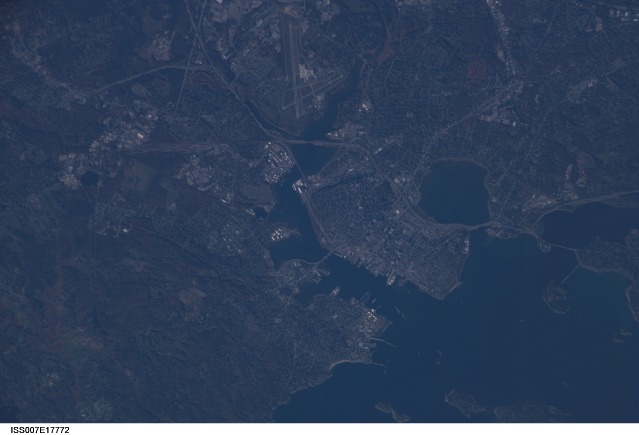
Low-resolution Browse Image
(Most browse images are not color adjusted.)Images
Conditions for Use of Images >>Image Transformation Tutorial >> Saving, Color Adjusting, and Printing Images >>
Images to View on Your Computer Now
| File Name | File Size (bytes) | Width | Height | Annotated | Cropped | Purpose | Comments | |
|---|---|---|---|---|---|---|---|---|
| View | ISS007-E-17772.JPG | 54431 | 639 | 435 | No | No | ||
| View | ISS007-E-17772.JPG | 96428 | 540 | 405 | Yes | Yes | NASA's Earth Observatory web site | |
| View | ISS007-E-17772.JPG | 96428 | 540 | 405 | Yes | Yes | NASA's Earth Observatory web site | |
| View | ISS007-E-17772.JPG | 117341 | 540 | 462 | Photographic Highlights | (resized 540 px images) | ||
| View | ISS007-E-17772_2.JPG | 297620 | 898 | 768 | Photographic Highlights | (actual files used) | ||
| View | ISS007-E-17772.JPG | 1568989 | 1000 | 854 | No | Yes | NASA's Earth Observatory web site | Color adjusted, rotated-North at top |
| View | ISS007-E-17772_2.JPG | 3392891 | 1688 | 1441 | No | Yes | NASA's Earth Observatory web site | Color adjusted, rotated-North at top |
Large Images to Request for Downloading
| File Name | File Size (bytes) | Width | Height | Annotated | Cropped | Purpose | Comments | |
|---|---|---|---|---|---|---|---|---|
| Request | ISS007-E-17772.JPG | 903810 | 3032 | 2064 | No | No | ||
| Request | ISS007-E-17772.JPG | 7989561 | 3027 | 2004 | No | No | NASA's Earth Observatory web site | Color adjusted |
| Request | ISS007-E-17772_2.JPG | 8373920 | 6144 | 4068 | No | No | Presentation | Earth Sciences Results Briefing/Ed Lu |
Download a Keyhole Markup Language (KML) file for use in Google Earth.
Electronic Image Data
Camera Files >> No sound file available.Identification
Mission: ISS007 Roll: E Frame: 17772 Mission ID on the Film or image: ISS007Country or Geographic Name: USA-MAINE
Features: PORTLAND, AIRPORT, HARBOR
Center Point Latitude: 43.5 Center Point Longitude: -70.5 (Negative numbers indicate south for latitude and west for longitude)
Stereo: (Yes indicates there is an adjacent picture of the same area)
ONC Map ID: JNC Map ID:
Camera
Camera Tilt: 9Camera Focal Length: 800mm
Camera: E4: Kodak DCS760C Electronic Still Camera
Film: 3060E : 3060 x 2036 pixel CCD, RGBG array.
Quality
Film Exposure:Percentage of Cloud Cover: 10 (0-10)
Nadir
Date: 20031020 (YYYYMMDD)GMT Time: 131401 (HHMMSS)Nadir Point Latitude: 43.6, Longitude: -70.0 (Negative numbers indicate south for latitude and west for longitude)
Nadir to Photo Center Direction: West
Sun Azimuth: 129 (Clockwise angle in degrees from north to the sun measured at the nadir point)
Spacecraft Altitude: 199 nautical miles (369 km)
Sun Elevation Angle: 21 (Angle in degrees between the horizon and the sun, measured at the nadir point)
Orbit Number: 59
Captions
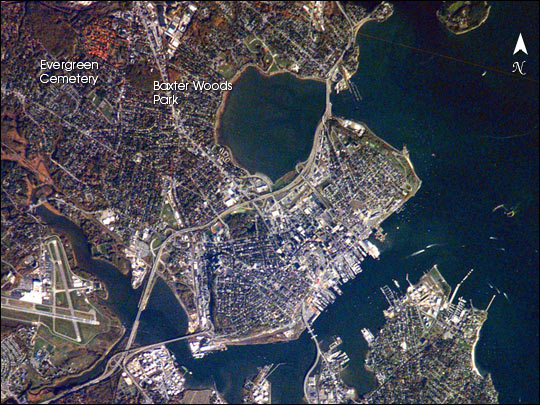
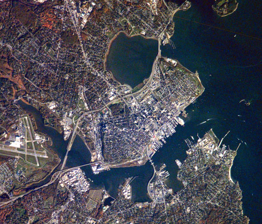
Fall Colors Portland, MaineThe ISS-7 crew of the International Space Station enjoyed a bird’s-eye view of New England’s fall colors on a fine October morning. The fall foliage of Baxter Woods Park in Portland, Maine, shows the reds and browns of a mix of trees, including maple, old-growth white oaks, and hemlock. Nearby Evergreen Cemetery is highlighted by the brilliant red and yellow leaves of maple trees. Surrounded by the cityscape of Portland, the wooded cemetery is known for both historic headstones and wooded trails. In the spring, the woods are a refuge for migrating warblers traveling from South America to New England and Canada. As increasing numbers of wetlands and woods are lost to development, migrating birds are losing their rest stops along their migratory routes. Urban parks and green spaces—including cemeteries—can become important oases for migratory birds.
Download Packaged File.
This option downloads the following items, packaged into a single file, if they are available:
- Browse image
- Cataloged information with captions
- Camera file
- Sound file
Server: 2 |
This service is provided by the International Space Station program. |
Recommended Citation: |
||

