
| ||
Glacial Retreat | |||
|
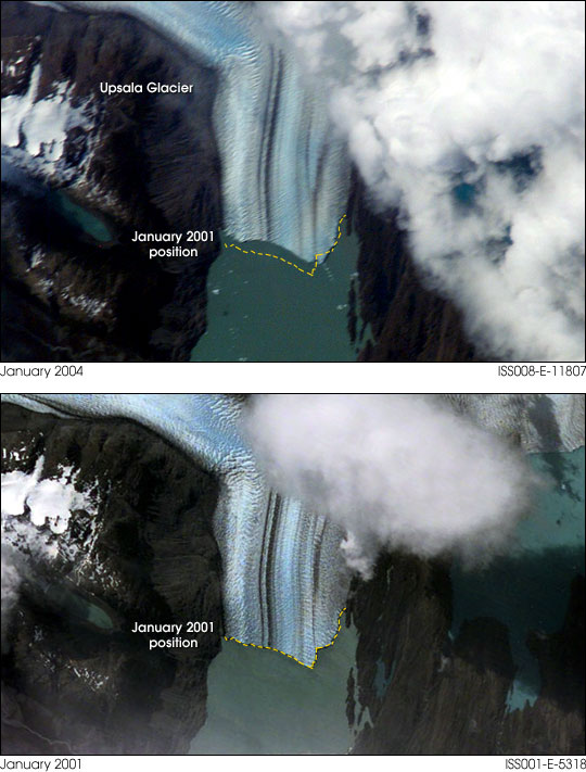
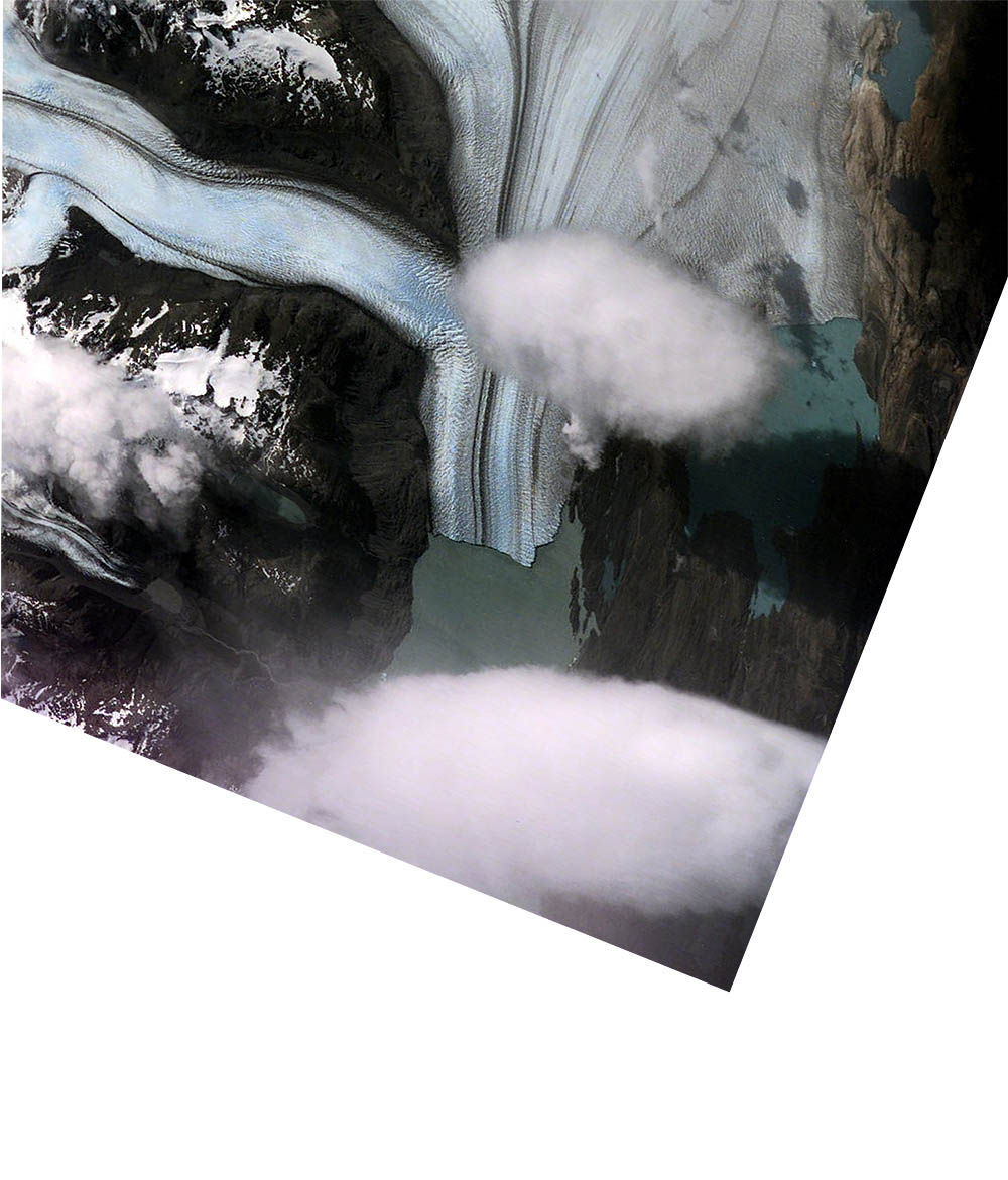
For the crew onboard the International Space Station daylight views of the Earth’s Southern Hemisphere offer fewer opportunities to observe and document land features with onboard cameras. However, South America’s Patagonian Ice Fields and glaciers in the far southern Andes mountains offer beautiful, dynamic features with frequent passes whenever weather conditions permit. On the afternoon of January 3, 2004, the crew took this view of the Upsala Glacier in Argentina through a 400mm lens. This is the third largest glacier of the Southern Patagonian Ice Field with an estimated area of over 800 square kilometers. This long, north-south oriented river of ice terminates in the northern arm of Lake Argentino. A worldwide retreat of glaciers was observed during the twentieth century and most of the Patagonia’s glaciers, including Upsala were no exception. From the late 1960’s to the mid 1990’s the retreat of some parts was in excess of 4 kilometers. The glacier’s retreat appears to be continuing during the Space Station era with visible changes along the terminus noted here when compared with another taken in December 2000. The crew continues to monitor most of the principal glaciers of Patagonia as science targets for Crew Earth Observations. For more information on the observed history of Patagonia’s glaciers please see: Historic Fluctuations of Outlet Glaciers from the Patagonian Ice Fields.
Photograph ISS008-E-11807 was taken from the International Space Station using a Kodak DCS760 digital camera: and a 400 mm lens on 3 January 2004. The January 2001 position was determined by coarse image referencing with another Space Station photography, ISS001-E-5318, taken in January 2001. Details provided by Michael Trenchard and Julie A. Robinson, Earth Observations Laboratory (Lockheed Martin), Johnson Space Center. The International Space Station Program supports the laboratory to help astronauts take pictures of Earth that will be of the greatest value to scientists and the public, and to make those images freely available on the Internet. Additional images taken by astronauts and cosmonauts can be viewed at the NASA/JSC Gateway to Astronaut Photography of Earth. Recommend this Image to a Friend Back to: Newsroom Also see |
View Images Index
| ||
| Subscribe to the
Earth Observatory About the Earth Observatory Please send comments or questions to: eobmail@eodomo.gsfc.nasa.gov Responsible NASA official: Yoram Kaufman NASA/GSFC Security and Privacy Statement |
