|
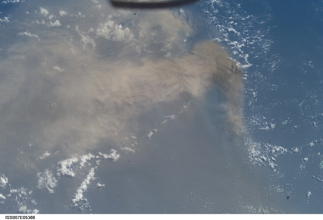
Anatahan
Island

High-resolution
image (708 Kb)
It is sleep-time
on the International Space Station, and Astronaut Ed Lu is supposed
to be asleep. He is looking out the window and admiring the Pacific
Ocean below. Suddenly he realizes something is strange -- a huge
yellowish-brown plume is sweeping across hundreds of miles of ocean.
A major volcanic eruption is in progress. He grabs a camera and
shoots.
Anatahan Island
is located 129 kilometers (80 miles) north of Saipan and is part
of the Northern Mariana Island chain. This small island, 10 kilometers
long by 3 kilometers wide (6 miles long by 2 miles wide), has been
uninhabited since 1990 when residents were evacuated because of
a strong earthquake. On May 10, a vigorous eruption that sent high-level
ash over a wide area. About 12 hours later, at 7:19 p.m. CDT (May
11 at 0019 GMT), the crew of the International Space Station observed
and photographed this ash plume, describing it as huge. By May 15,
a state of emergency had been declared in the Northern Mariana Islands
as the eruption appeared to be intensifying.
Space station
crewmembers receive a daily list of photographic targets that include
areas of scientific interest and dynamic events. In this case, though,
the crew observed the eruption before news had spread to the international
media or to the networks that track volcanic events worldwide. Lu
checked with Mission Control to find out if it really was a volcano
and precisely where the eruption was occurring.
Astronaut photograph
ISS007-E-5366
was provided by the Earth Sciences and Image Analysis Laboratory
at Johnson Space Center. Additional images taken by astronauts and cosmonauts can be viewed at the NASA-JSC Gateway
to Astronaut Photography of Earth.
| 

