 |
 | |
  | |
|
|
|
|
Glacier Bay National Park and Preserve
Maps
|
|
|
|
|
| |
 |
 |
Click on image to open
(best if opened in new window) |
 |
NOAA Chart of Glacier Bay
(Requires Adobe Flash) This NOAA website contains a very user-friendly feature enabling charts to be displayed on the screen. You can zoom in and pan around any portion of the charted area.
|
 |
| Click on image to open |
|
Boating Regulations
Map of park areas subject to boating closure, speed limits, or other regulations designed to protect wildlife and provide for a range of visitor experiences (195 KB PDF file).
|
 |
| Click on image to open |
|
Satellite Image
Combination of two Landsat images (August 1999 and August 2000) showing entire park (510 KB JPG file).
|
 |
| Click on image to open |
|
Park Map
Map from the Glacier Bay National Park and Preserve brochure (765 KB PDF file).
|
 |
| Cick on image to open |
|
Bartlett Cove
Glacier Bay Lodge, docks, visitor center, campground, trails, and park headquarters highlighted (100 KB JPG file).
|
 |
| Click on image to open |
|
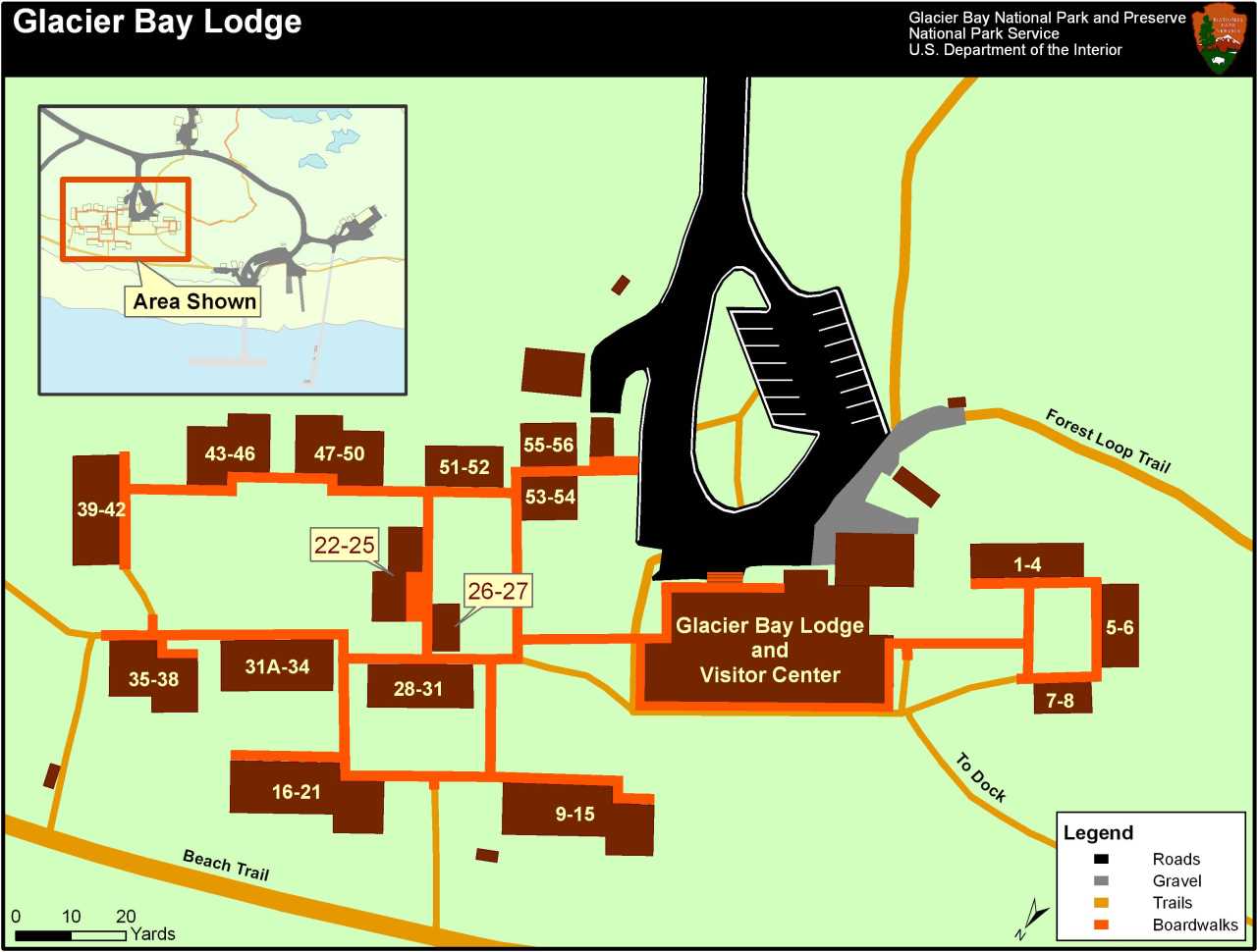
Glacier Bay Lodge
Close-up of the lodge, showing main lodge, room layout and connecting boardwalks (85 KB JPG file).
|
 |
| Click on image to open |
|
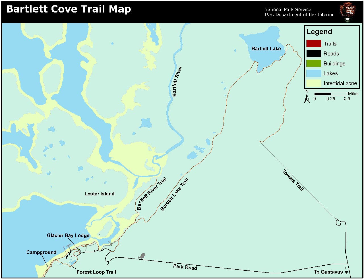
Bartlett Cove Trails
Map showing Bartlett River trail and Bartlett Lake trail (150 KB JPG FILE).
|
 |
| Click on image to open |
|
Bartlett Cove Campground
Diagram of Bartlett Cove campground showing individual and group campsites, fire ring, warming hut, food caches, etc. (12 KB PDF file).
|
 |
| Click on image to open |
|
Bartlett Cove Dock
Schematic diagram of the Bartlett Cove Dock showing no-anchor zones and slips available to the public (11 KB PDF file).
|
 |
| Click on image to open |
|
Gustavus Boundary
A map showing the Gustavus boundary with the park.
|
|  | | |
|
|

New!! Interactive Park Map
Open this map and you can pan and zoom wherever you like in the park! (Requires Adobe Flash)
more... | | 
Brochures
Checklists, maps, park information, etc.
more... | |
|
|
|
|
|
|
|
 |
|
Did You Know?
John Muir, beloved naturalist and father of Yosemite National Park, came to Glacier Bay in 1879 to find direct evidence of the presence of glaciers. He believed that Yosemite had been carved by glacier and was able to validate his hypothesis with what he saw in Glacier Bay.
|
|
|
|
Last Updated: August 22, 2008 at 16:09 EST |


