

Images & Animations
-
Credit
Jeff Schmaltz, MODIS Rapid Response Team, NASA/GSFC
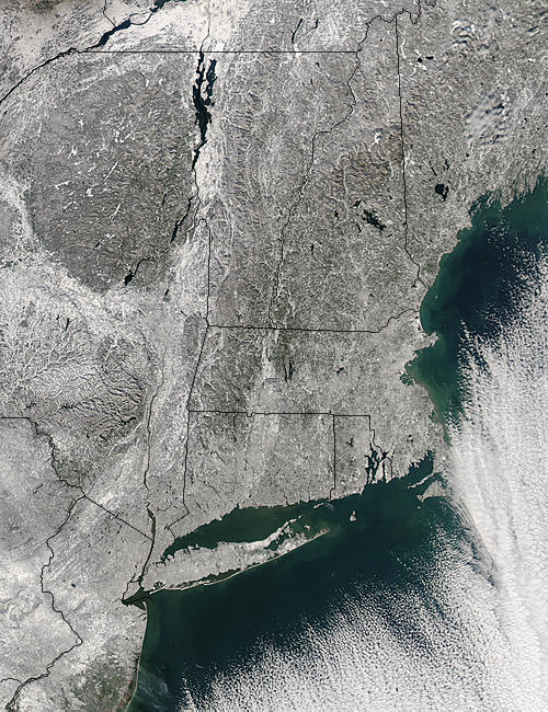
The first major snow storm of the year blanketed New England with as much as three feet of snow in regions. Two large storms combined between December 4 and 7, 2003 and dumped enough snow to nearly paralyze many northeastern cities. The white snow contrasts sharply with the inky black water of numerous lakes in New England in this Moderate Resolution Imaging Spectroradiometer (MODIS) image. The largest lake in the image is Lake Champlain, top center. The snow also outlines the wrinkled crags of the Appalachian Mountains, making them more obvious than they would otherwise be. The lower reaches of Quebec, Canada are visible in the top left corner of the image. The US states shown include, from the top left going counterclockwise, New York, Pennsylvania, New Jersey, Connecticut, Rhode Island, Massachusetts, Vermont, New Hampshire, and Maine. This image was captured by the Aqua satellite on December 8, 2003.
Metadata
-
Sensor
Aqua/MODIS -
Visualization Date
2003-12-09