PRELIMINARY DAMAGE ASSESSMENT
AERIAL PHOTOS OF TORNADO TRACK
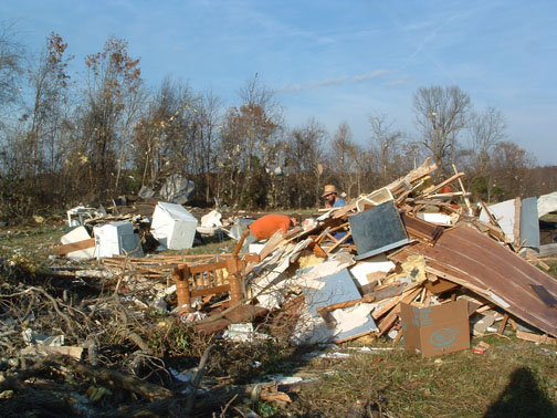
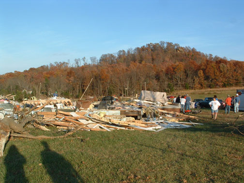
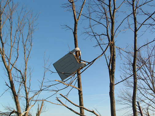
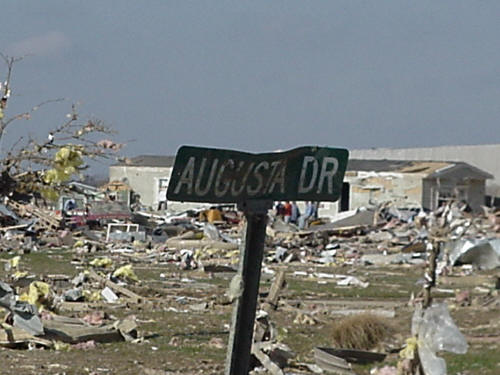
GROUND PICTURES OF TORNADO DAMAGE
EVANSVILLE AREA TORNADO IN HISTORY
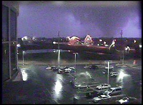
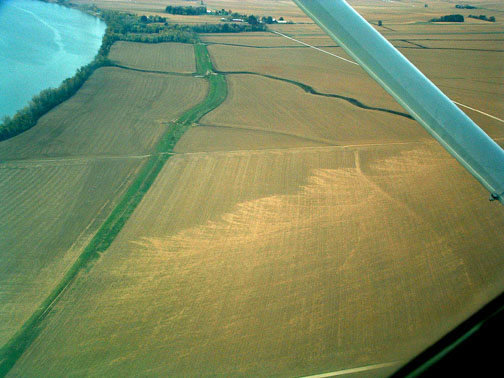
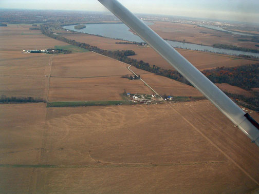
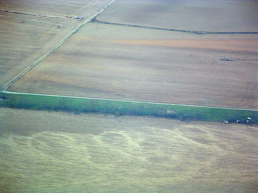
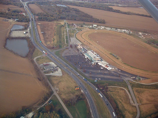
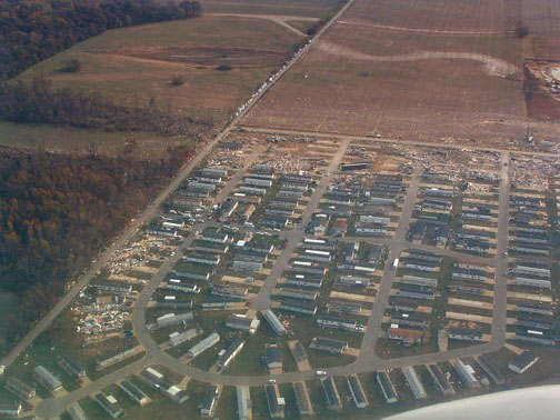
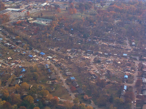
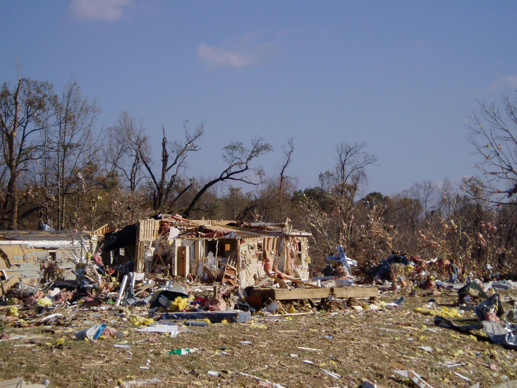
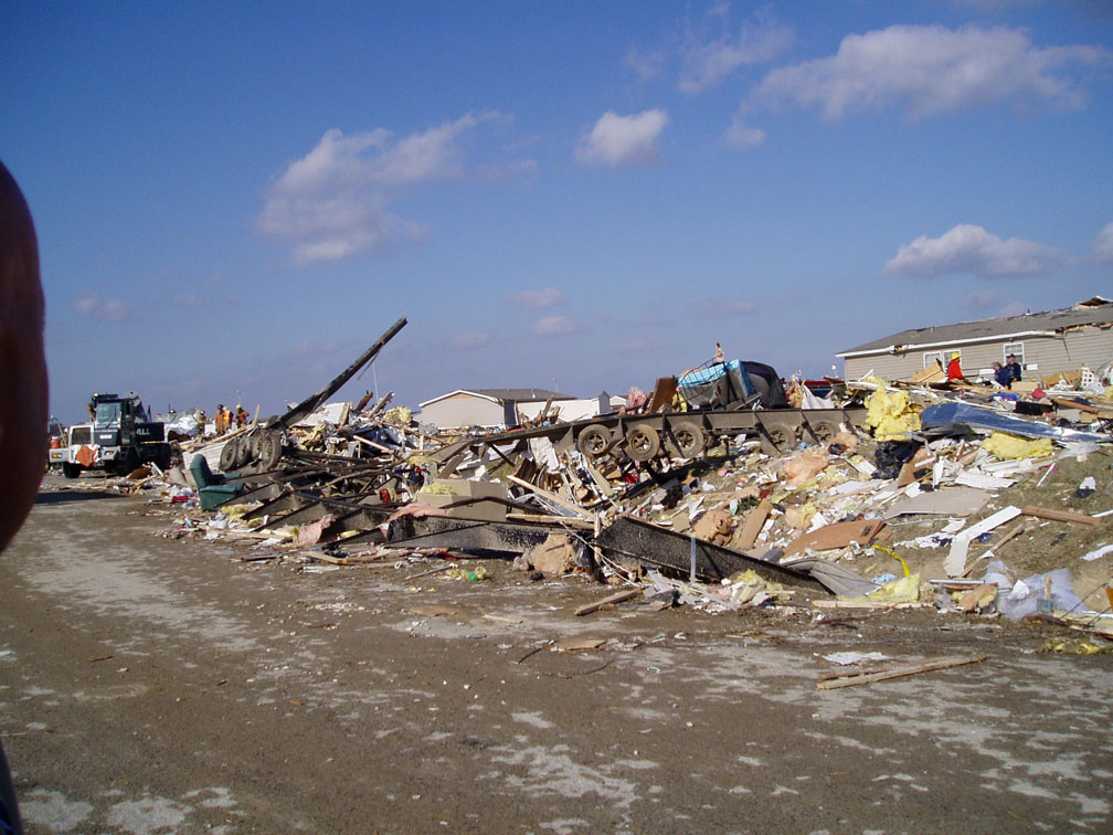
Crittenden/Webster County, KY F-3 Tornado Note - Numerous images on this page may slow loading time. THE FOLLOWING IS A PRELIMINARY DAMAGE ASSESSMENT FOR THE TORNADO Lowest angle (0.5°) reflectivity and storm relative motion images respectively from the Evansville Doppler Radar (VWX) at 1:39 a.m. This was near the time of tornado touchdown and depict the storm rapidly intensifying and acquiring supercell characteristics. Lowest angle (0.5°) reflectivity and storm relative motion images respectively from the Evansville Doppler Radar (VWX) at 1:58 a.m., which was near the time the tornado ripped through the Eastbrook Mobile Home Park. Note the appendage-like shape of reflectivity that correlates with the strong rotational couplet. Photo of actual tornado taken by webcam at Deaconess Women’s Hospital Aerial Photos (squenced from west to east along the tornado path): Widespread path of large trees snapped and uprooted in northwestern Henderson county, KY. Scoured land in the floodplain peninsula of southwest Vanderburgh county, IN. Damage to Ellis Park racing facility, located just north of the Ohio River. Aerial view of the most extensive damage at Eastbrook Mobile Home Park.
Damage between mobile home park and Vanderburgh/Warrick county line. Damage on the northern side of Newburgh, IN. Ground Photos (squenced from west to east along the tornado path): Photo of destroyed house and tossed truck (to right of standing tree) taken a few miles northeast of Smith Mills, Kentucky in Henderson County. Photo of tossed truck, taken a few miles northeast of Smith Mills, KY. This is a close-up of truck in above photo. The next two photos were taken at Ellis Park, a racing facility off U.S. 41 near the Henderson County, KY/Vanderburgh County, IN line. The following photos were taken at a mobile home park off of Interstate 164 where many of the fatalities and injuries occurred. The following photos were taken near Angel Mounds, which is near the Vanderburgh/Warrick County line. Damage in Degonia Springs - Warrick County Indiana: Residents in this house took shelter in the bathroom, which is in the part that is still standing behind the white wall in the picture below. Here is a picture of the bathroom mentioned above: Another house destroyed in Degonia Springs: Evansville Area Tornado in History:
...DAMAGE SURVEY RESULTS FOR CRITTENDEN-WEBSTER COUNTY KENTUCKY F-3 TORNADO... * EVENT DATE: SUNDAY - NOVEMBER 6TH 2005 * EVENT TYPE: F3 TORNADO * ESTIMATED START TIME: 145-150 AM CST * ESTIMATED END TIME: 200-205 AM CST * EVENT LOCATION: ONE QUARTER MILE WEST OF HIGHWAY 654 IN CRITTENDEN COUNTY...(APPROXIMATELY TWO MILES NORTHWEST OF MATTOON KENTUCKY)...TO THE NORTH SIDE OF WHEATCROFT KENTUCKY IN WEBSTER COUNTY. * PEAK WIND: 160 MPH * DAMAGE AREA DIMENSIONS: * INJURIES: 5 PERSONS / 1 CRITICAL/ * FATALITIES: NONE * DAMAGE: SEVERAL STRUCTURES DAMAGED...ONE TWO STORY HOME COMPLETELY DESTROYED. ONE MOBILE HOME OVERTURNED AND DESTROYED. NUMEROUS LARGE TREES SNAPPED OFF AT BASE. TWO CAMPERS FLIPPED ON THEIR SIDE. NUMEROUS VEHICLES MOVED SEVERAL HUNDRED FEET AND DAMAGED. Map of damage path. Home damaged on Highway 654...northwest of Mattoon. This is a mobile home that was destroyed adjacent to the home pictured above. Panning further to the right...the rest of the destroyed mobile home can be seen. This was a two story home that was destroyed on Highway 365. Panning further to the right...the rest of this destroyed home can be seen. Another view of the destroyed home on Highway 365. A door hoisted into a tree.
THAT TRACKED FROM HENDERSON COUNTY KENTUCKY NORTHEAST ACROSS
VANDERBURGH...WARRICK AND INTO SPENCER COUNTIES IN SOUTHWEST INDIANA.
* EVENT DATE: SUNDAY - NOVEMBER 6 2005
* EVENT TYPE: TORNADO - F3
* ESTIMATED START TIME: APPROXIMATELY 150 AM CST; CROSSED
VANDERBURGH-WARRICK COUNTY LINE BETWEEN 202 AND 203 AM CST
* EVENT LOCATION:
TORNADO TOUCHED DOWN 2 MILES NORTH NORTHWEST OF SMITH MILLS IN
HENDERSON COUNTY KENTUCKY AND MOVED NORTHEAST ACROSS THE OHIO
RIVER AND ACROSS ELLIS PARK; STAYED SOUTH OF I-164 IN EVANSVILLE;
CONTINUED MOVING NORTHEAST INTO WARRICK COUNTY THROUGH DE GONIA
SPRINGS AND SOUTH OF TENNYSON; LIFTED 1.5 MILES SOUTH SOUTHWEST OF
GENTRYVILLE IN SPENCER COUNTY.
* PEAK WIND: ESTIMATED 200 MPH
* DAMAGE AREA DIMENSIONS:
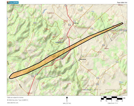
PATH LENGTH - APPROXIMATELY 41 MILES
MAXIMUM WIDTH - 400+ YARDS
* INJURIES: AT LEAST 200 PERSONS /APPROXIMATELY 50 CRITICAL/
* FATALITIES: 23 PERSONS
* UNACCOUNTED FOR: 5-6 PERSONS
* DAMAGE:
100+ BUILDINGS/HOMES DESTROYED OR SEVERELY DAMAGED. MUCH OF THE
DAMAGE APPEARS TO BE UPPER F2 TO LOWER F3 INTENSITY.
PEAK WINDS OCCURRED ON PROSPECT ROAD IN THE INDUSTRIAL PARK NEAR
PARADISE IN WARRICK COUNTY.
THE SURVEY INVESTIGATION IS ONGOING AND SUBJECT TO FURTHER
COORDINATION WITH LOCAL EMERGENCY MANAGEMENT AGENCIES.
Full Tornado Path Map


.jpg)


.JPG)


Deadliest Tornado in the United States since:
1999
Deadliest Tornado in Indiana since:
1974
Deadliest Tornado in NWS Paducah Forecast Area since:
<1950
THE FOLLOWING IS A UPDATED PRELIMINARY DAMAGE ASSESSMENT FOR THE CRITTENDEN-WEBSTER COUNTY KENTUCKY TORNADO. AFTER FURTHER INVESTIGATION OF THE DAMAGE...THE INTENSITY OF THIS TORNADO WAS INCREASED TO THE F3 CATEGORY.
PATH LENGTH: APPROXIMATELY 11.25 MILES
MAXIMUM WIDTH: 150 YARDS